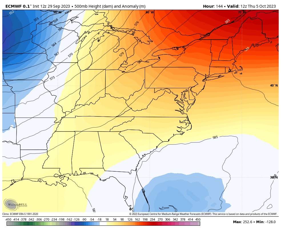
Good Saturday, everyone. We’ve made it to the weekend and the final day of September. We are sending the 9th month out on a warmer than normal note and this pattern carries over into the fist few days of October. Beyond that, things take on a much different look and feel.
Highs today range from the upper 70s east to the middle 80s west. Some early morning fog will be noted before a mix of sun and fair weather clouds take over.
Highs from Sunday through Wednesday are generally in the 80-85 degree range for many with the numbers in the west going above and beyond from time to time. Skies are dry during this time, as well.
The pattern flips late next week as a powerful fall cold front sweeps in here later Thursday and Friday. That’s likely to bring more showers and some thunderstorms our way as it’s behind pushed by a huge trough digging into the region…
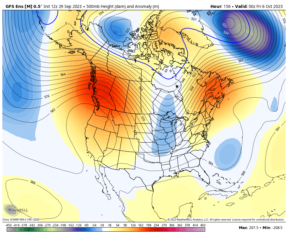
That’s a really chilly setup for next weekend and early the following week. It’s one that, with overnight clear skies, can bring our first frost threat of the season.
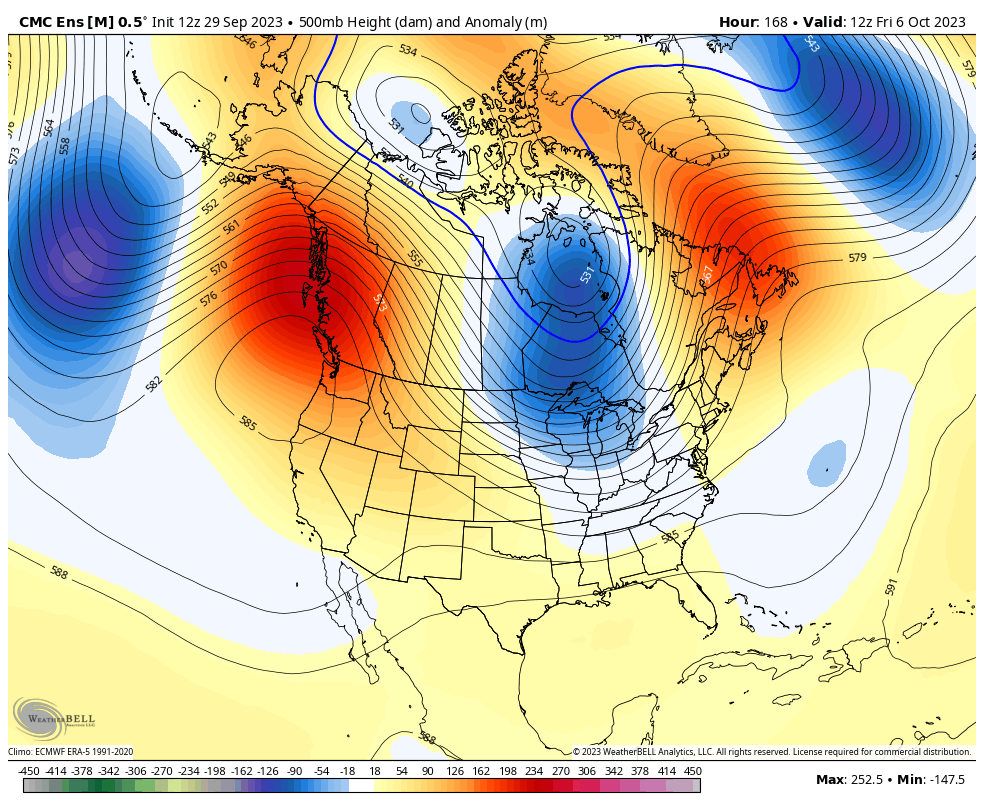
That trough likely lifts out, but the Ensembles are trying to go toward additional troughs in the east into the middle of the month…
GFS ENSEMBLES
CANADIAN ENSEMBLES
If we look deeper into October and the start of November via the EURO Weeklies, we find the look of troughs in the east with a ridge in the west…
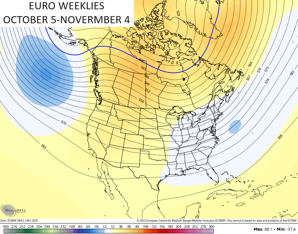
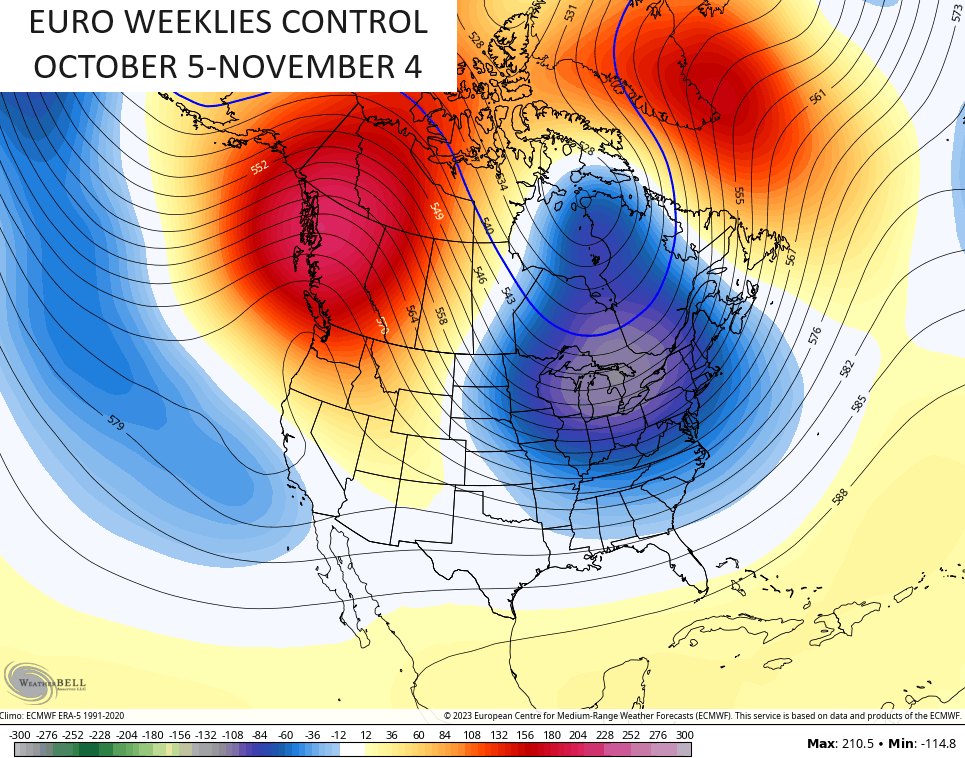
The Control Run of the EURO Weeklies is even more emphatic on blocking and a deep eastern US trough…
How about we get something like that this winter?
Have a great Saturday and take care.

Maybe it’s just me… but doesn’t anyone else feel like this summer has been SO LONG? It’s weird because usually the seasons go by pretty fast… but for whatever reason it feels like we’ve been in slow motion with this summer.
I agree Mark! I’m glad to know it’s not just me that felt that this summer has drug on.
It does seem that way, Mark. For the past 10 years or so we haven’t eased into or out of the major seasons like we did in the past. It feels like the first half of Fall is an extension of Summer, just like the last half of Spring is the beginning of Summer.
YES, The Summers are getting longer compared to let’s say 60 years ago. I remember many years where our first Frost was before October 1st, but that was in South Central Indiana. Since I’ve been living here in Kentucky the Autumn weather seems to last well into December, and the Winter lasting from January into early April. Springs are not as long either maybe a month.
The only weather event that really stands out was that awful Ice Storm in 2009. My area of the state is Snow Starved most years. Maybe that will change this Winter. Don’t know.
Thanks Chris. Looks like Autumn weather the week after next according to the anomalies. Hoping those model forecast pan out. Again don’t know.
Is anyone else having trouble posting Iris it just me?