Good Sunday to one and all. Warm temps roll on as we kick off the month of October, but we have a big time change on the way in the week ahead. This change brings in rain chances and a big blast of chilly weather by the end of the week into next weekend.
The forecast today through Wednesday is pretty straightforward with above normal temps for the entire region. I laid the groundwork for this pattern a few weeks ago and Mother Nature is delivering the warm goods. Highs in the 80s are common during this time.
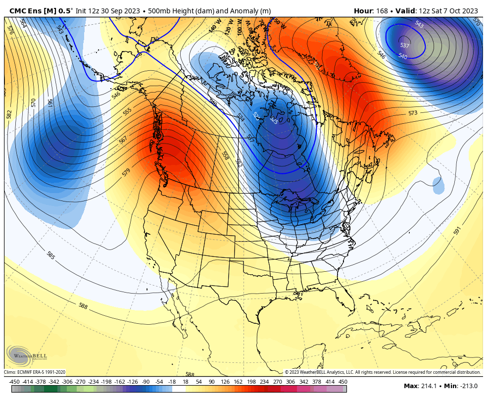
A cold front works into the region by Thursday and Friday with the threat for showers and some thunder…
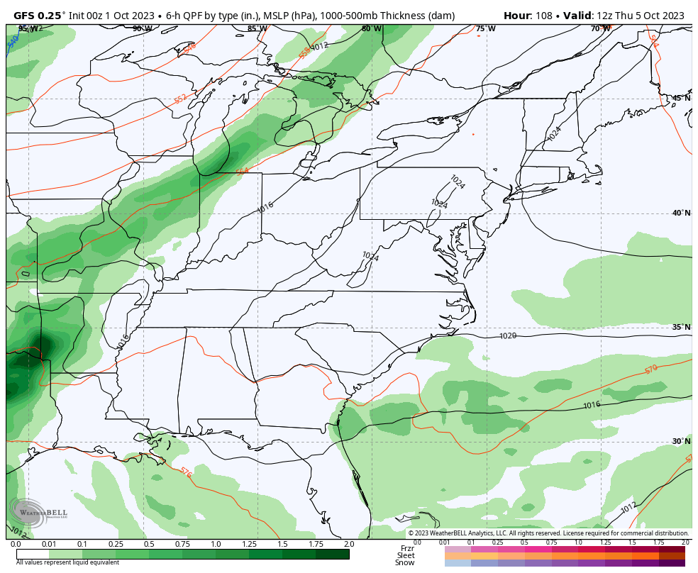
This is being pushed by a massive trough digging into the eastern half of the country…
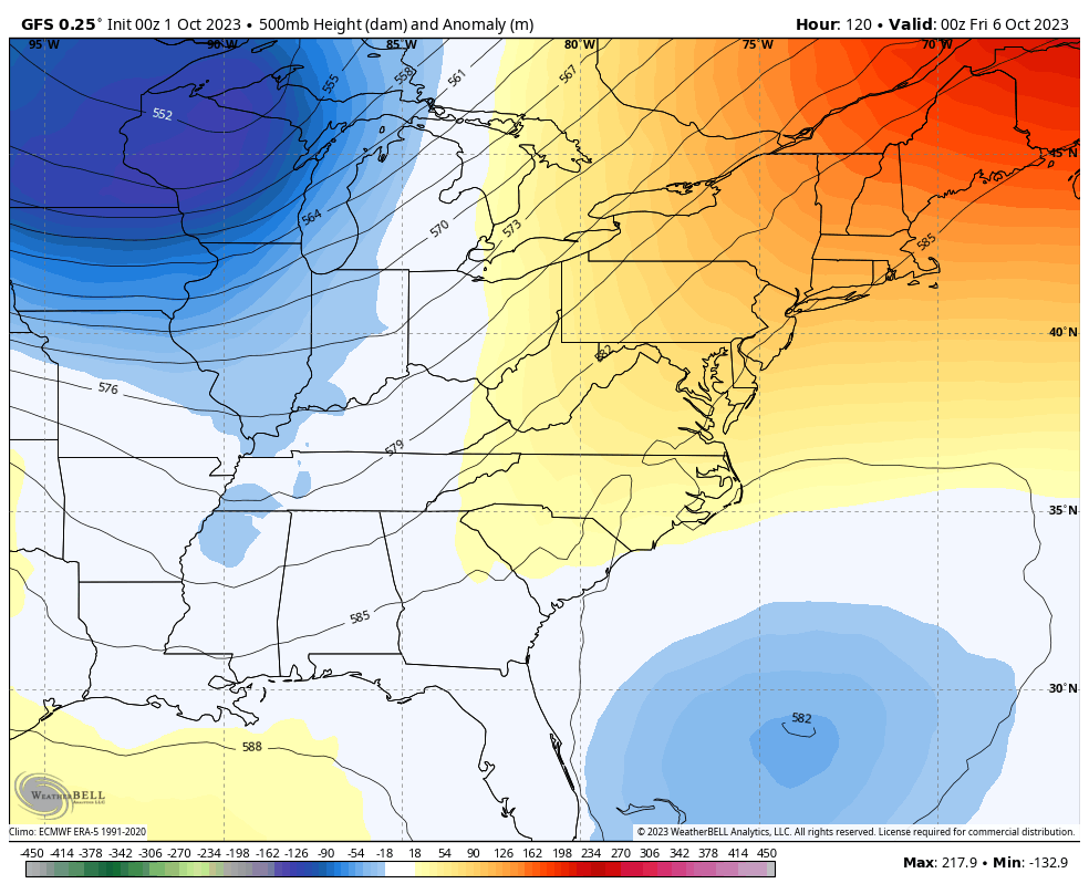
A trough like that can produce early season flakes for parts of the Great Lakes and New England!
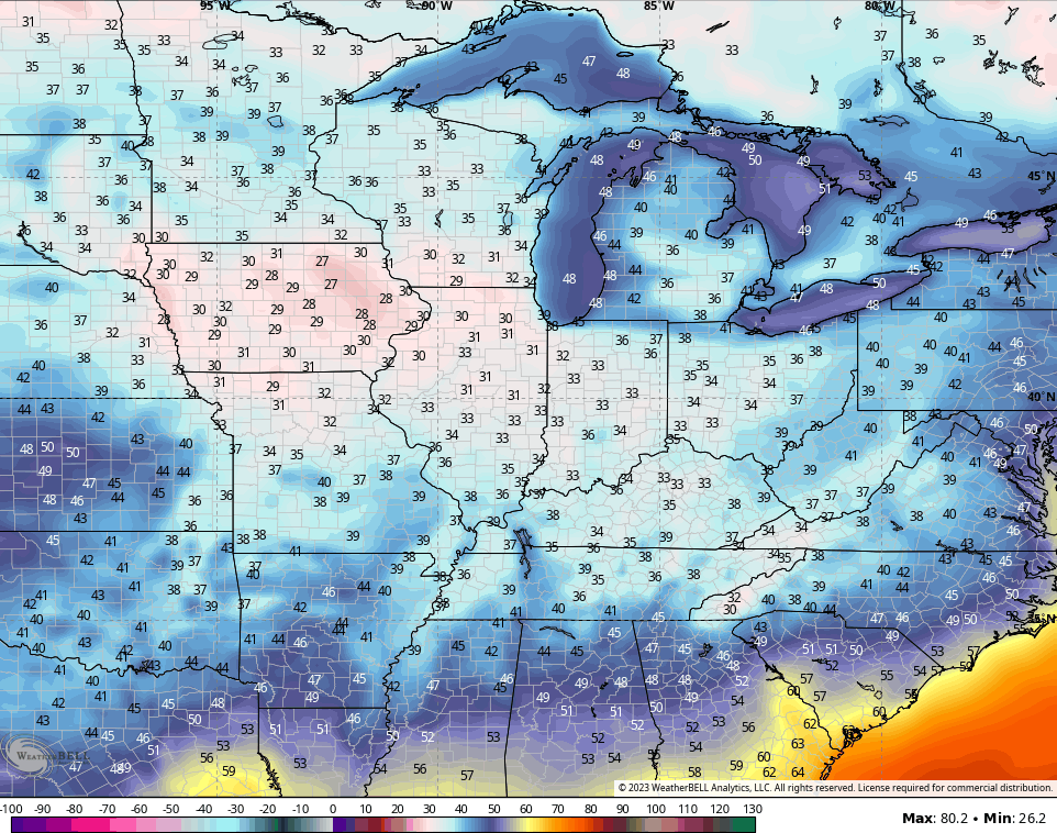
Chilly temps and the potential for a little frost is there at some point, perhaps as early as next Sunday. That’s when the most models give us a shot of 30s for lows…
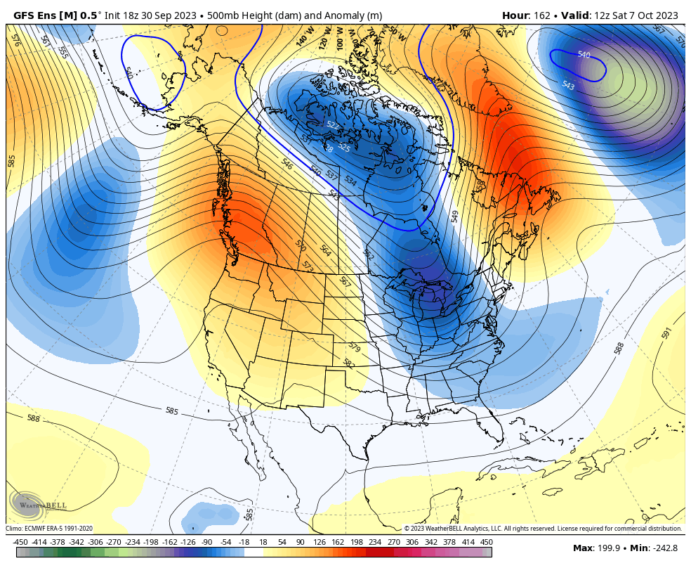
The Ensembles show this trough weakening a bit by the middle of the following week before another trough targets our part of the world…
GFS ENSEMBLES
CANADIAN ENSEMBLES
Since late spring, our region has been the bullseye for troughs and cooler than normal temperatures. I’m not seeing anything to disrupt this trend as we roll through much of the fall and I think there’s a real chance we can see this continue into the winter months.
Have a great Sunday and take care.

The good news from the tropics is that aside from T.S. Philippe and T.S. Rene, which are forecasted to move NW and then N into the central Atlantic, there are no forecasted areas of tropical development expected over the next 7 days. Which should allow systems to proceed cross-country, and that news is totally fine by me!
Thank you!!! Same!
It does seem weird that NOTHING developed in the gulf that went toward TX/LA/MS/AL which sometimes gives us at least some remnants. I guess that’s great for them though.
I’m SOOOO glad October is here. I sleep so much better during fall/winter. I think because we keep the house so cold.
It’s funny… In my subdivision lots of homes have fireplaces and it can be a nice fall full sun day with temps around 75…then the sun goes down and before the temp even has a chance to cool off someone’s already building a fire… I have all the windows open letting the cool air through maybe 65 outside…. and someone has started a fire in their fireplace and I’m thinking WHYYYYY???? My Tstat in the house says 72 with the windows open and someone needs a fire? LOL
Mark, one thing that El Niño affects is the direction of steering air currents in the central Atlantic, giving us a more west to east flow, and increasing the presence of “shear”, which has a tendency to shear the tops off of tropical systems (hence the name). It doesn’t impede the development of tropical systems that form in the Gulf of Mexico or western Caribbean, just the migration of storms coming from the eastern and central Atlantic.
Regarding people who build fires when the temp drops slightly, either they like the ambiance of a fire in the fireplace, or they have a lot of wood to burn!
This is the official NOAA long range forecast for October 2023. Doesn’t appear to be much difference from the September pattern :
https://www.cpc.ncep.noaa.gov/products/predictions/long_range/lead14/
Thanks Schroeder! I agree with the precipitation map, but not so much with their temperature map. It seems as though the NOAA CPC charts are always overstating temperature; maybe the fact that the primary model they use to generate these outlooks is the GFS has something to do with that!
The Atlantic Tropical Storm season thus far parallels the year 2021 :
https://weatherstreet.com/hurricane/2023/Hurricane-Atlantic-2023.htm
It hit 84 degrees Saturday at Chicago’s O’Hare Airport and 83 at the NWS Forecast Office in the SW Suburbs. This superb early Fall weather will continue for the next four days, with high temps continuing in the low and even mid 80s.