Good Monday, folks. Here’s hoping each of you had a phenomenal weekend. The first work week of October is off and running with warm temps but a major change blows in late this week. That’s when a fall cold front brings some rain and very chilly temps. As a matter of fact, frost is possible by Sunday and Monday.
Highs today through Wednesday are in the low and middle 80s for the most part. Skies are dry with a mix of sun and clouds.
At the same time, a major buckle in the jet stream develops across the Rockies and Plains states. This will barrel its way to the east Thursday and Friday and into the weekend and has the chance to develop into quite the monster upper low…
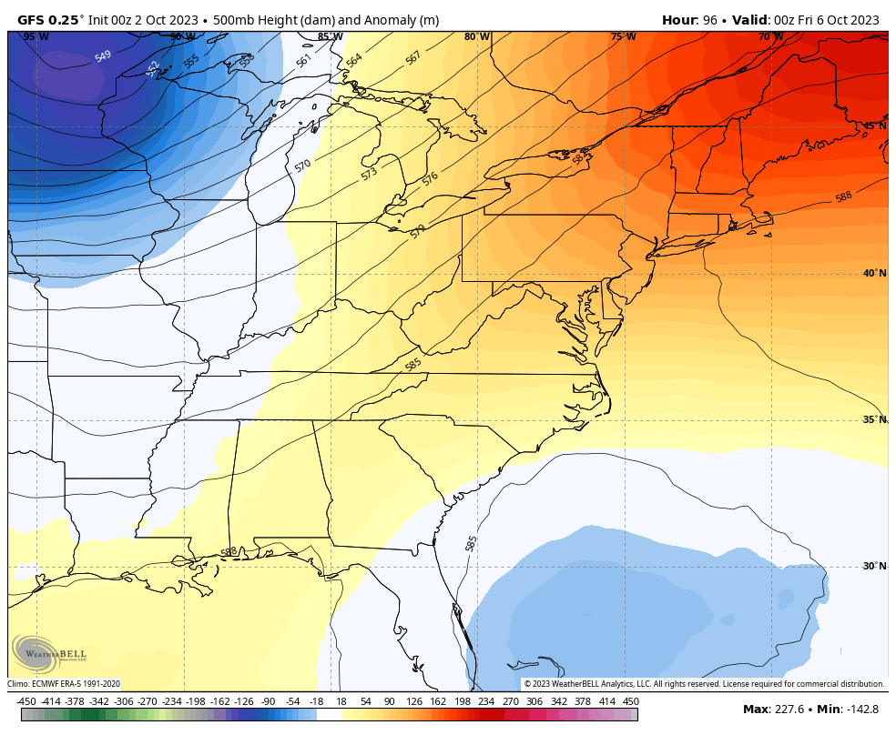
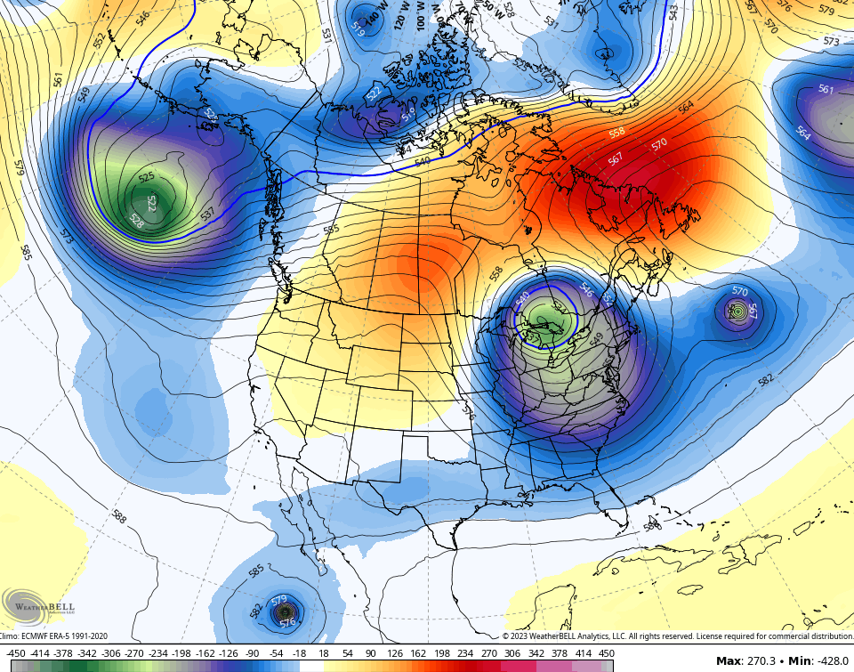
My goodness, that’s highly anomalous for this time of year and resembles the week before this past Christmas.
This will be introduced by gusty showers and some rumbles of thunder sweeping across Kentucky late Thursday into Friday…
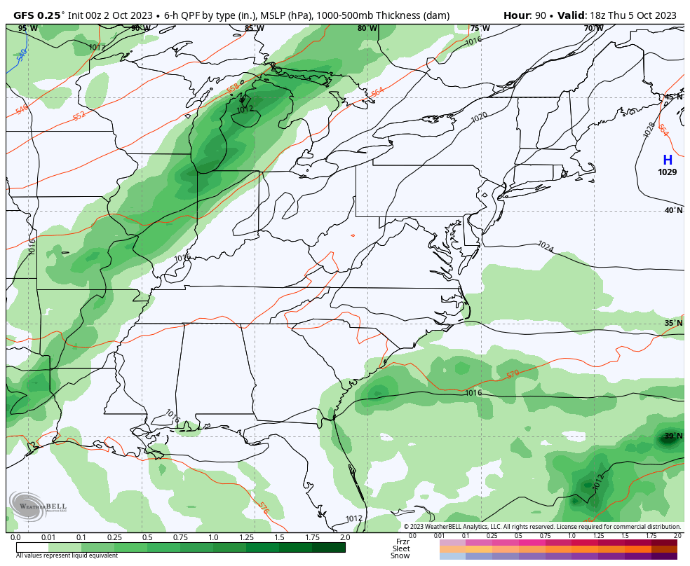
Can we get a wave of low pressure to develop and wrap up along this boundary and keep chilly showers into Saturday? It’s a possibility.
Temps behind this front will be dramatically cooler than where we are now and will be well below normal for early October. Highs may not get out of the 50s for some this weekend with lows that can reach the frosty cold 30s Sunday into Monday mornings.
I’ve talked a lot over the past few months about the blocky look to the pattern and I’ve been ramping that talk up even more of late. Blocking patterns can create some monster upper level systems as evidenced by this upper level map for this coming weekend…
Is this a sign of the winter ahead? I’ll have some winter talk and breakdown with my next update.
Have a great Monday and take care.

Maybe the last week of the growing season.
It has to be around 25 degrees to end the growing season, but I hope that doesn’t happen before the foliage has colored and fallen. A good Frost would help start the Fall foliage color however.
I guess I’ll get busy and help hubby split wood today. Sounds like we’re going to need it early this year.
Dottie, you sure have perfect weather for that chore. I haven’t done that kind of work in years and I’m sure my doctor would not approve of me doing that kind of work.
Thanks Chris. Looking back and trying to find a year that the weather pattern was similar to this year. The one I came up with was 1987. That Autumn was cooler and drier on the average. We had an El Nino that year with a mild and dry Winter, and a early than normal Spring. It was the beginning of a widespread drought that lasted until 1990. Hope that doesn’t happen again. Once in a lifetime is enough.
Here is the link for the climate recap for September for the Chicago area. Thanks to the very warm first ten days and last ten days of the month, temperatures averaged a healthy 3.2 degrees above normal, with near normal precipitation. There were twelve days of 80+ degree temps, including three days in the 90s. http://weather.gov/lot/September2023
That’s pretty warm for your area this time of the year Mike. This El Nino seems to be the cause plus Solar Cycle # 25. Don’t really know. My area of Kentucky is currently in a moderate drought ( D1 ) and there are no signs of any significant rains in our local forecast anytime soon.