Good Tuesday, folks. Warm temps continue for a few more days but the focus continues to be on a big blast of real deal fall chill arriving by Friday into the weekend. This brings us more rain and the potential for some patchy frost on the pumpkins.
I’m also going to take a little look ahead into winter courtesy of a brand new seasonal model.
Let’s start things our with the now and the now is warm. Highs are in the 80s today and Wednesday.
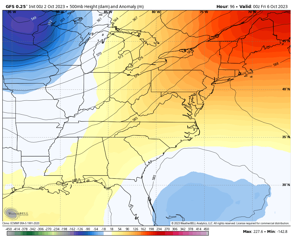
For a while now, we’ve been talking about a deep trough arriving late in week one of October, setting the stage for a blast of much colder than normal taking hold of the region. The closer we get to this, the deeper this trough looks as it takes on the appearance of something straight out of winter.
This animation starts on Friday and goes through next Thursday, showing the staying power of this system…
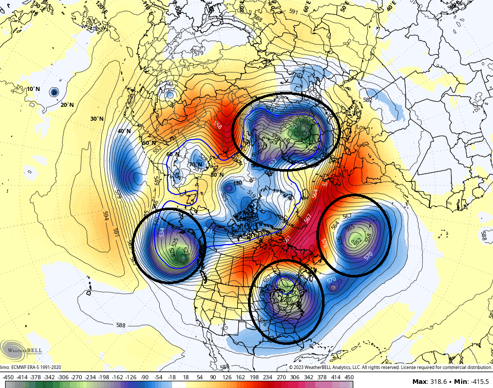
The blocking is doing some serious work and you can see that by looking at the northern hemisphere. Check out the 4 different massive cutoff systems showing up this weekend…
What does this mean for us? Here’s a breakdown:
- Gusty showers and a rumble of thunder will sweep eastward across the region late Thursday and Friday.
- This isn’t very much rain at all but there’s a chance for up to a half inch in a few spots.
- Temps crash from northwest to southeast on Friday. Highs Friday range from the middle 60s to middle 70s.
- The weekend is just flat-out cold for early October. Highs range from the upper 50s to low 60s. Lows reach deep into the 30s if skies are clear Saturday night and Sunday night.
- Some frost is very possible Sunday morning and again on Monday morning.
Folks, you just don’t see these types of cold anomalies very often this early in October…
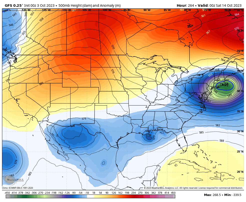
Temps remain seasonably chilly through the first half of next week with the potential for a few more deep troughs to swing through here late next week into the following week. This is a wild looking pattern…
The brand new run of the seasonal model known as the CANSips is out and the model continues to show a nice look for winter weather lovers. As I’ve mentioned before, this is a seasonal model that never really shows much in the way of troughs and rarely has anything but above normal temps. That has not been the case with recent forecasts for the upcoming winter.
One of the reasons the model is so gung-ho on the winter is because of what’s going on out in the equatorial Pacific. The model continues with a stout El Nino…
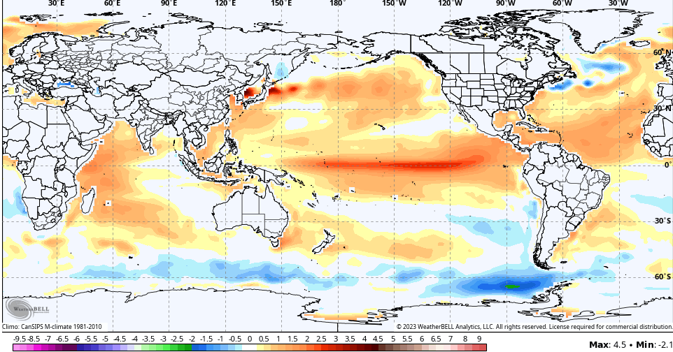
The placement of the warmest waters is usually a big factor in seasonal weather patterns, especially during the winter months. You can clearly see the warmer waters are into the central zone known as region 3.4…
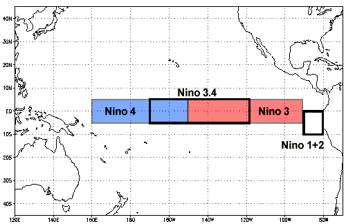
Historically speaking, El Ninos that have the warmest water in region 3.4 are better for winter lovers in the eastern part of the country, including here in Kentucky and surrounding states. When the warmest waters are farther east along the coast of Peru in region 1+2, our winters are skewed pretty warm.
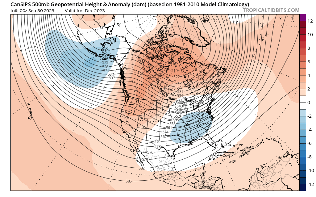
The CAN Sips month by month breakdown goes like this…
December has a ridge in the west with a weak trough across our region into the southeast…
By the time we reach January, we find blocking showing up across much of Canada and Alaska, allowing for much lower heights across the southern half of the country…
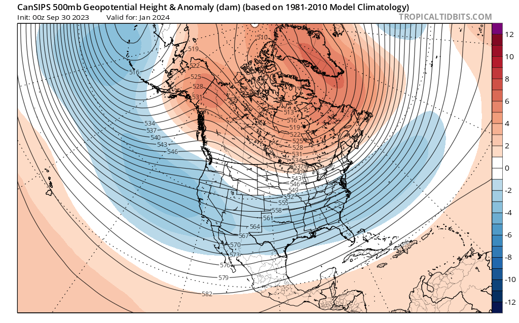
That signal has been there on most of the seasonal models for some time.
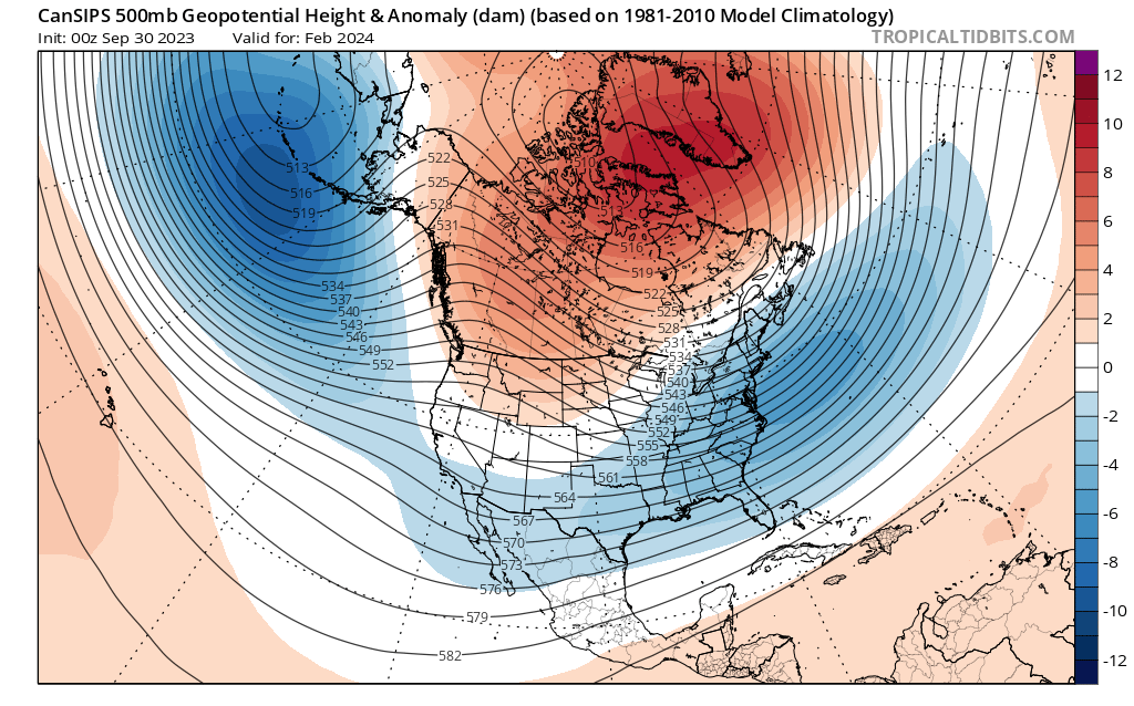
By February and March, this new run of the CANSips shows more of a trough in the eastern half of the country…

Seasonal models do have relatively low skill, but the consistency of what these models are showing is pretty rare.
Have a terrific Tuesday and take care.

Could be a January 1994 storm if these verify.
It looks more hopeful than what we have seen in awhile. Chris I am anxious to hear your bold prediction for the upcoming winter. Does it have the S word in it????
Thanks Chris. For the very detailed Blog this morning. Hoping it pans out for all the Winter Lovers on the Blog. I would like to see more of a Snowy Winter than dry and cold, but the placement of where the Snows will fall in the country is next to impossible to predict this early in the season of Autumn. I’m currently more concerned about the lack of good rains to end this moderate drought. I would like to see a well organize low pressure system come out of the southwest without the ” Southeast Ridge ” weakening it and shoving it to our Northwest.
Hoping that the still developing ENSO will be moderate and a ” warm pool ” / central Pacific type would activate the North Pacific jet stream, and cause it to amplify and take a Southern route ( Subtropical jet stream ) to give the Southern states the best chance for good Rains and Snows this Winter. All this will only happen if the PDO goes positive like it phased in the years 1976 to 1979, and more recently in the year 2015 – 16. I read that the PDO has been very negative since May 2023, so we will see what happens.
Nino 4 impressive also..Looking at the animation maps sure looks like the warmer waters are moving westward..Think maybe a basin wide event with a high end moderate..I’m with Schroeder on the -PDO..It’s currently near record and one of many things that can throw a wrench in winter..Could see a strong -PDO countering a +PNA or maybe MJO staying in bad phases..Anyways a interesting winter coming up with the record warm waters..