Good evening, folks. It’s another awesome fall weather day that’s wrapping up and we have another touch of frost on the way tonight. Beyond this, temps climb for a few days before tanking this weekend with a prolonged November pattern settling in.
As expected, frost was out there in some areas with our first 32 degree temp showing up this morning…
This morning hit the low and middle 30s for many with Meade County hitting the freezing mark. All of this without a Frost Advisory.
Here are the Top 10 lowest of the lows from the Kentucky Mesonet. #kywx pic.twitter.com/ndaaw9KxiU
— Chris Bailey (@Kentuckyweather) October 10, 2023
It looks like another night of the NWS dropping the frosty ball with readings dropping into the 30s with more patchy frost, especially across the northern half of the state…
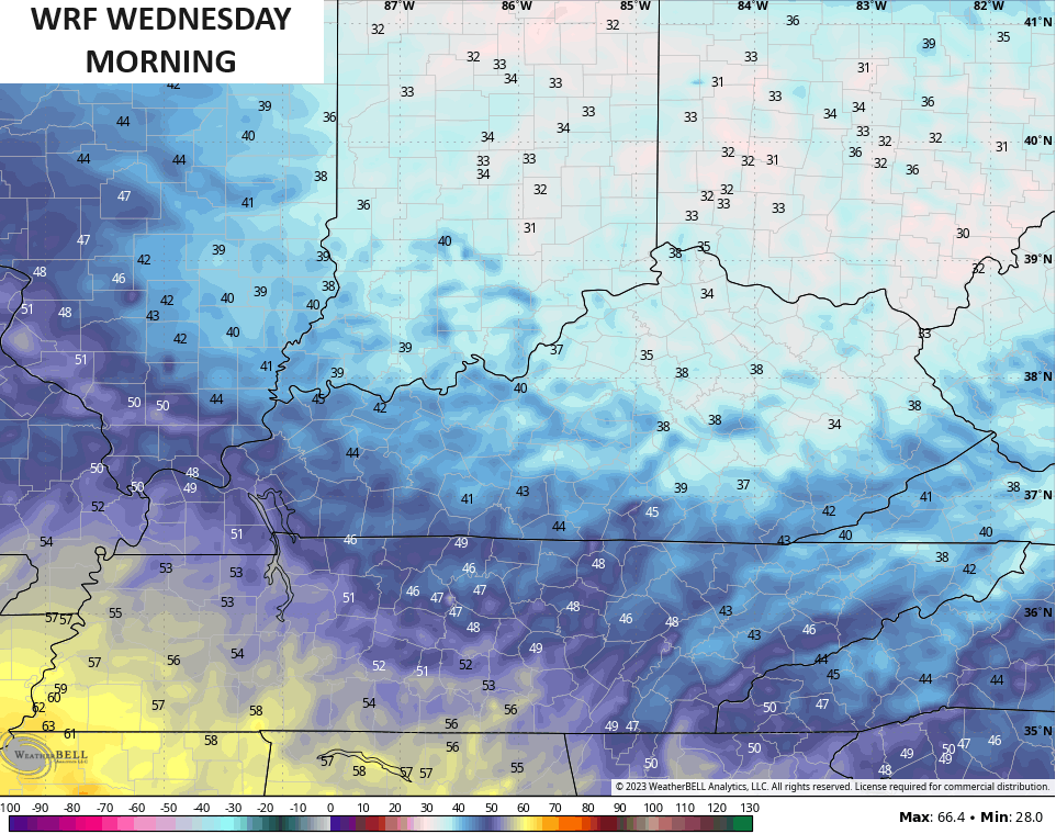
Temps recover into the 70-75 degree range west with 65-70 for central and eastern Kentucky by Wednesday afternoon with some clouds. There’s still a small shower chance in the north.
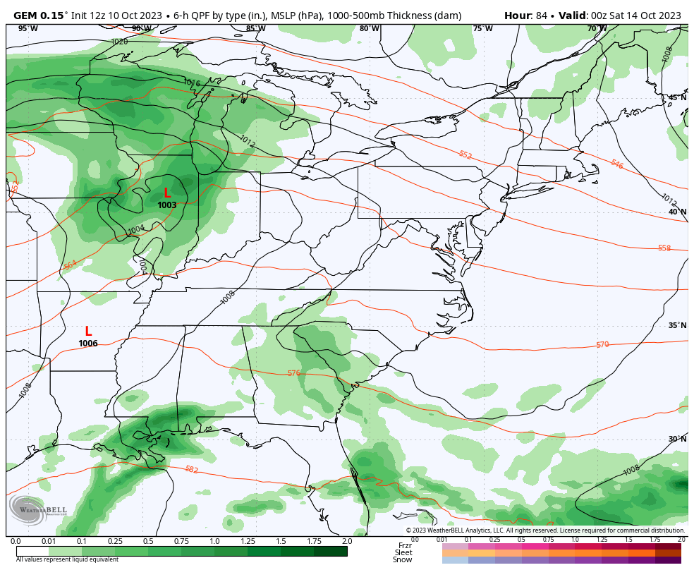
Highs are deep into the 70s for Thursday and Friday before a big fall storm system moves through. Showers and some storms will be noted Friday night with crashing temps and gusty winds for Saturday with a few more showers.
Chilly showers and gusty winds will then be likely into the first half of next week…
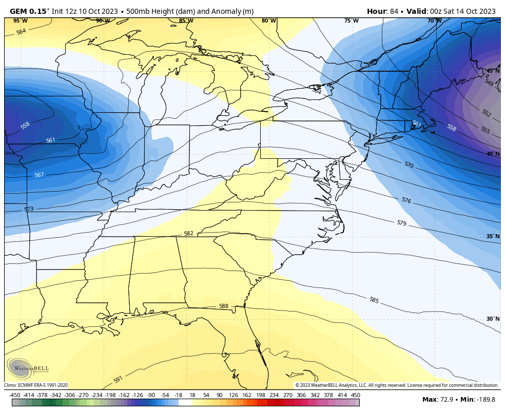
That’s a highly anomalous pattern for the middle of October as yet another monster upper level system digs in…
This is an amazingly stable overall pattern and the GFS Ensembles show this maintaining itself into the start of the final week of October…
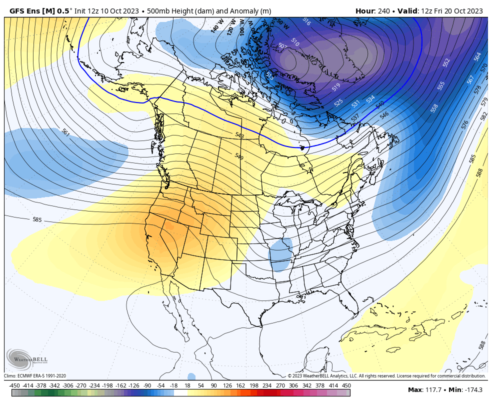
Can we get this to just lock in for November and into winter? It’s been a while since we had something like this happen, but it’s certainly plausible.
Enjoy the evening and take care.
