Good Tuesday to one and all. Patchy frost is with us this morning and that returns Wednesday morning before we mild it up for a few days. This is ahead of another big storm system set to usher in another November looking look and feel.
Temps this morning are in patchy frost producing 30s for many areas. By the afternoon, expect gorgeous sunshine and temps in the 60s.
Another round of, at least, patchy frost is likely tonight and early Wednesday as temps dip back into the 30s…
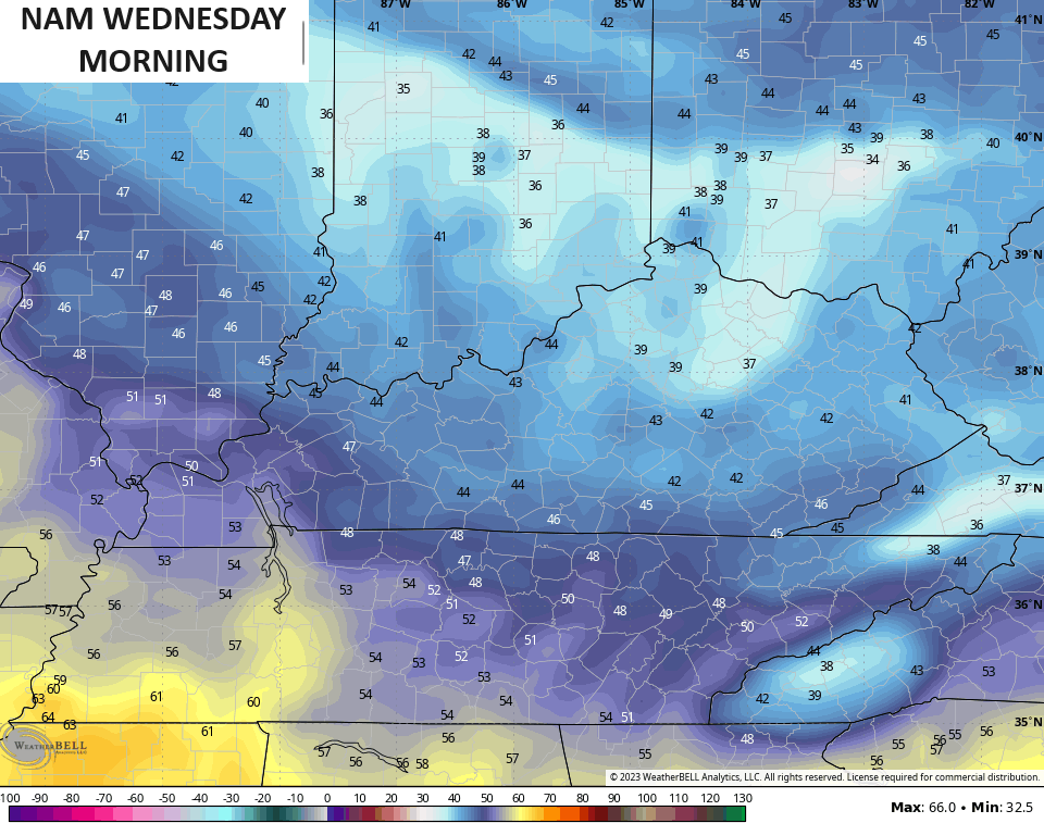
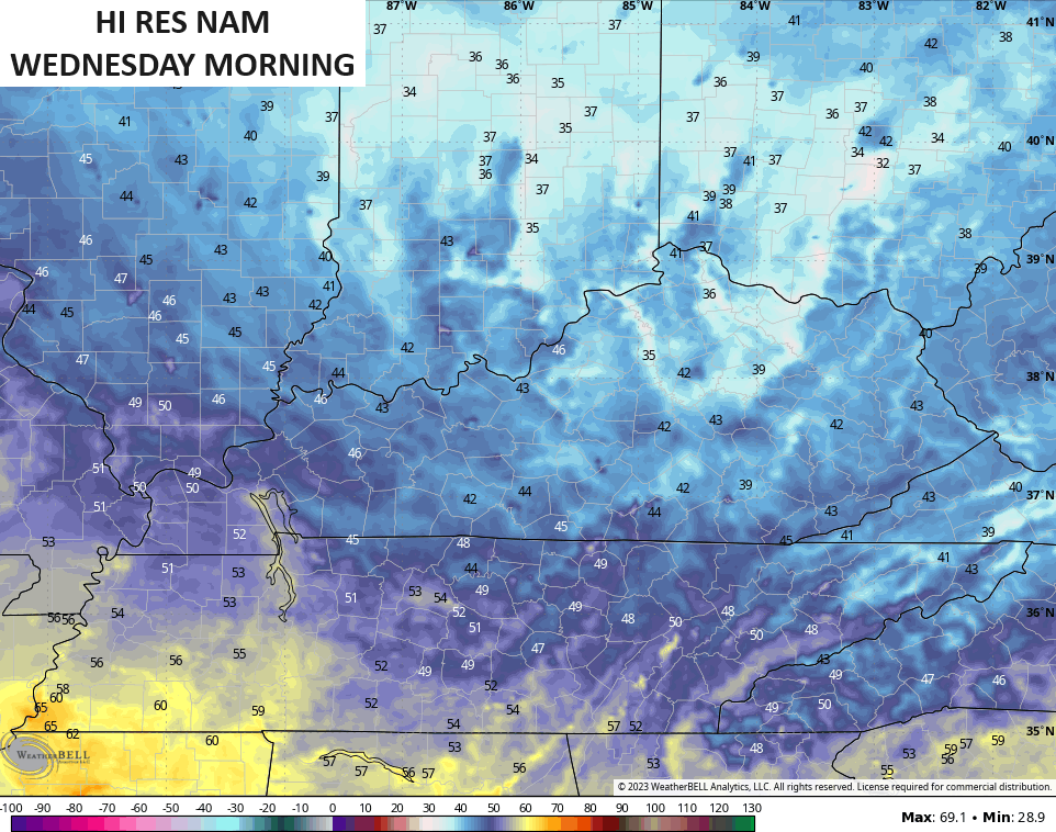
Temps start to climb from this point with upper 60s and low 70s for many Wednesday afternoon. There’s the slightest chance for a shower showing up, especially in the north.
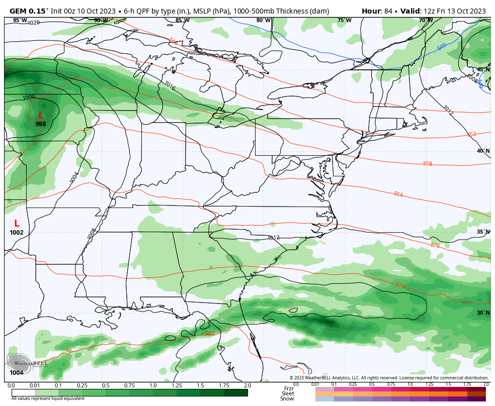
The numbers for Thursday and Friday climb deep into the 70s on a southwest wind cranking ahead of a potent low storm system developing in the plains. This system rolls eastward for the end of the week into the weekend. Here’s what it may mean for you:
- Showers and a few thunderstorms roll into western Kentucky Friday and then across the rest of the state Friday evening into early Saturday.
- There’s a low-end chance for a some strong storms with this.
- Winds are very gusty during this time and may reach 35-40mph at times.
- Wrapround showers show up behind the departing low late Saturday as temps fall through the 60s and into the 50s.
- More in the way of wraparound showers will be noted Sunday and Monday on a strong northwest wind flow.
- Highs from Sunday into early next week have a really good chance to stay in the 50s.
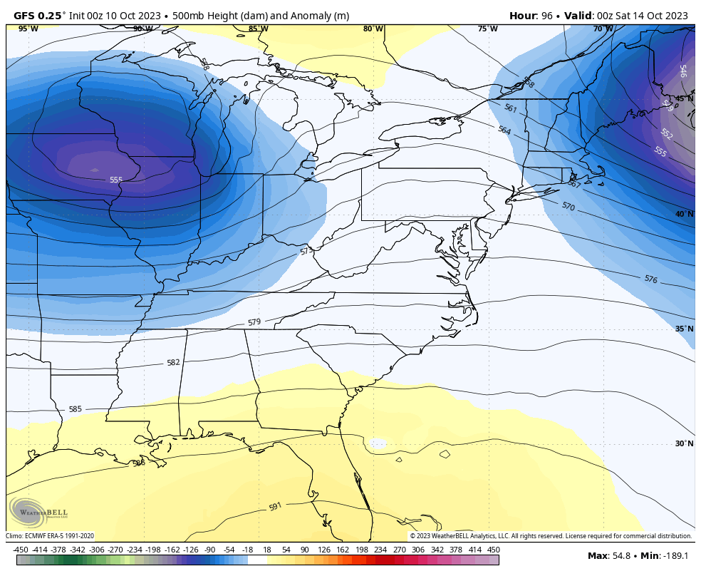
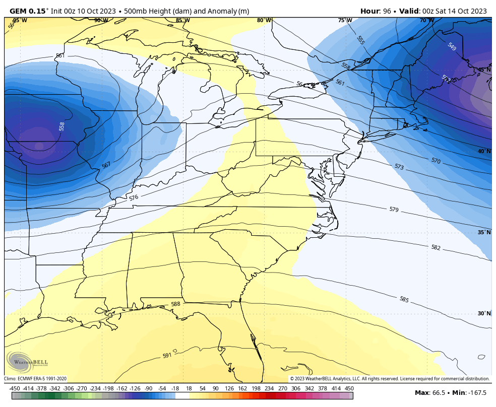
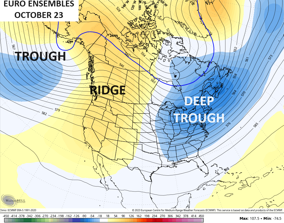
All of this is a result of a lazy jet stream that continues to give us a lot of blocking. That blocking leads to a lot of big time closed lows and it just so happens that our region is in the bullseye of these slow lows.
Here’s the upper level setup from the weekend through early next week..
GFS
CANADIAN
At the surface, this block forces the low eastward across the Ohio Valley before essentially getting trapped off the east coast. That strong, cold northwest flow behind all this actually produces lake effect rain showers…
Give us this setup in November or later and look out.
As is, there’s a chance for highs to stay in the 40s either Sunday or Monday. Wow!
The stable pattern continues into the final full week of October…
I’ll see you guys back here later today for another update. Have a terrific Tuesday and take care.

No frost as of yet in my part of Richmond.
Yes, the upcoming rain might be a decent snow maker in December. I see the low is traveling along the Ky.& Tn. border.
It would probably start out as rain changing to snow.
Maybe some additional accumulation from lake effect snow. (I-65 east) A nice setup for Cincy & her surrounding areas.
Hoping that rain forecast Saturday is a bust, particularly between 11a and 2p. We’re supposed to have a partial solar eclipse (~50%) about that time.