Good evening, folks. Our showers are out of town and it’s game on toward another night of patchy frost showing up across Kentucky. As I look longer range, the big storm system later this week into the weekend seems well-behaved… For now.
Lows tonight drop into mid and upper 30s for many, leading to some patchy frost.
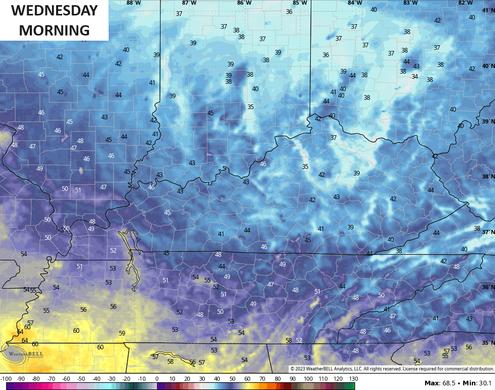
Tuesday is another nice day with highs in the 60s with a mix of sun and clouds. It looks like we have another patchy frost threat by Wednesday morning…
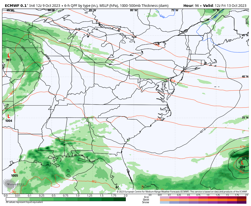
The setup for the end of the week and weekend continues to look to be the same as I’ve talked about for almost a week now. The potential is there for gusty winds with a few strong storms Friday into Friday night. That will be followed by another blast of November numbers this weekend and early next week.
Watch these upper lows that deepen on top of us during this time…
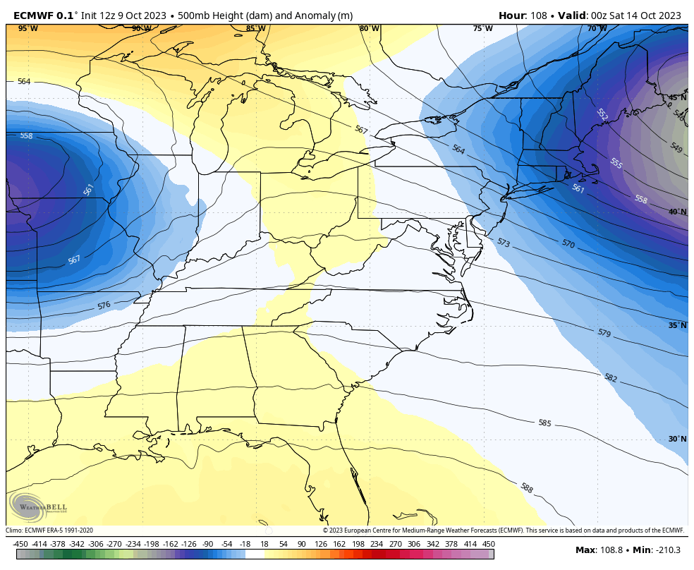
That block across Canada is forcing things a bit farther south and the low may very well roll right on top of us with wraparound showers this weekend…
I will go more in-depth on that later tonight.
Enjoy the rest of your evening and take care.

did you know about the weather cams on KY Mesonet go to site click on data and cameras box on bottom left you scrol to the camera you want