Good Monday, folks. A few showers are sliding through the region to kick off our brand spanking new work week. The focus is on later this week into the weekend as a powerful storm system threatens us with strong storms before unleashing another round of November numbers.
Before we get too far ahead of ourselves, let’s start things out with what’s going on today. As mentioned, a few showers are quickly sliding from northwest to southeast with the greatest concentration across central and eastern Kentucky. This isn’t terribly widespread but whatever is out there will show up on your radars…

Highs range from the low 60s east with mid and upper 60s west.
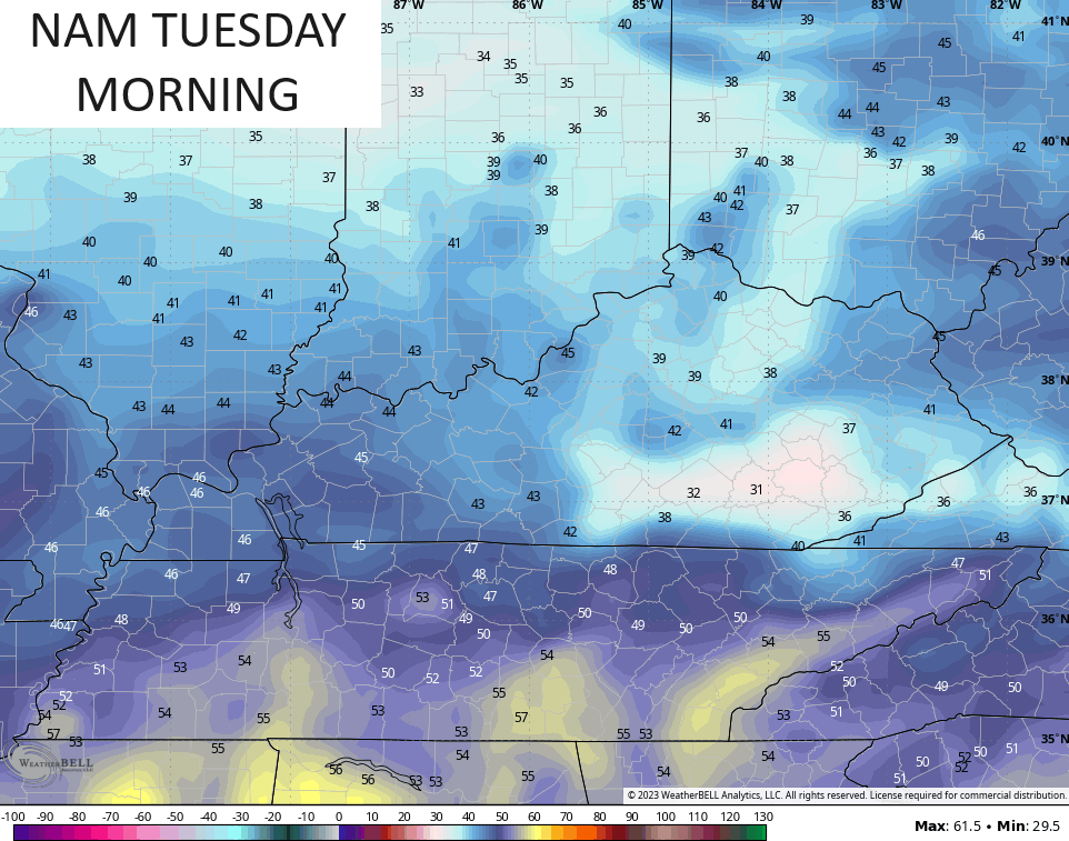
Another frost threat shows up tonight and Tuesday morning with readings deep into the 30s for many areas.
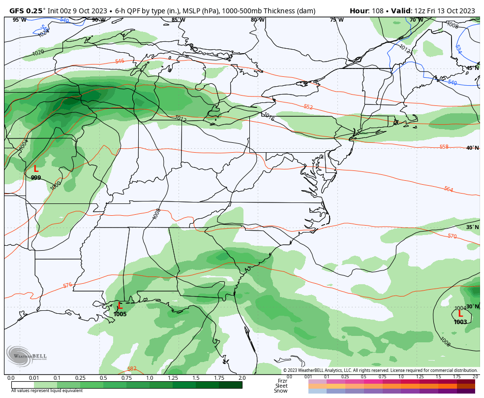
After a seasonally cool Tuesday, temps climb for the rest of the week on a strong southwest wind flow kicking in ahead of the late week storm system. This brings the chance for a shower or two on Wednesday with the bulk of the action coming Friday into the weekend.
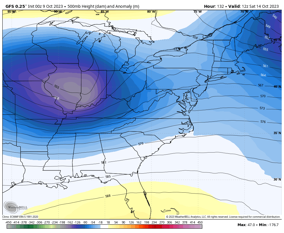
Ahead of this storm system comes gusty winds and the threat for strong storms on Friday. Behind it comes gusty showers and chilly temps for the weekend.
Watch how this plays out…
This comes from a deep trough that’s followed by another deep trough next week…
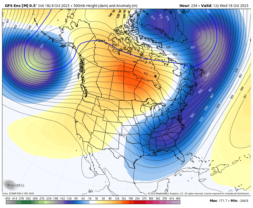
The medium range pattern on the various ensembles continue to to be very steady across North America. They still show a ridge in the west and a trough in the east going toward the final week of October…
GFS ENSEMBLES
EURO ENSEMBLES
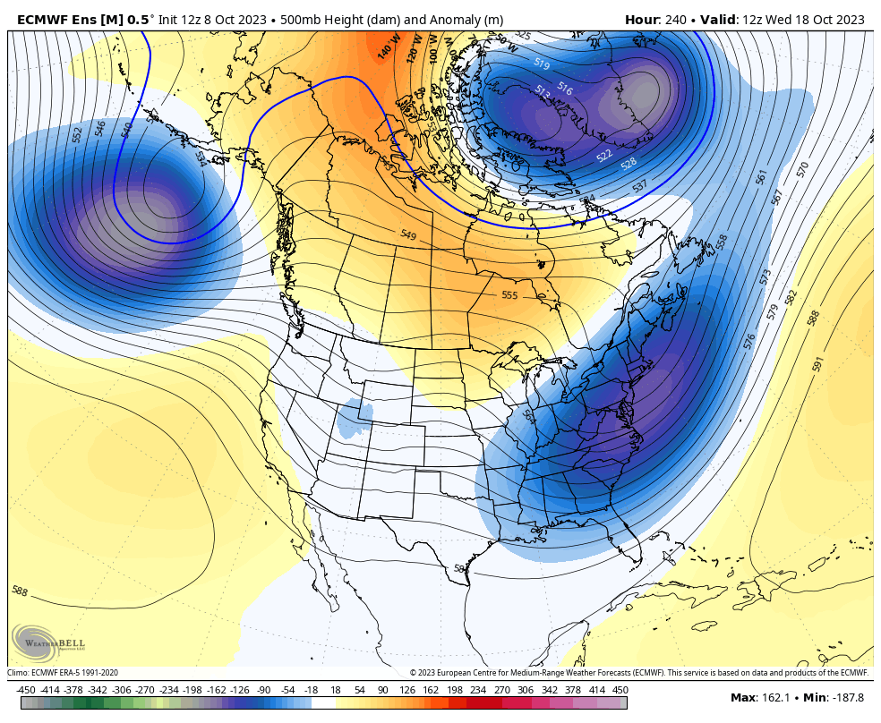
Snow and cold lovers want this pattern to hang around through the winter!
Another update comes your way later today. Have a great Monday and take care.

A nice looking fall forecast.
Thanks Chris. Enjoying the early morning temperatures and mild afternoons. My area has not seen any of the Autumn Frost as of yet. I just hope we don’t receive a Hard Freeze before our first Frost. That would destroy our Fall foliage color. Also, I wish my area would receive one or two of those Northwest showers. Not liking the strong Southwest to Northwest winds as dry as it currently is. High Fire potential in my area. Might as well forget about receiving any phased storms out of the Gulf to bring real relief to the current drought.
A lot changes will have to occur in the Atmosphere before we receive that Long Range forecast for a Cold and Snowy Winter.
It wouldn’t surprise me if we have a cold but dry winter in Central Kentucky..
Here’s the Satellite map of the entire US. Look to the Gulf and you will find the El Nino Jet Stream going West to East cutting off our main moisture source. If this remains this Winter it will be dry :
https://weatherstreet.com/us-weather-satellite.htm
Yell, the blocking is great but it might cut off the southern jet stream.
If the stream is cut off we will have to hope for over performing Clipper systems. Which probably means a lot of disappointing snowfall totals.
Most of the time Alberta Clippers are well North of the Ohio River thanks to the Southeast Ridge, especially here in South Central Kentucky. We still would receive the Cold, dry winds on the back side of the storm. With maybe a few Snow Flurries.