Good evening, folks. Our much colder than normal weekend is wrapping up with a few showers dropping in from the northwest. The overall setup for the week ahead remains unchanged from what I’ve been talking about for a while now.
As expected, frost was noted in most of the state this morning. The Kentucky Mesonet sites show temps hit the low and middle 30s well outside of where the Frost Advisory was…
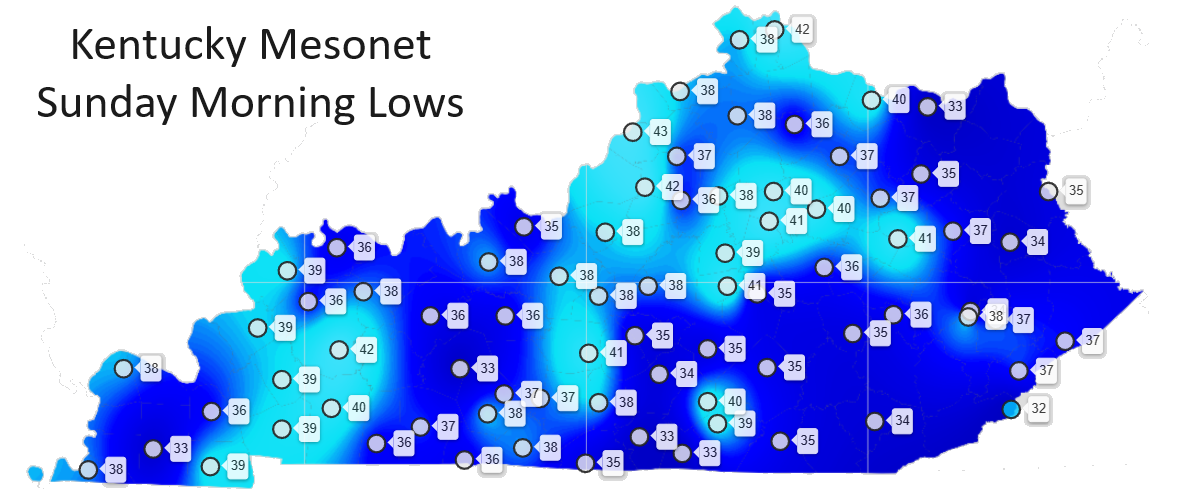
The NWS needs to do better because a lot of agricultural interests only respond to headlines such as a Frost Advisory.
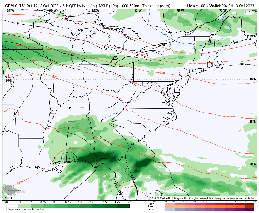
As noted earlier, scattered showers are working in from the northwest and will continue to zip across the area into the first half of Monday. Here are your radars to follow along…

Another frost threat follows the showers for Monday night and Tuesday morning as readings hit the 30s again.
Mild winds then kick in for Wednesday and Thursday ahead of a potent storm system rolling east out of the plains. This brings a shower chance to us for Wednesday and Thursday and may bring strong storms rumbling through here on Friday. From there, temps come way down for the weekend with wraparound showers and November winds taking over…
It’s gonna get very chilly again and that lasts into the first half of the following week, at least.
Enjoy the rest of your Sunday and take care.

Thanks for the update.
No frost noted in Richmond