Good Sunday, everybody. Rain continues to increase across the state today as a powerhouse of a system rolls through the region. This brings a winter looking feel and setup to the region for the end of October and the start of November.
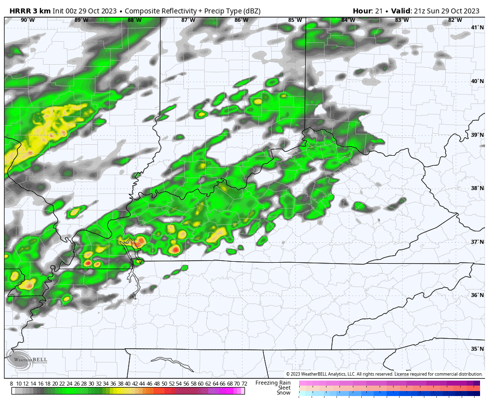
Rain today is more prominent across areas of western and central Kentucky with lighter amounts in the east and southeast. This action will come in waves today before ramping up to widespread this evening through early Monday.
Here are your radars to follow along with today’s action…

As mentioned, rain will increase areawide later today through early Monday afternoon as a wave of low pressure rides overhead. Some thunder may even enter the picture along and ahead of this system today.
The HRRR Future Radar shows all this very well. This animation starts at 5pm today and goes through 8pm Monday…
If you look closely enough, you will even see a speck or two of blue just to our north and northwest late Monday afternoon and evening.
Temps during this time drop from northwest to southeast today with the 40s for the entire region on Monday. Gusty winds will make it feel like the 30s.
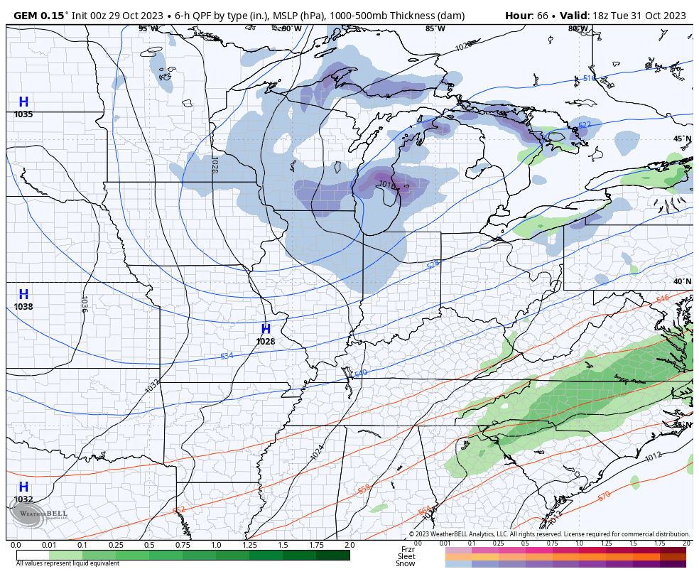
The next system has the look of a wintertime clipper and it brings light snow and flurries from the midwest into the Great Lakes and Ohio Valley late Halloween into Wednesday, the first day of November. Can some of these flakes reach parts of central and eastern Kentucky? Yep. Flakes and nothing more, folks.
The Canadian Family continues to give us the best chance for some flakes…
SHORT RANGE CANADIAN
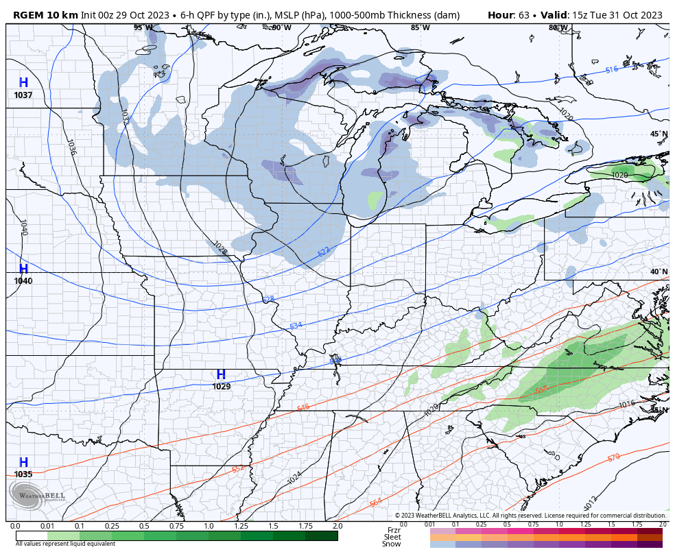
CANADIAN
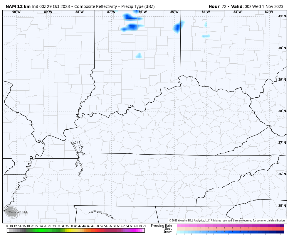
The NAM doesn’t do well in northwest flow events because the model has a dry bias in these situations, but it’s starting to see a few flakes toward the end of the run. This future radar has some spots of blue Tuesday night across eastern Kentucky…
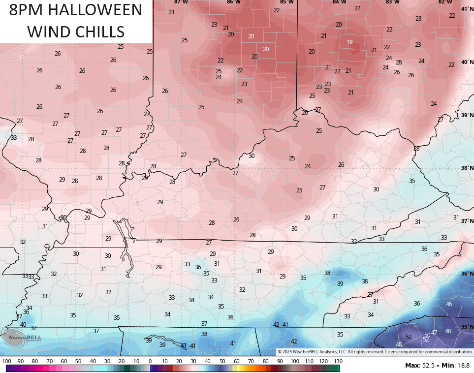
In terms of Trick or Treat hours, temps are frigid for the little ones. Gusty winds and cold temps will combine to make things a little miserable. Wind chills at 6pm are in the low 30s then drop into the 20s in the next hour or two…
Frigid temps and wind chills will be with us on Wednesday into early Thursday. Morning temps are deep into the 20s with wind chills that can reach the teens. Highs are low and middle 40s.
Temps become more seasonable by the end of the week into the weekend but the jet stream looks active and is likely to throw several systems into the region next weekend into week two of the month. These are likely to carve out a series of deep troughs in our region.
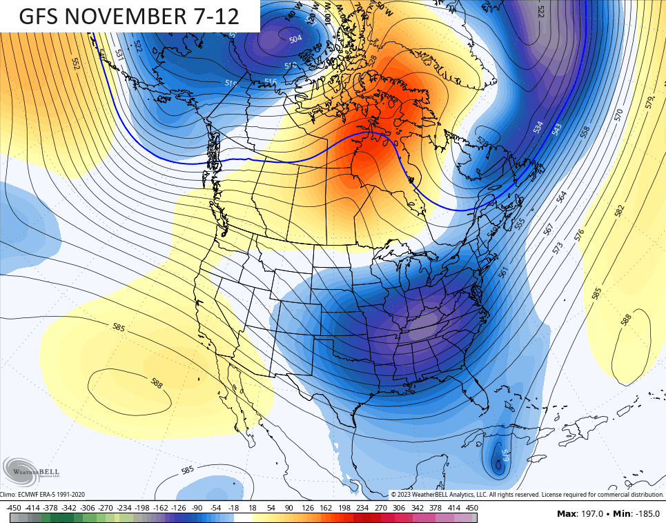
The GFS is even seeing this, so that has me concerned it may not happen…
😜😜
I will have another update later today. Have a great Sunday and take care.
