Good Monday to one and all. Heavy rain and falling temps are how we are starting out the week, but the big story is on a blast of wintertime coming late Halloween into early November. This is essentially an early season arctic front pushing into Kentucky.
Before we get to the possibility of the first flakes of the season, let’s talk about the weather out there today.
Heavy rain slows down this morning from west to east but not before leaving behind one heck of a drink of water. Areas of far western Kentucky have picked up more than 4″ of rain with a general 1″-2″ into central and northern Kentucky. Much lighter amounts are being noted in the southeast.
The rain tapers to showers this afternoon as we slowly end the action from northwest to southeast as a cold wind blows.
Here are your radars to follow along with your Monday rain…

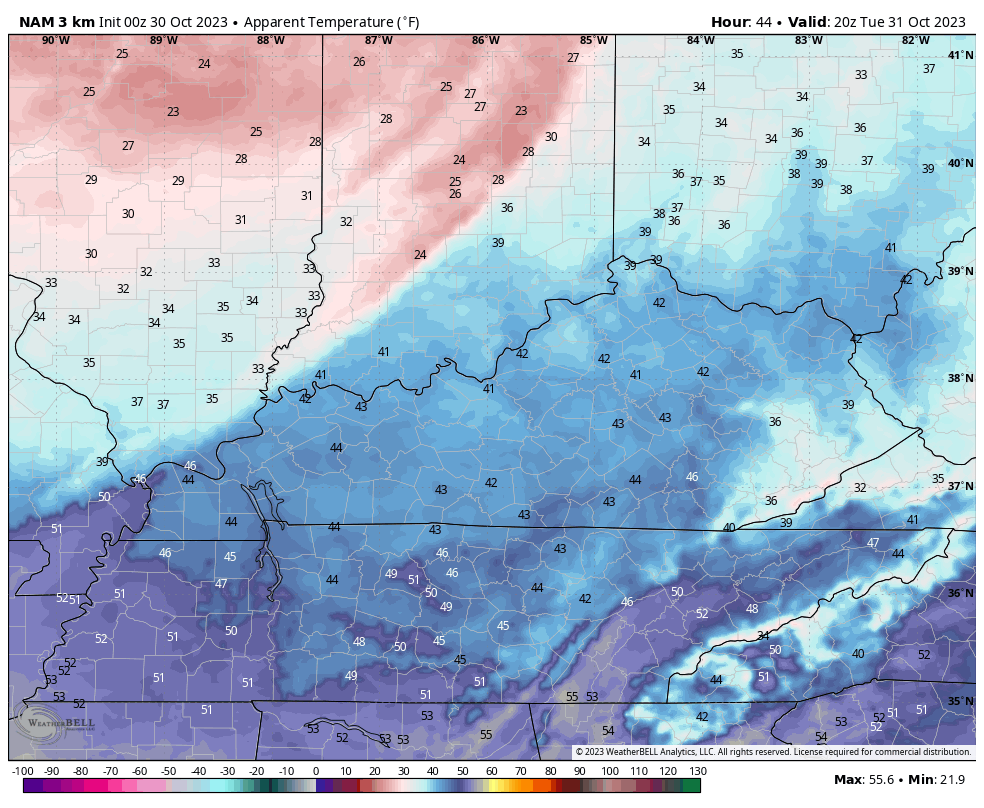
Very cold temps are then on tap for tonight as much of the region slides deep into the 20s. A few of the models take parts of central Kentucky into the low 20s to start Halloween…
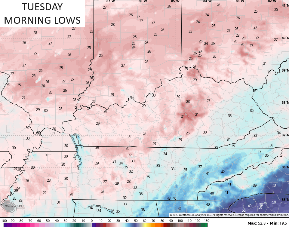
Notice the far east isn’t as cold and that’s because of lingering clouds. There’s a chance for those clouds spit out a light shower of rain or snow late tonight into early Tuesday in the southeast.
Temps then warm into the 40s for Halloween but this late October version of an arctic front slams in quickly from northwest to southeast Halloween evening into the wee hours of Thursday. A few flakes will be possible along and behind this boundary, especially in central and eastern Kentucky.
The future radar from the HRRR actually has a quick-hitting line of snow showing up along the boundary. This animation goes from Noon through 8pm Halloween…
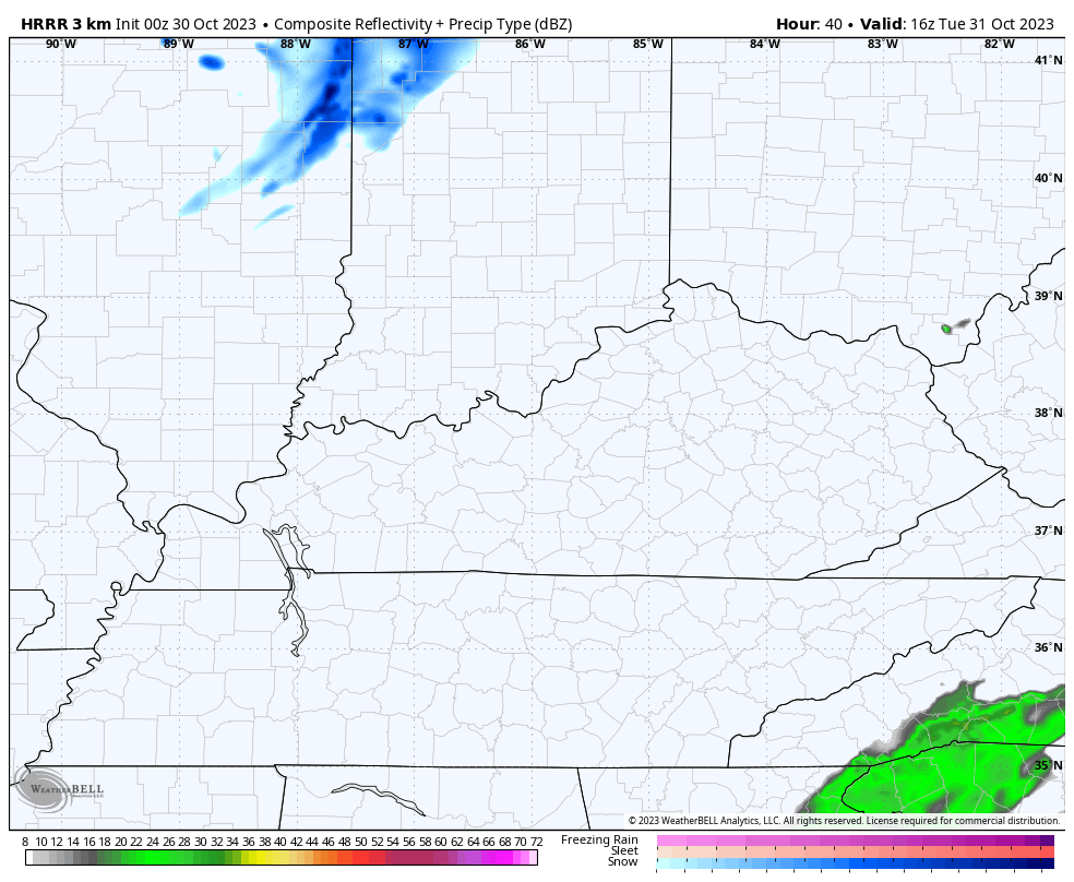
That may very well be overdone, but the model does have some healthy forcing right along that boundary.
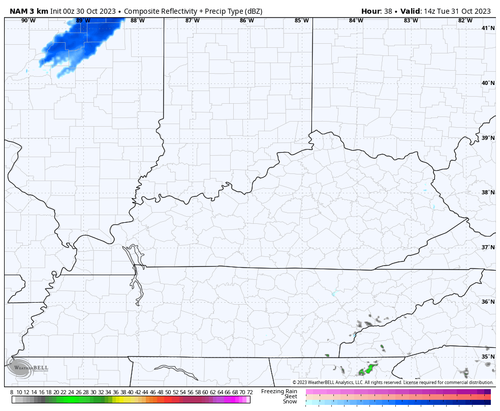
The future radar from the Hi Res NAM isn’t as robust with that line, but it has it and some flakes trying to come in behind it…
Again, the chance for the first flakes of the season is with us late Halloween into early Wednesday with the best chance in the north and east. Obviously, the HRRR likes those chances across a much greater swath of real estate.
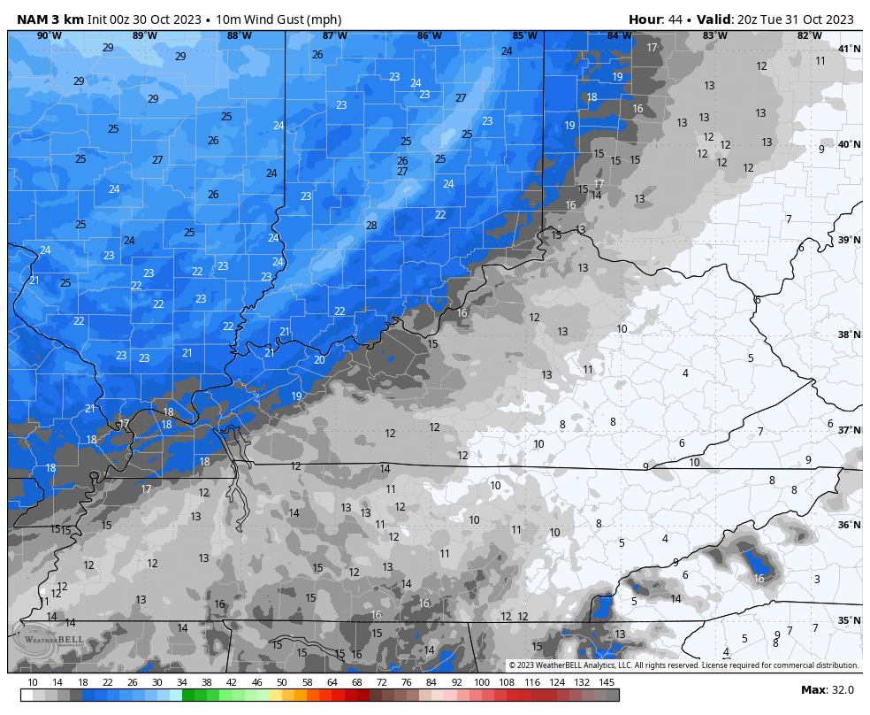
Winds are going to absolutely crank along and behind this front. Watch the hour-by-hour wind gusts from 4pm-11pm Halloween…
Temps crash through the 30s and into the 20s right behind that front. Combine that with those gusty winds and you have an honest to goodness wintertime feel with wind chills dropping through the 20s and into the teens. This wind chill animation starts at 4pm Halloween and goes through 3am Wednesday…
That’s some real deal wintertime cold air, folks!
Temps by Wednesday morning will range from 20-25 for those areas with clear skies and I can’t rule out a few upper teens. For those with clouds and maybe a morning flurry, temps will be upper 20s to around 30.
Highs for the first day of November stay in the 40-45 degree range with gusty winds making it feel even colder. Take the under on Wednesday night and Thursday morning temps as readings may very well hit the upper teens and low 20s for many.
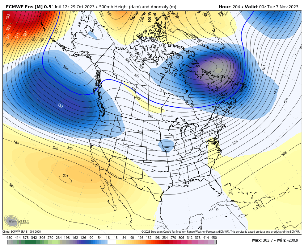
Temps come up to more seasonable levels by the upcoming weekend but another system is likely to swing in here by Sunday or Monday. That’s part of a pattern likely to carve out several deep troughs in our region and across the eastern half of the country.
The average of the EURO Ensembles is all over this…
The Control run of the EURO Ensembles shows the individual troughs and the potential they bring…
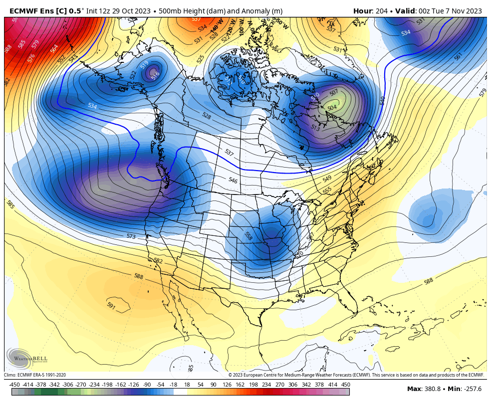
The setup looks like one that can go from thunderstorms to flakes with one system.
I will have another update later today, so check back. Make it a great day and take care.

test
Thanks Chris. I’ve seen it go from thunderstorms to heavy Snow, but that’s been a long while ago. Good welcome Rains yesterday and this morning with the stationary cold front in my area.
We’ll see on the flake potential. 🙂
Tomorrow could very well be one of the coldest and snowiest Halloweens on record for the Chicago area, with temperatures predicted to reach only the mid 30s with on-and-off snow showers or squalls in the morning and afternoon leading to some accumulation. Wind gusts are going to reach near 40 MPH in the afternoon and evening.
This is a temperature question someone has sit a kitten off here she won’t let me pick her up yet she’s on my carport I have given her food and put a carrier to get in if she has too my question is will the next few night temperatures wise be too low for her to withstand????? The temperature has been dropping all day with some rain. Anyone got any answers or suggestions she won’t let me pick her up????? I thought even about straw to keep her warm. I do love the snow but not a great fan of the cold but guess if we have one we have to have the other. Mike you sound right in line for some snow and cold,
If you can create some sort of shelter for it with straw and a blanket, that will help. Put food and water in it as well.
I will it’s just too wild or scared for me to catch her