Good evening, folks. It’s a dreary and cold Monday wrapping up across the region as we get set for a small taste of winter late Halloween. This comes in the form of a few flakes and crashing temps that take us into early November.
Showers continue across the east and southeast this evening but will slowly diminish in the coming hours. Here are your radars…

Clearing skies across western and parts of central Kentucky will allow overnight temps to drop deep into the 20s for a hard freeze. Temps in the east stay above that as clouds hang around tonight. There’s even the chance for some sprinkles or flakes in the morning in the southeast.
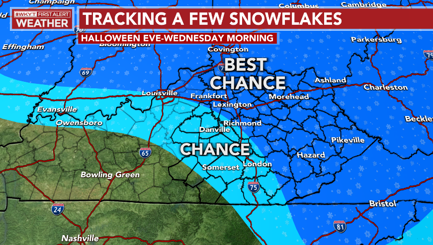
The system zipping into the Ohio Valley Halloween will bring the chance for a few snowflakes to parts of the state. Here are the areas that have the best chance of seeing those flakes fly…
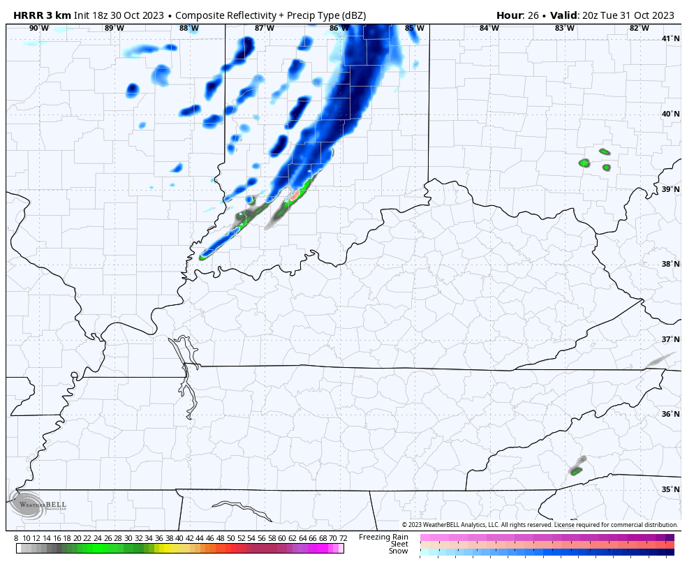
The HRRR continues to indicate a quick-hitting line of snow showers and flurries along the front during the evening with some flurries coming in behind that on a northwest wind into Wednesday morning. Here’s the future radar…
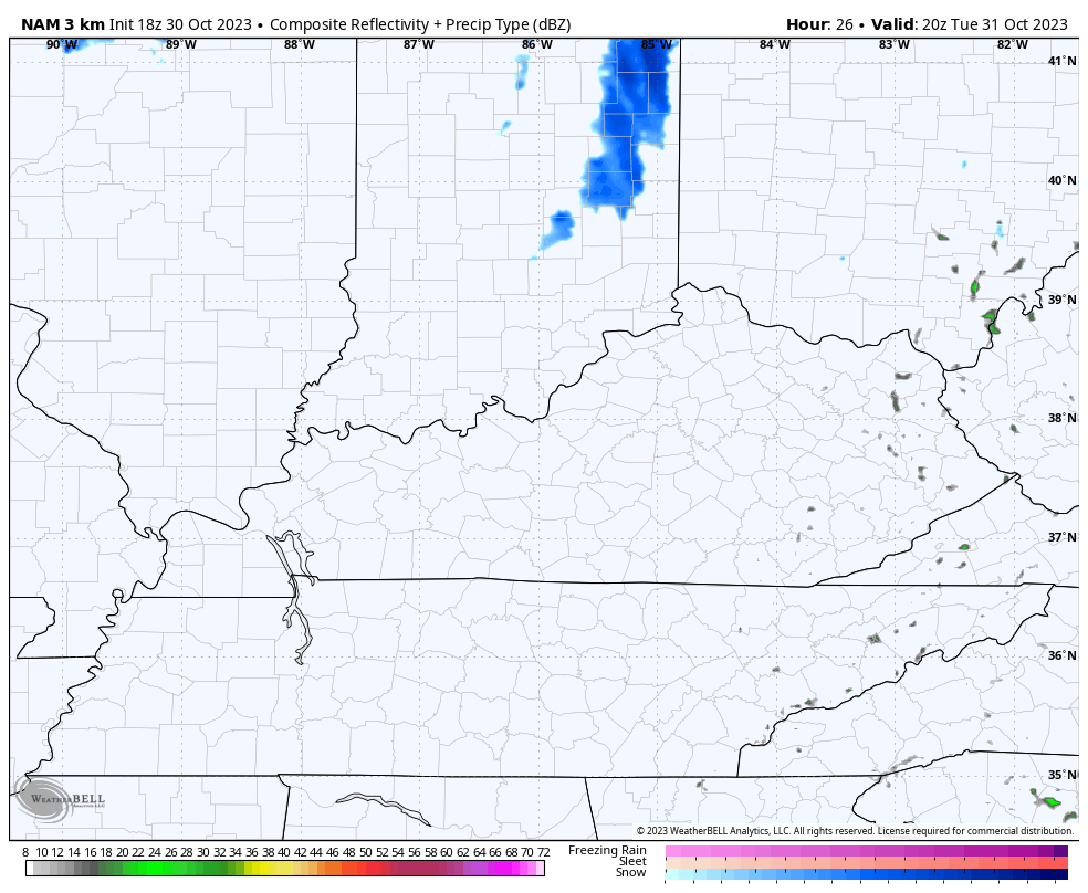
The Hi Res NAM is showing something similar, but isn’t as robust with the line of snow showers…
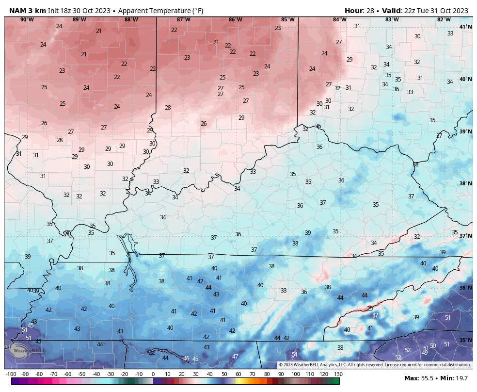
Winds are very gusty as temps crash, leading to very cold wind chills Halloween evening into Wednesday morning. This animation shows the wind chills from 4pm Halloween through 2am Wednesday…
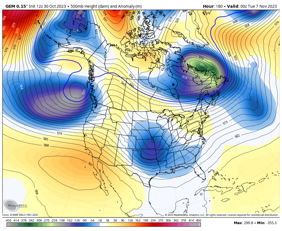
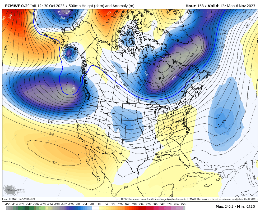
Temps stay cold through Thursday then bounce back over the weekend. That will be ahead of a big storm system early next week as the jet stream looks very energetic. Watch how the Canadian and EURO both carve out another deep trough…
CANADIAN
EURO
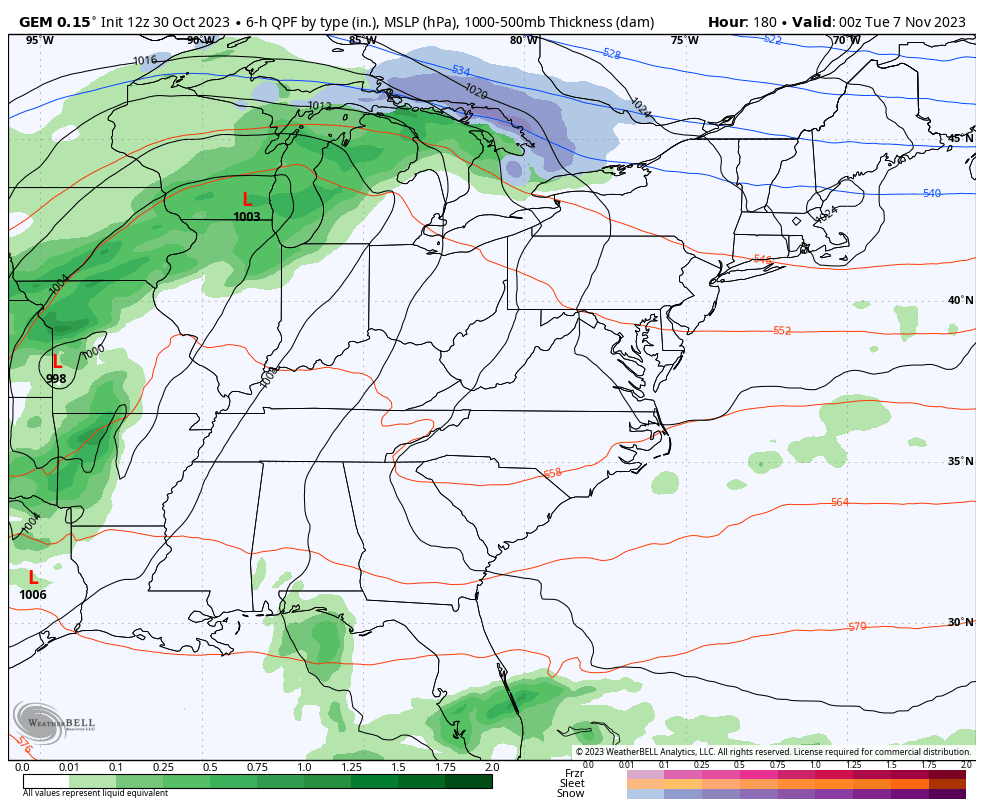
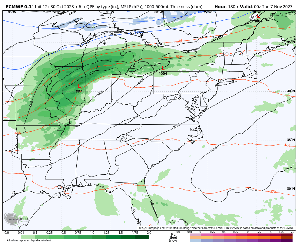
Thunderstorms to some snowflakes with this setup? Maybe so…
CANADIAN
EURO
Enjoy the evening and take care.

Not that big of a deal, but maybe a tiny bit of trick or treat fun.
Chris is only trying to put us in the mood. Maybe title
this new post ‘Snow Appetizers Are Back on the Menu.’