Good Saturday to one and all. It’s the first weekend of November and things are starting off on a decent enough note with mild temps and just a small shower chance. This mild pattern hangs tough through the middle of next week before changes blow in.
Temps out there today are back into the 60-65 degree range for many with just the slightest threat for a quick-hitting shower to show up. These will zip from west to east very quickly but won’t be widespread by any means. As a matter of fact most of the region is dry.
Just in case one of those showers show up, here are your radars…

Sunday is another mainly dry day with temps in the 60s.
Winds gust up Monday and Tuesday as that southwest wind really kicks in. Temps make a run at 70 and that’s likely to continue into Wednesday before a cold front moves in by Wednesday night and Thursday.
This front may wind up carrying a wave of low pressure along it with cold air coming in behind it.
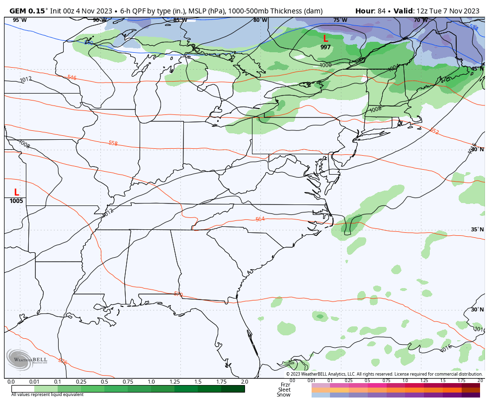
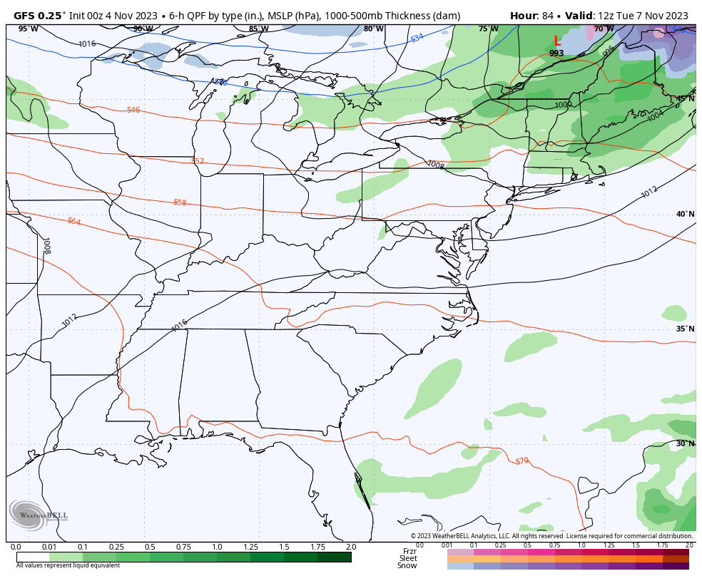
The Canadian and GFS are actually on a similar page with this…
CANADIAN
GFS
That whole scenario is still a work in progress. Of course, aren’t we all? 😁
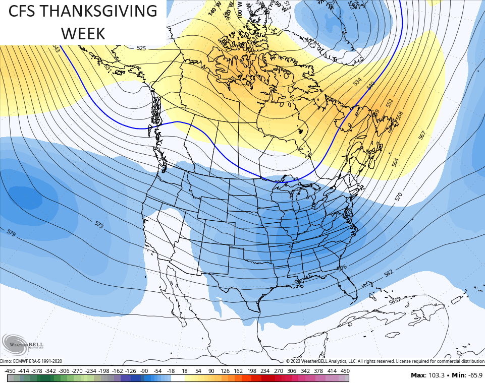
The pattern likely breaks mild again after that and that should carry us into the middle of the month. The target for the next winter looking setup may very well be Thanksgiving week. This is something I’ve been showing of late and the CFS continues to have that look for the big week…
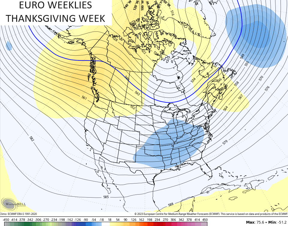
The EURO Weeklies are also liking the potential for a trough in our region…
Cold turkey, anyone? As long as there’s gravy and dressing, I’m good with whatever. 😜
I’ll through you another update later today. Make it a good one and take care.

I’m on board.
Thanks Chris. Nice and boring weather coming up. Don’t care for the dry, windy afternoons. Fire Danger is high in my area. El Nino Drought developing through the Winter months is possible. Reminds me of the Autumn 1987 weather pattern.
I just read an article that said El Niño was usually less snow for our neck of the woods. I am confused I thought La Nino was less snow and El Niño was more???? I know it’s probably one person’s opinion but has anyone read that that we could have less snow with El Niño???? Nice day out feels good after the last cold nights.
Crystal, I agree it has been confusing ever since NOAA brought up El Nino earlier this year. I’ve been studying El Nino and La Nina for decades and still learning how and what. I made a comparison between this El Nino and the last one in the years 2014 to 2016. The difference is that the less talked about Pacific Decadal Oscillation went very strongly positive in the year 2014 prompting El Nino to form and react with the Atmosphere hince a very Cold and Snowy Winter. This years El Nino carries a negative charge indicative of the last La Nina hince no reaction with the warm Ocean / Atmosphere is occuring, therefore we are stuck in this persistent weather pattern. Until the Pacific Decadal Oscillation changes our weather pattern of no Snowy Winter will continue. You are right La Nina produces less Snowy Winters in our part of the World.