Good evening, everyone. Rounds of rain are developing and rolling across the region, bringing significant help to the forest fire situation in southeastern Kentucky. Chilly winds come in behind this as we watch for the possibility of a much bigger system later next week.
Rain amounts tonight into Friday morning are heaviest across the south and east with .25″-.50″ for some…
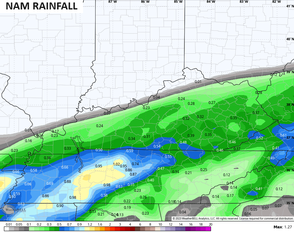
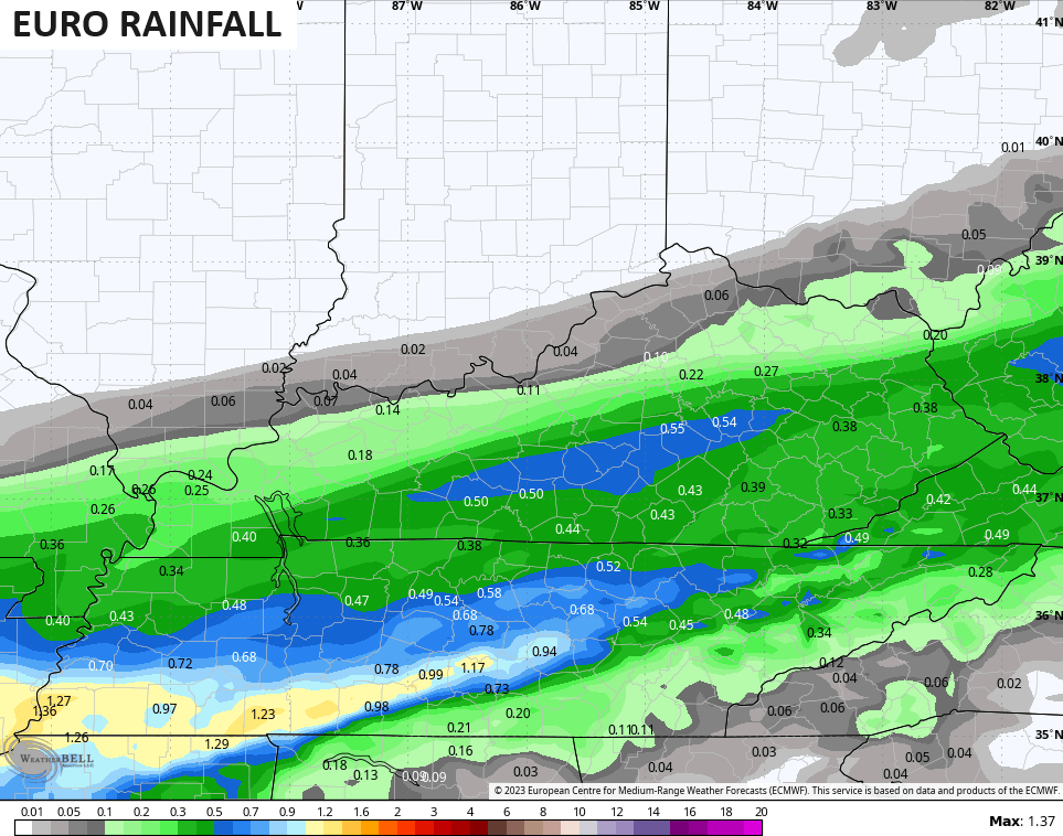
That’s a very sharp cutoff on the northwestern side of this and that’s more typical of a snow system in the winter.
Here are your radars to follow the rain in from the southwest…

The rain ends from northwest to southeast Friday with a pretty good looking weekend taking shape. Near normal temps and mainly dry skies will be the norm.
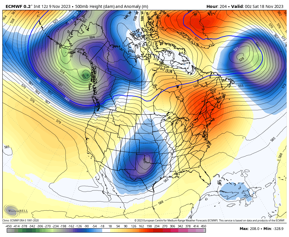
We stay dry into early next week but the models are speeding up the arrival time of the big change before Thanksgiving. A few showers may move in as early as Wednesday and Thursday as an upper level system brings in some precipitation during that time. This ahead of what may be a bowling ball looking system arriving by next weekend. That may spawn a healthy Ohio Valley storm system…
You can see how that unleashes much colder air next weekend and that’s a pattern going into Thanksgiving week. Watch how the EURO crashes these systems in from the west…
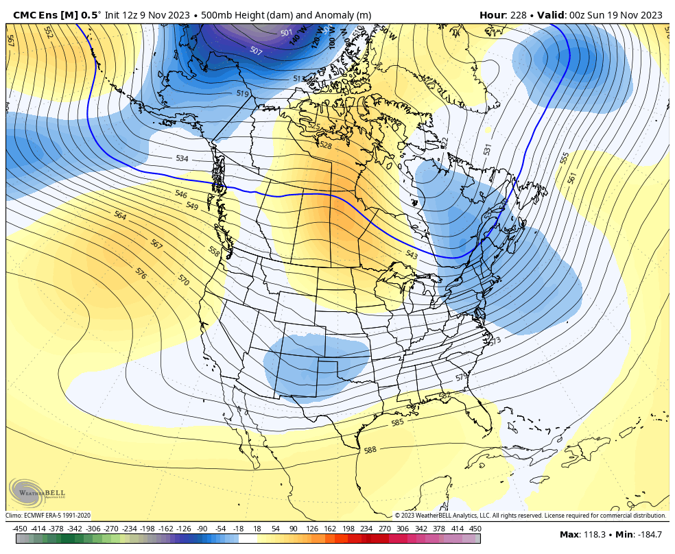
The Canadian Ensembles are really taking on a winter look Thanksgiving week into the holiday weekend…
Nice progression showing up, right now!
Enjoy the evening and take care.
