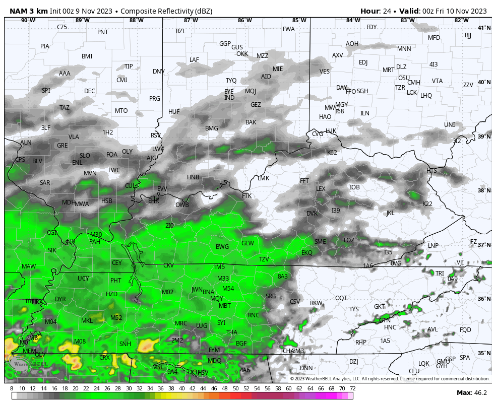
Good Thursday, everyone. That much anticipated cold front is rolling across the region today and it’s changing things up in a hurry. Temps come way down behind this front but the big story is the rain it’s bringing. Much needed rainfall should give fire crews a big helping hand with the forest fires in eastern and southeastern Kentucky.
That boundary slides through early today with a gusty band of showers. This isn’t a lot of rain with this front, but some wet streets may show up in some areas through noon today. Here are your radars…

Drier and cooler winds take over for a few hours this afternoon with temps coming down into the low and mid 60s then quickly dropping from there this evening. That’s when more showers arrive from southwest to northeast as a wave of low pressure develops along the front and zips across the southern Appalachian Mountains. Here’s the future radar from the Hi Res NAM…
Winter weather loves would like to see this same setup a month of so down the road as it would deliver a snowfall to the region.
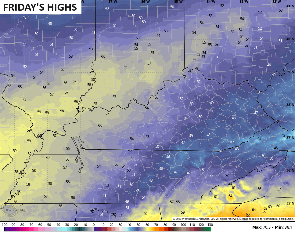
As is, it’s a cold rain in the east and southeast with highs likely staying in the 40s with low to mid 50s in the west…
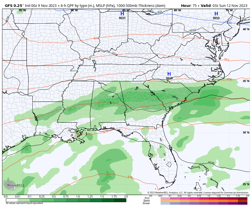
Temps this weekend are in the 50s for highs and there’s still the low-end risk for a Sunday shower to impact southern and southeastern Kentucky. The models go back and forth on the northward extention of this system
You can see how the GFS is back to brushing the southeast with a shower…
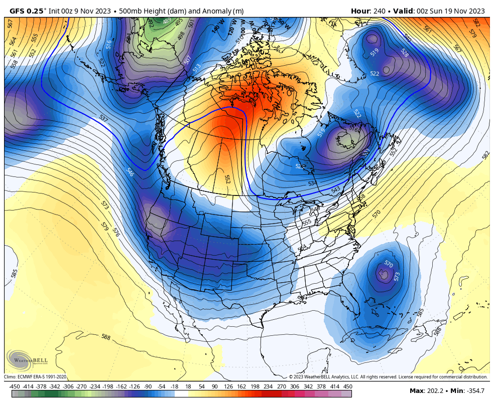
It’s near normal into the first half of next week before temps warm back into the 60s before the week is over. From there, things start to transition toward a move active and colder pattern into Thanksgiving week.
The various ensembles have been hinting at this for a while and we are starting to see some of the operational models displaying this trend. Even the GFS is showing this more active pattern complete with a Carribean tropical system that gets into the southwestern Atlantic.
Watch how the model shows the undercutting systems working in from west to east as blocking develops in Canada and then along the west coast…
Another update comes your way later today so check back. Have a good one and take care.

Thanks Chris. Glad to see a change in the precipitation patterns. Yesterday’s high temperature was 80 degrees here in Maple. I like the warm, dry weather, and then again I want to see more weekly Rainfalls that gives all areas a good soaking.
No one knows how much Snow will fall and accumulate here in Kentucky this coming Winter, but with the troughs and the amplified Subtropical Jet Stream, I wouldn’t be surprised if most areas of the State exceed their yearly average.
The Climate Prediction Center has issued their November ENSO update. They indicate that we are in a strong El Niño, and there is a greater than 55% chance for a strong El Niño persisting into the Jan-Mar 2024 period, and a 35% chance that we could see a historically strong El Niño during the Nov ’23 to Jan ’24 period. Overall, they anticipate that El Niño will persist through Spring 2024, and a 62% chance through the April to June 2024 time frame.
https://www.cpc.ncep.noaa.gov/products/analysis_monitoring/enso_advisory/ensodisc.shtml#:~:text=Synopsis%3A%20A%20transition%20from%20La,Ocean%20%5BFig.%201%5D.
Wow! Very interesting! Thank you for sharing this update with us!
Good news for all the Winter Lovers and Snow Lovers out there with a Strong El Nino and a PDO trending positive.
I feels weird thinking of snow when we can’t even get a decent rain