Good evening, folks. We have a normal brand of air coming in for the weekend as skies stay dry. Looking down the road, though, is a much more active pattern that turns cold with the threat for some winter weather Thanksgiving week.
Let’s just go ahead and quickly focus on that setup.
I’ve pointed toward Thanksgiving week for big changes for a few weeks now and the models are now catching up. The changes start with a potent system likely diving in late next week into the weekend. That then opens the floodgates for colder systems to drop in from the northwest through Thanksgiving week.
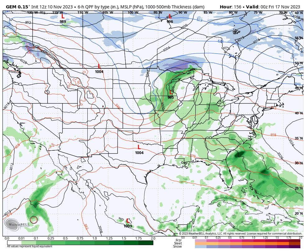
The Canadian Model shows the system for next weekend and shows the next system diving into the northern Rockies to start Thanksgiving week…
The GFS goes out farther in time than all other models and the latest run is interesting. Granted, this is way out there in fantasy land, but it’s fun to look at nonetheless. This shows the first system next weekend being more wrapped up with rain to some winter. It then follows it up with that second system taking a snow lovers fantasy track in the days before Thanksgiving…
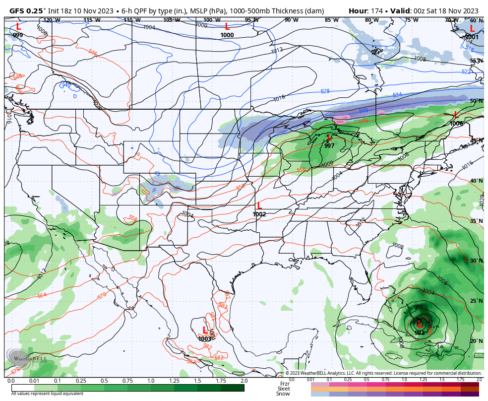
Again, that’s just for fun folks, but it does highlight the pattern we are looking at.
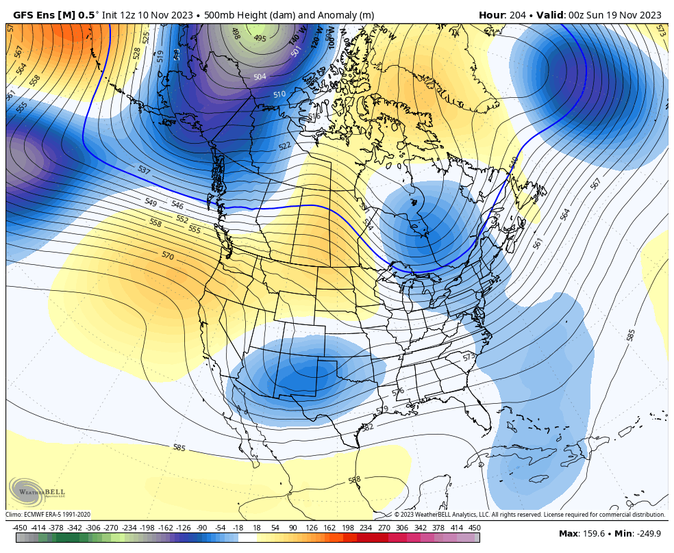
The GFS Ensembles from next weekend through Thanksgiving weekend have a pretty solid winter look..
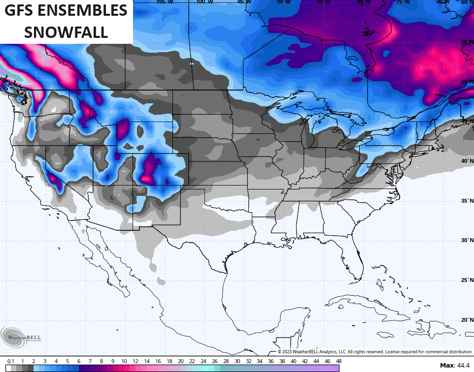
Those same ensembles are starting to pick up on snow chances fairly far south…
Enjoy the evening and take care.

The weather blog is about to get real busy! 🙂
It’s about time, Dottie!