Good Sunday to one and all. For lovers of nice weather, this calm pattern is right up your alley. For lovers of active weather, this is about as boring as it gets. As we look down the road, the pattern turns more active by the end of the upcoming week with mroe action and changes for Thanksgiving Week.
Temps today generally range from the mid and upper 50s central and east to low 60s west. The dry and pleasant skies continue and roll into the first half of the new week as temps come up just a bit. Highs range from the upper 50s to middle 60s.
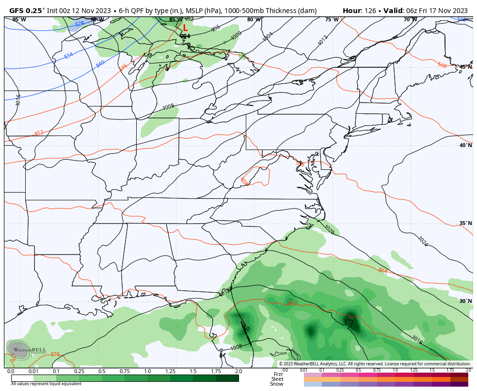
There’s still the slight chance for a shower or two coming at us Wednesday or Thursday but the best chance for showers shows up on Friday as a cold front sweeps quickly through the region. The models go back and forth on just how deep this system gets and I suspect we see that for a few more days…
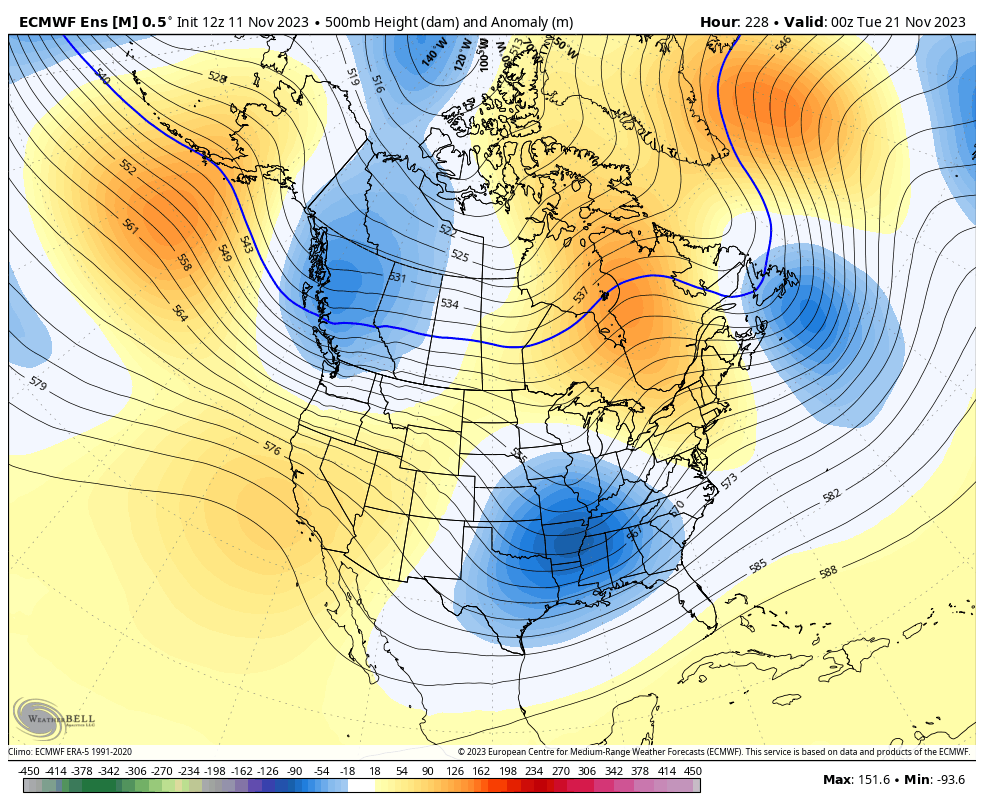
The jet stream undergoes changes Thanksgiving week as a few deep troughs sweep in here from the west. Timing and magnitude of these systems is, like everything else, a work in progress. Here’s the GFS…
 A fairly big pre-Thanksgiving storm system is possible. Temps would pike ahead of it and crash behind it. Another system may follow that up over Thanksgiving weekend. Given the overall setup, there’s the chance for a touch of winter weather to show up around here during this time.
The EURO Ensembles are locking on to the overall change and you can see how we see ridging going up the west coast into Alaska, allowing these troughs to dive into the central and eastern parts of the country…
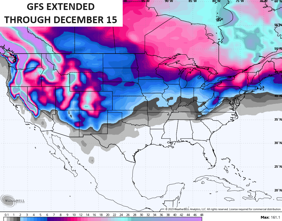
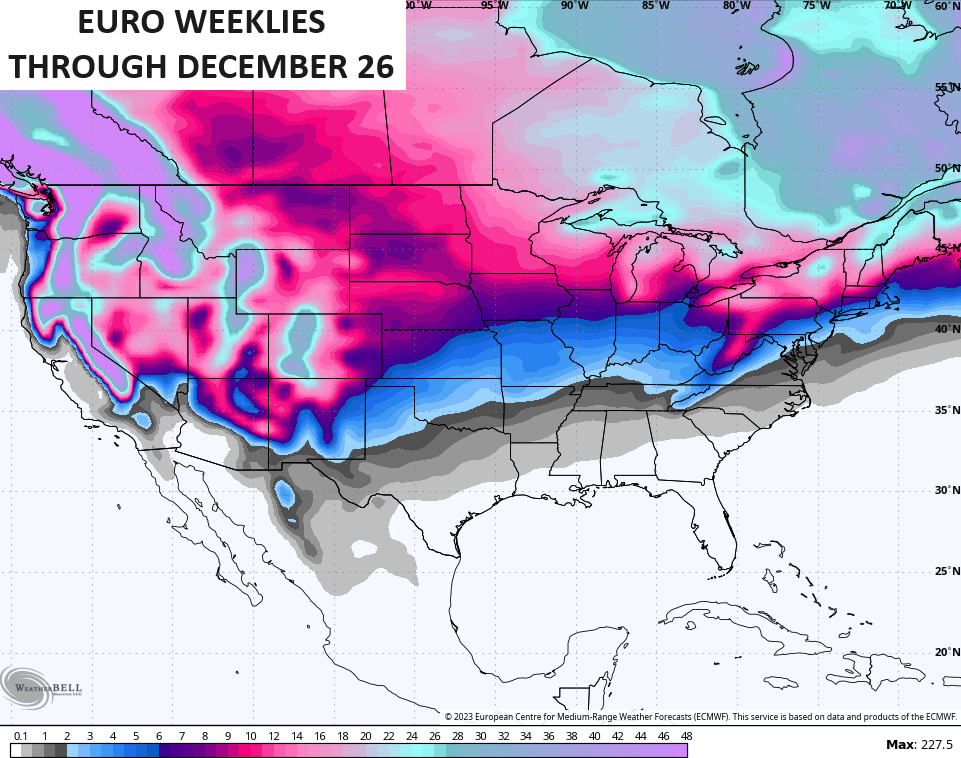
If we look farther down the road via the extended runs of the GFS and EURO, we see them looking deeper into December. While none of this is meant to be taken verbatim by any means, these models can give us a hint at the general patterns.
The GFS Extended goes through December 15 and it sees some winter weather…
The EURO Weeklies go through the day after Christmas and have a healthy signature…
We. Shall. See.
I will have another update later today so check back. Have a good one and take care.

Nothing new Kentucky borderline blue.
Thanks Chris. Enjoying the pleasant late Fall weather that our part of the country has most years. Good news is that we won’t have to worry about Severe Weather, but the Drought going on since last Spring has me VERY concerned about Wildfires increasing in the State. The Bermuda High pressure ridge keeps getting stronger and more dominate. This action may keep good soaking Rains and Winter weather at a minimum in our area as it has in past recent years.
Still hoping El Nino’s influence will kick in some time this Winter with a dominate Subtropical Jet Stream to give us more chances of phased storms that will bring drought breaking precipitation events. Still don’t know if this will happen.