Good Sunday, everyone. We are putting the wraps on a gorgeous and normal November weekend here in the Bluegrass state. This pleasant weather takes us into the first half of the new week, but changes show up before the week is over. Bigger changes show up for Thanksgiving week.
Highs Monday and Tuesday range upper 50s central and eastern Kentucky to the 60-65 degree range in the west.
Everyone should see temps climb into the 60-65 degree range Wednesday and Thursday as more clouds show up. Those clouds may spit out a shower or two, especially in the south.
A strong cold front then sweeps across the state Friday and Friday night with much colder air pouring in behind it…
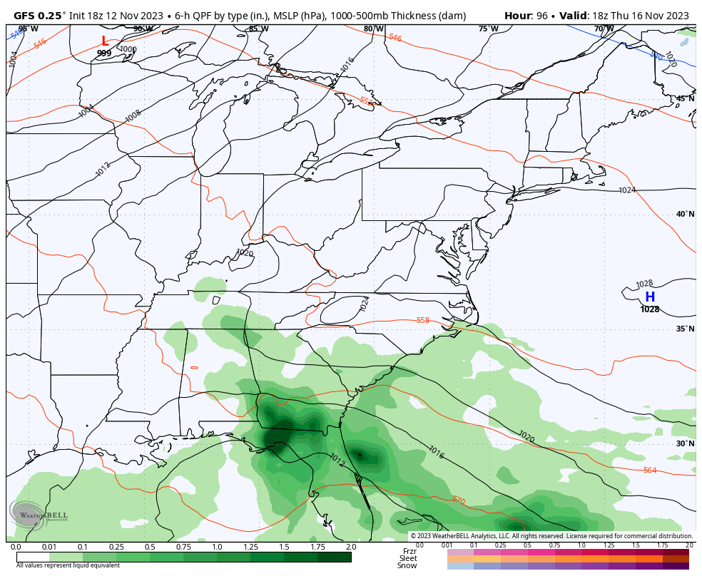
Gusty showers are likely with the passage of this front as temps drop to a little below normal behind it into next weekend…
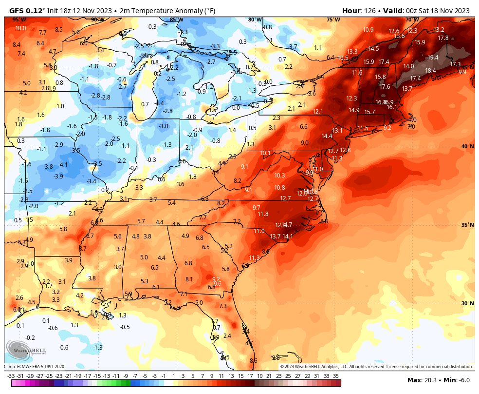
Those numbers spike again early next week ahead of a much stronger storm system. This comes from a big bowling ball of a system rolling from west to east across the country and is likely to spawn a disruptive storm for pre-Thanksgiving travel.
It’s still a ways out for any consistency from the models, but they’re giving it the ol college try.
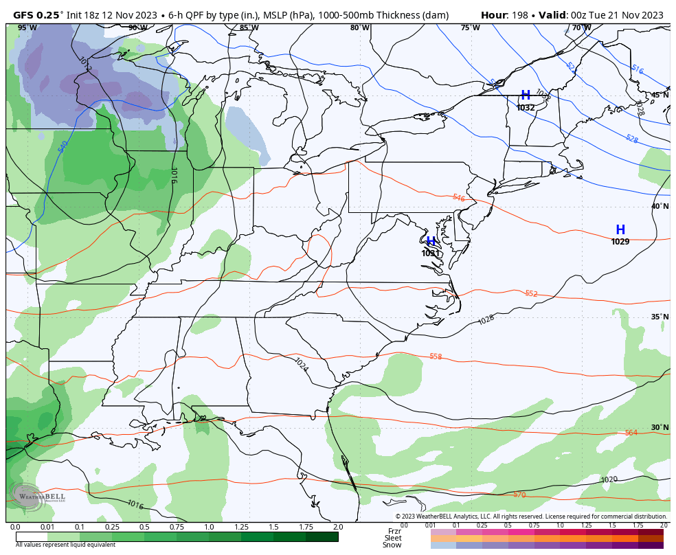
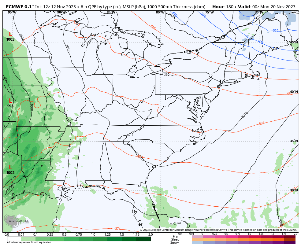
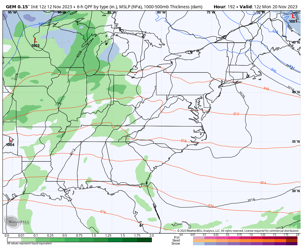
The GFS has a pretty wrapped up system and is close to some wraparound flakes…
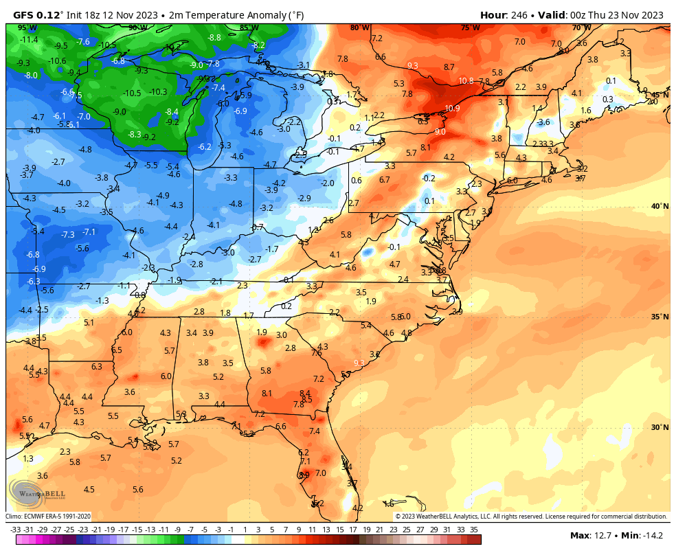
That unleashes a cold Thanksgiving with temps going well below normal…
The EURO doesn’t go out quite as far as the GFS but it also shows a potent system that’s close to some wraparound flakes…
The Canadian is more wrapped up with the low pressure and that means it pulls down cold enough air for wrapround winter…
Again, these are just to illustrate the potential as we head into Thanksgiving week. The pattern is one that should throw a couple of good cold shots in here and it’s one that can give us a touch of winter weather at some point.
I’ll see you guys for the full update later tonight. Have a good one and take care.

Thanks for the update.