Good Monday, everyone. Our week is off and running on a pleasant note with some really nice weather across the Bluegrass State. Changes show up by the end of the week as a strong fall cold front drops in, leading to bigger changes for Thanksgiving week.
Highs today range from the upper 50s to middle 60s across the state and we can put this weather on a loop for Tuesday and Wednesday.
Thursday brings about the chance for a shower or two as moisture increases from the south and southwest. This is ahead of a big dip in the jet stream diving in here for Friday. That’s when the cold front shows up with gusty showers and crashing temps.
Here’s what our system looks like…
A slightly colder then normal air mass comes in behind that before the numbers jump again by Monday as we get set for what could be a major storm system in the days leading up to Thanksgiving. The signal has been there for some time and the operational models are showing only slight deviations from run to run, even from a week out.
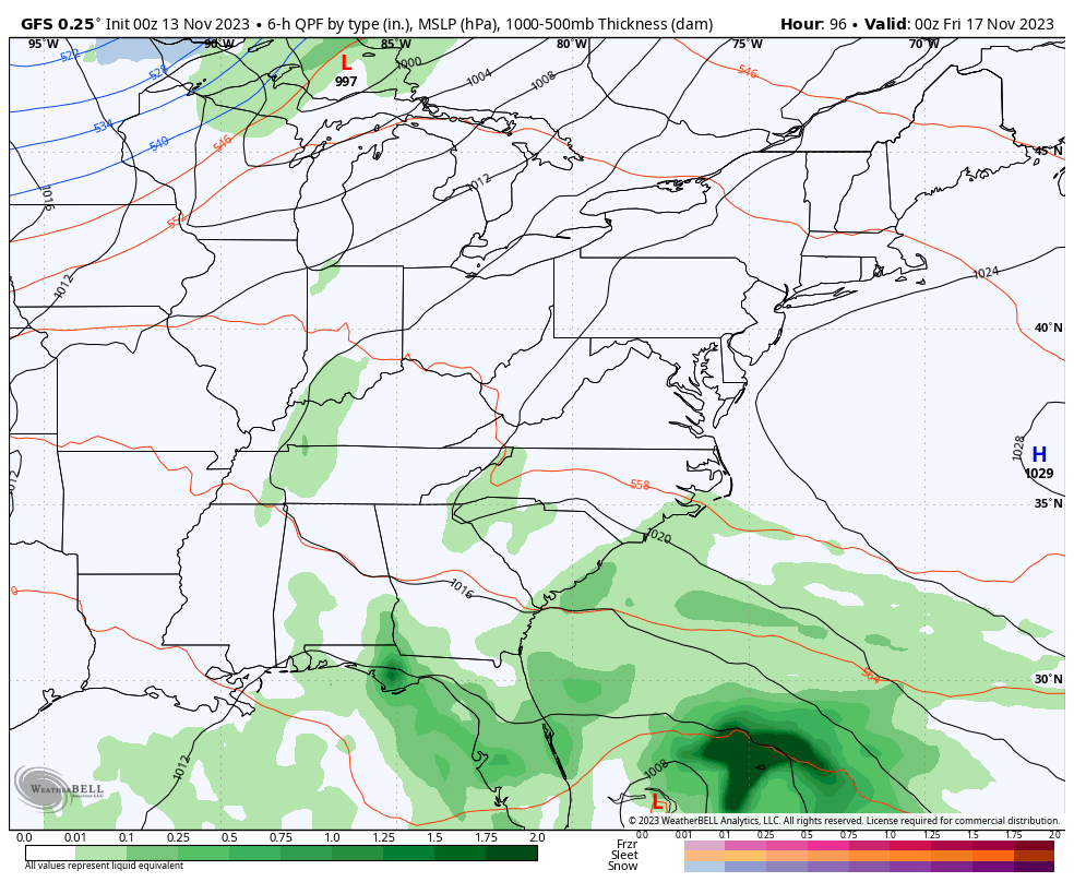
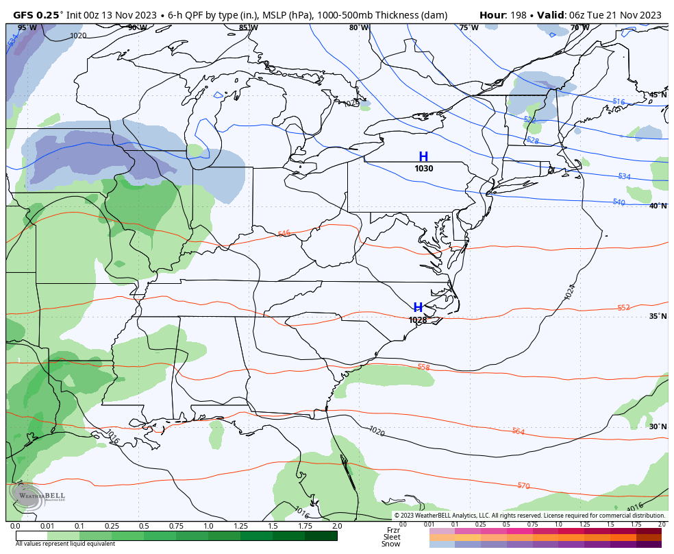
The GFS shows our bowling ball looking system rolling through our region, strengthening along the way from Tuesday into Wednesday. Rain, wind, crashing temps and some winter weather shows up on this run…
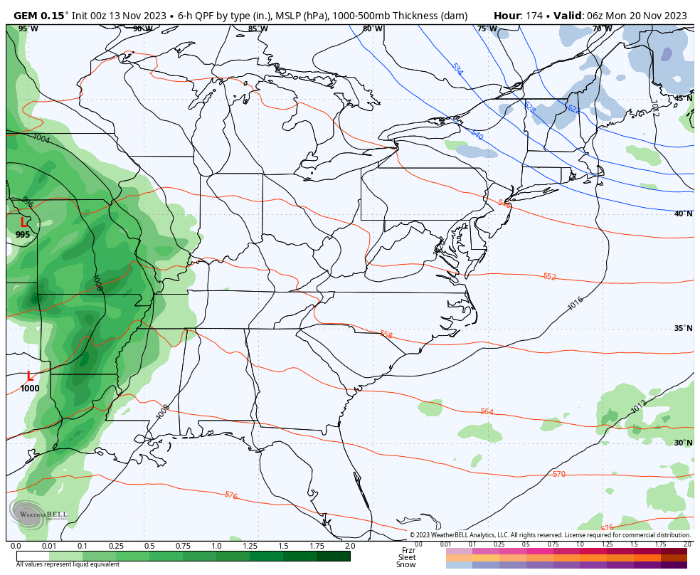
The Canadian Model is a little quicker and not as strong with the storm system, but also produces rain, wind, crashing temps and some winter weather…
If you’re a regular reader of KWC, then you’ve known this Thanksgiving week pattern was, at least, possible since the start of November. The signals have been there that long and they continue to show up a little better as we get closer.
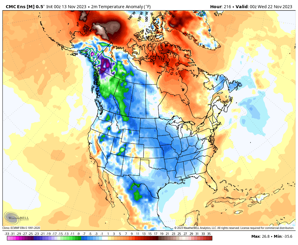
The various ensembles have been seeing this for a while and the latest Canadien Ensembles shows some real deal cold across much of the country for the Thanksgiving holiday period…
Don’t forget, the Winter Forecast is this Thursday at 6pm on WKYT. ❄️🥶
I will have another update later today so y’all come back now, ya hear? Have a magnificent Monday and take care.

We might have one of the best fall weather in years in terms fall like temps. but the lack of moisture is a concern if this pattern continue in the winter months ahead.