Good evening, folks. It’s a seasonably cold night across the region as we start to really focus on the storm system moving in this weekend. That storm is likely to bring thunderstorms, heavy rain, gusty winds and a few flakes to the region.
The models continue to get a better handle on this setup, but I don’t anticipate much change in my overall thought process with this.
Here’s a breakdown:
- Scattered showers and thunderstorms roll in Friday night into early Saturday.
- Storms will be around through Saturday afternoon and evening and a few of these may be strong, especially in the south.
- As low pressure moves across the region Saturday night and early Sunday, heavy rain becomes likely.
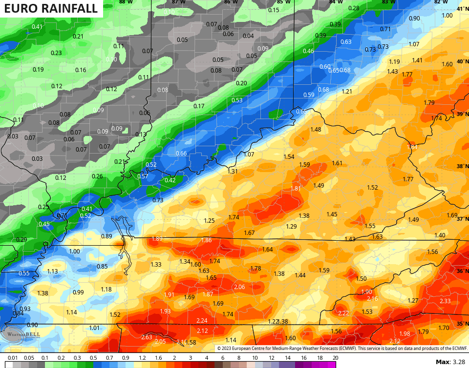
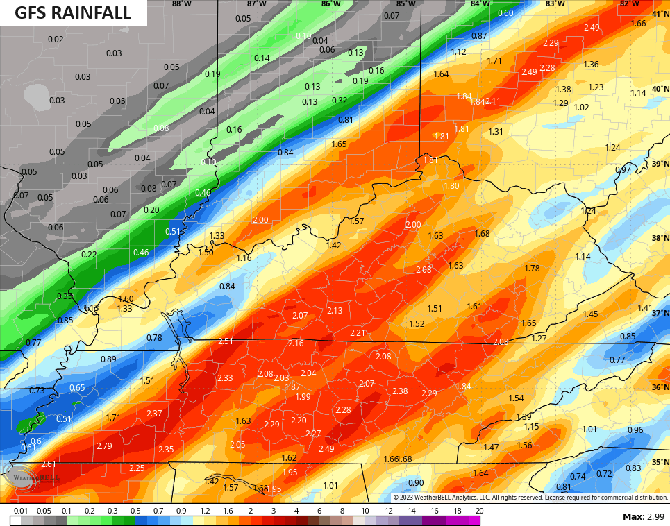
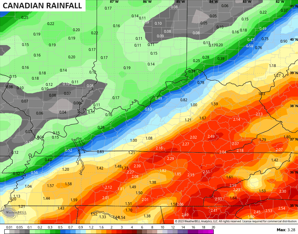
- A general 1″-2″ of rain looks likely across central and eastern Kentucky with lighter amounts in the west.
- Wind gusts may approach 30-40mph at times.
- Highs Saturday reach the upper 50s and low 60s before crashing quickly from west to east Sunday.
- The air gets cold enough for some flakes to fly for parts of the region later Sunday and Sunday night.
- Can this turn into a bigger snow threat? Yes, but you really need this second low to deepen and slow down more than the models are showing right now.
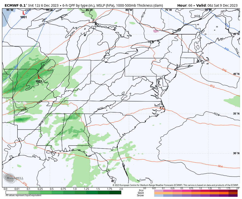
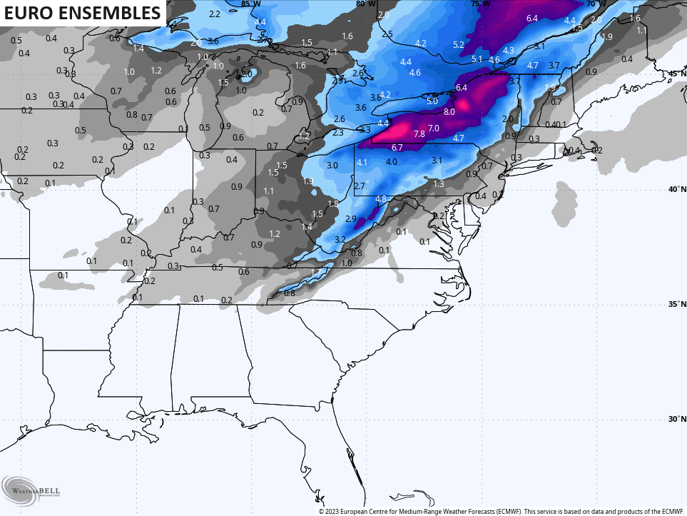
Speaking of the models, the latest EURO is a bit farther east than recent runs…
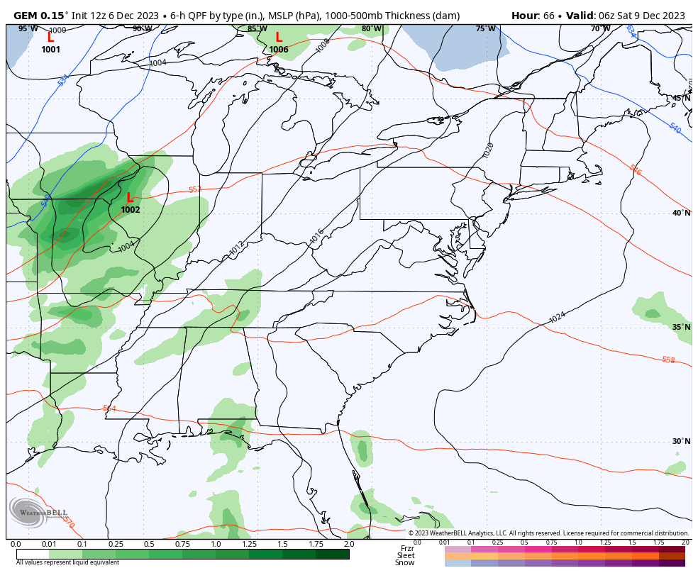
So is the Canadian…
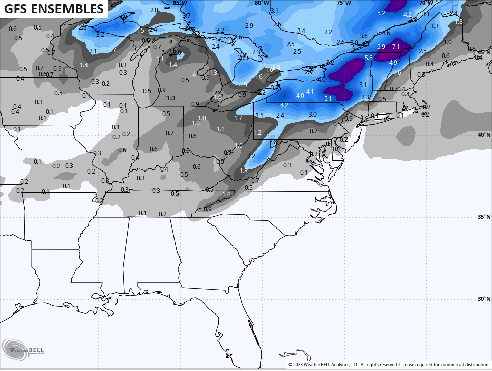
The GFS is starting to slow down a bit, but is a littler slower with the cold air…
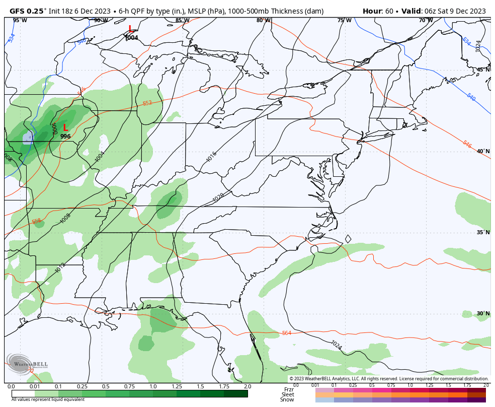
In terms of rainfall, the models are in good agreement with the general 1″-2″ of rain, but have the usual placement disagreements…
It’s interesting to note how the various ensembles see a better chance for some Sunday and Sunday night flakes than the operational models do. I’m showing these maps to illustrate that point…

I’ll see you guys for the full update later tonight. Make it a good one and take care.
