Good Thursday, folks. It’s a much better looking and feeling day out there as milder winds surge in from the west and southwest. This is ahead of a big storm system that promises to bring a little bit of wild weather for the upcoming weekend.
Before we get to the wild, let’s talk about the mild. Highs today reach the 50s for the entire region and will make a run at 60 on Friday as clouds increase. Those clouds are ahead of the weekend storm system.
Let’s break down what I’m expecting as of right now:
- Scattered showers and thunderstorms roll in Friday night into early Saturday.
- Storms will be around through Saturday afternoon and evening and a few of these may be strong, especially in the south.
- As low pressure moves across the region Saturday night and early Sunday, heavy rain becomes likely.
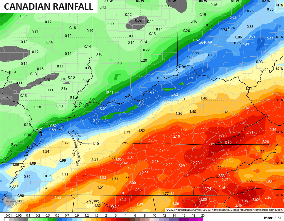
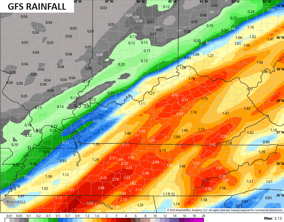
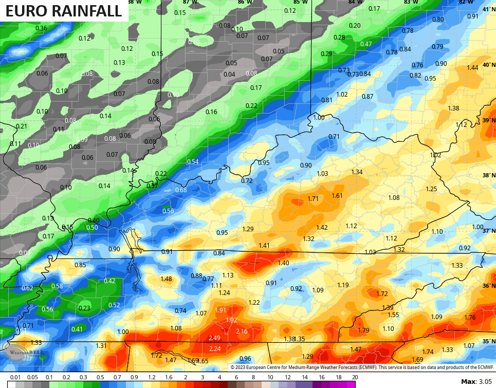
- A general 1″-2″ of rain looks likely across central and eastern Kentucky with lighter amounts in the west.
- Wind gusts may approach 30-40mph at times.
- Highs Saturday reach the upper 50s and low 60s before crashing quickly from west to east Sunday.
- The air gets cold enough for some flakes to fly for parts of the region later Sunday and Sunday night.
- Can this turn into a bigger snow threat? Yes, but you REALLY need this second low to deepen and slow down more than the models are showing right now.
In terms of the models…
The Canadian continues to have a better snow signal across the east and southeast as it develops yet another low across the Carolinas…
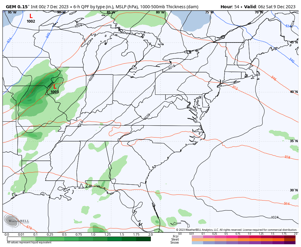
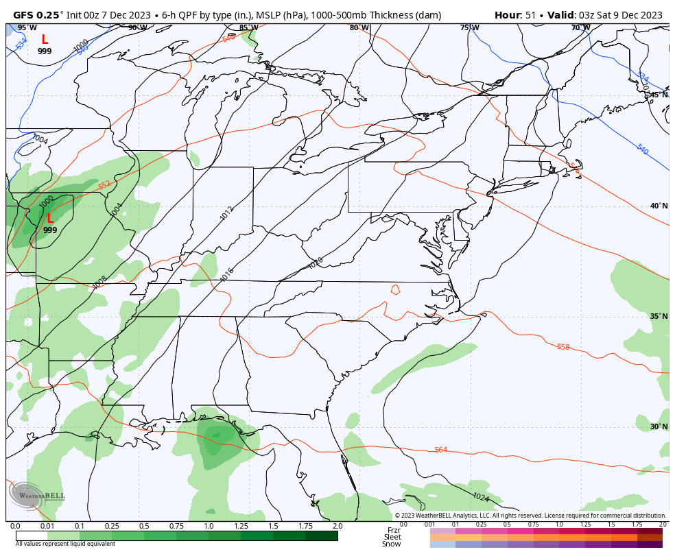
The GFS continues to put too much emphasis on the initial low working into the western Great Lakes on Saturday. That low is likely to be weaker with more energy diving into the base of the trough. Still, the GFS is trending back toward spitting out some flakes across the southeast…
The EURO goes back and forth between matching the Canadian and the GFS…
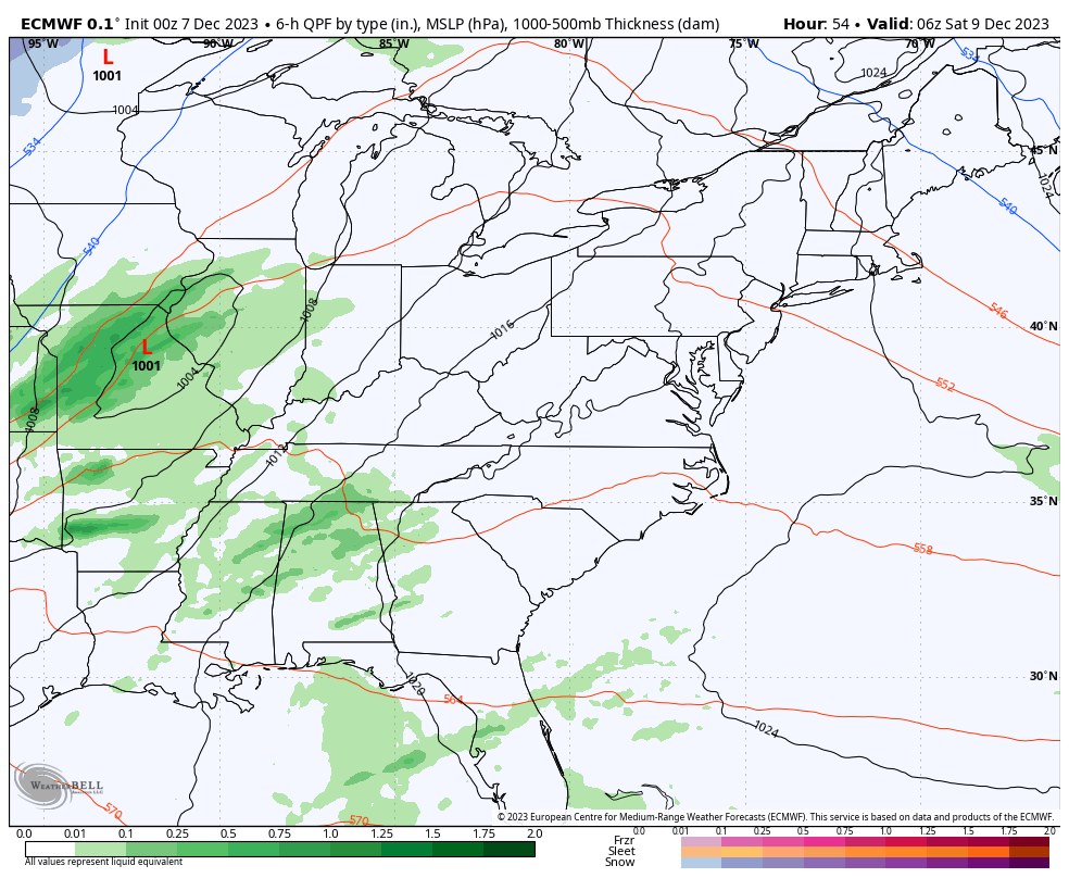
The models are all spitting out hefty rainfall totals during this time. The greatest concentration continues to be across central and eastern Kentucky…
If we look at the Ensembles, they continue to show more of a winter look for later Sunday and early Monday…
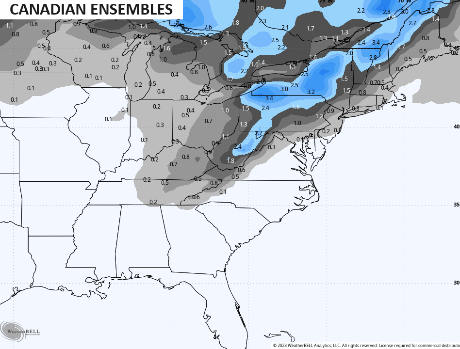
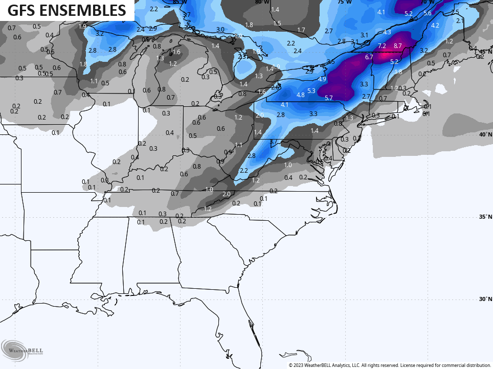
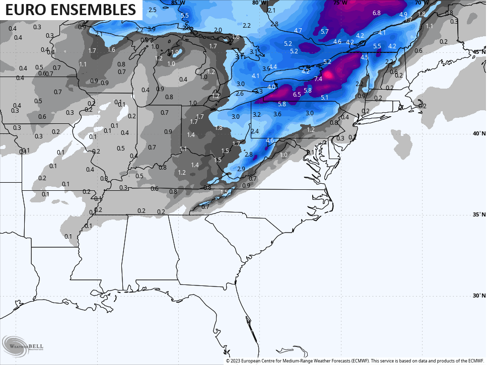
That’s certainly interesting and is suggesting there are many ensemble members seeing a slower and deeper system.
I will have updates later today. Have a great day and take care.

Another rain filled weekend.
Our New Normal…
Thanks Chris for the detailed outline on what may happen with this impending storm. I’m hoping that those who want the Snow get the Snow this Winter. According to the models you displayed in this morning’s Blog the farther East is best for accumulating Snows with this storm. The rest of us will have to be satisfied with the predicted much needed Rains. Hoping too that severe weather doesn’t occur in our southern counties.
Have a great day !
I hope we get some snow out of the upcoming storm next week. I have been seeing some crazy model runs online for the 11th or 12th of December for lots of snow has anyone else here seen that???? I know it’s just model runs and take it with a grain of salt but that would be nice to get some accumulating snow.
Late morning, on the Ventusky Weather Site. The GFS was forecasting 5 inches of Snow on the 20th of December.
Found this interesting
https://www.severe-weather.eu/long-range-2/january-february-winter-forecast-cold-anomaly-snow-united-states-pattern-fa/