Good evening, folks. We continue to track the big weekend storm system that can bring about a lot of active weather to our region. The rain and storm part of this system isn’t in question, but the change to snow behind it is.
The biggest questions include: Do we get a full blown transition to snow or just some passing flurries at the tail end of this system? If we do get a full blown transition, how much?
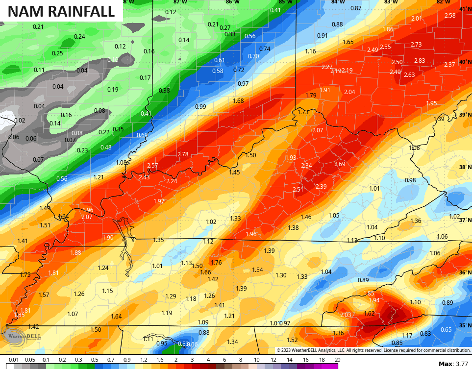
The latest models are split on this, but if you’re a snow lover, the NAM is your new best friend for Sunday as it goes full blown transition to snow…
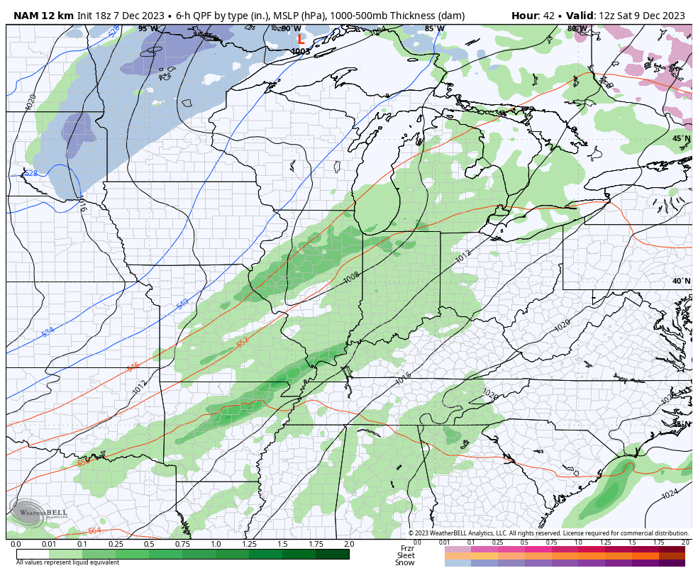
The problem with the NAM is that it doesn’t have many friends right now. The WKYT in-house computer model from IBM does actually show something similar for Sunday, but that’s about it at the moment.
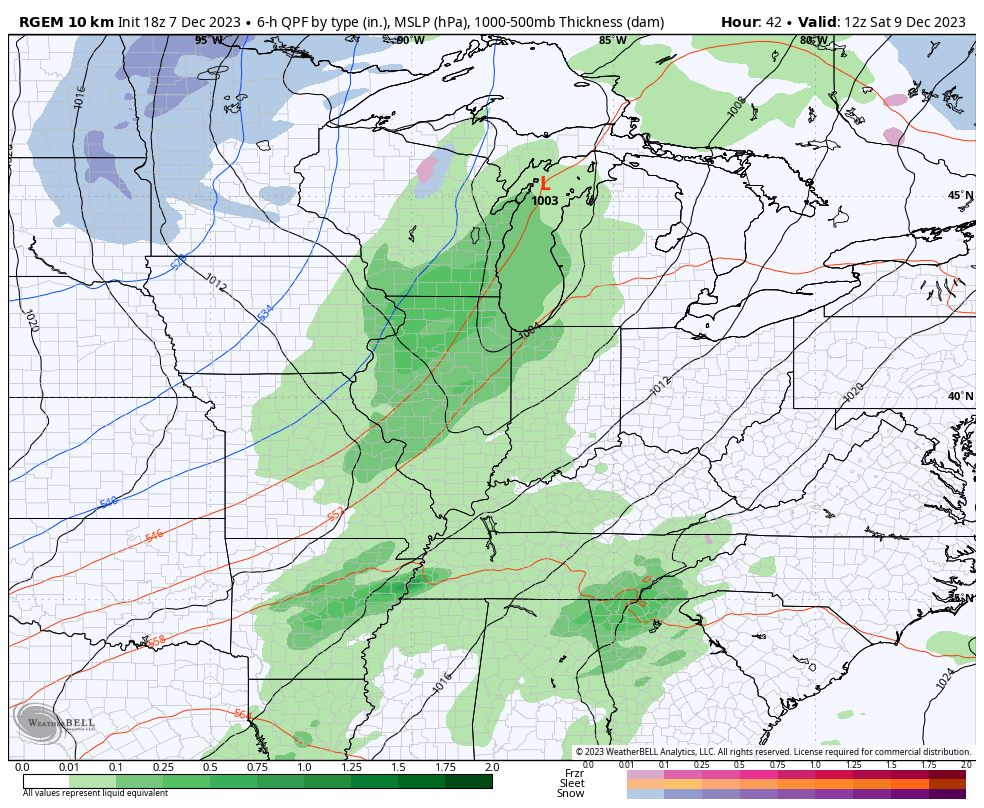
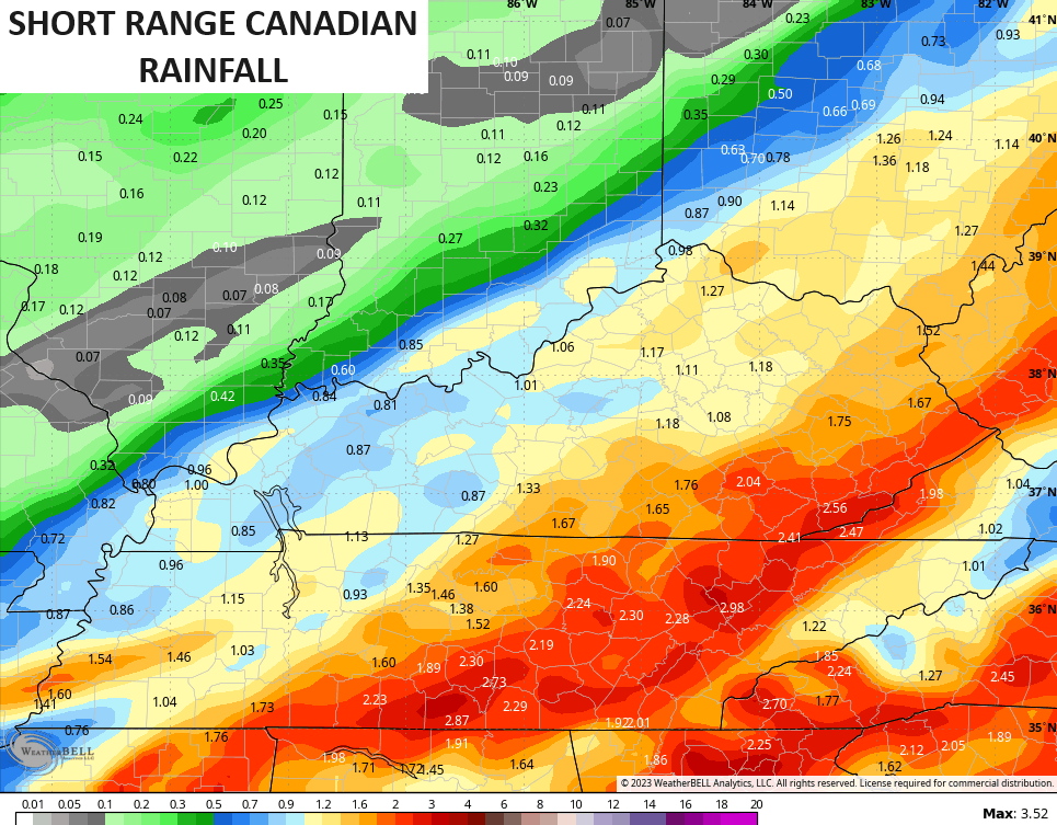
The closest we have to the NAM is the short range Canadian which has a switch to light snow in the east…
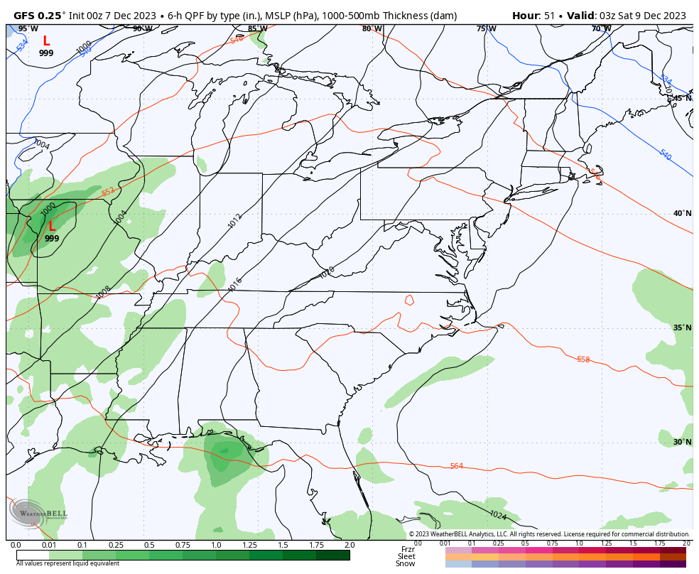
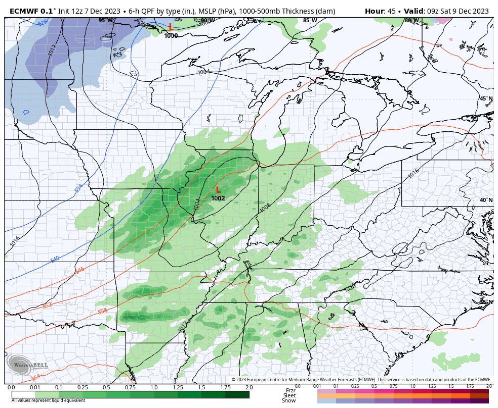
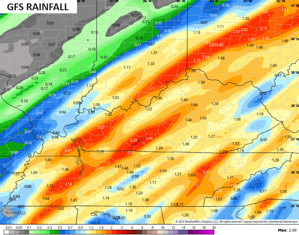
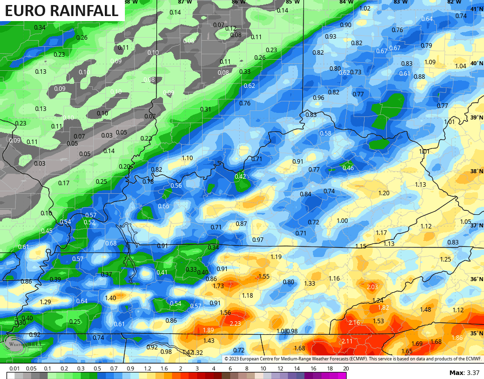
The GFS and EURO want nothing to do with that and only bring some flakes to eastern Kentucky…
GFS
EURO
I don’t have a ton of faith in the NAM until I see it gain some new friends. 😉
All models do have a big rain event across central and eastern Kentucky, especially. The American models like the NAM and GFS have the most widespread and highest totals…
The Short Range Canadian and, especially, the EURO are farther east and not as wet…
I may drop by for a quick late evening update if needed. Have a good one and take care.
