Good Sunday to one and all. Our Saturday severe weather maker is now a thing of the past as cold winds kick in across the region today. This cold wind will also spit out a few flakes this afternoon and tonight, especially across the eastern part of the state.
Rain starts the day across eastern Kentucky and some of that changes to a bit of light snow in the high ground this afternoon. That’s also when the northwest flow starts to do some work, spitting out some flakes across the eastern half of the state. It’s a weak upslope flow setting up through tonight and that can fire off a snow shower or two.
The future radar from the HRR has this action in the animation that starts at Noon today and rolls through 7am Monday…
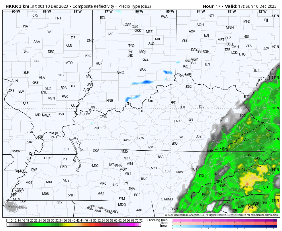
The far southeastern mountains can see another light accumulation tonight.
Here are your radars to follow along today…

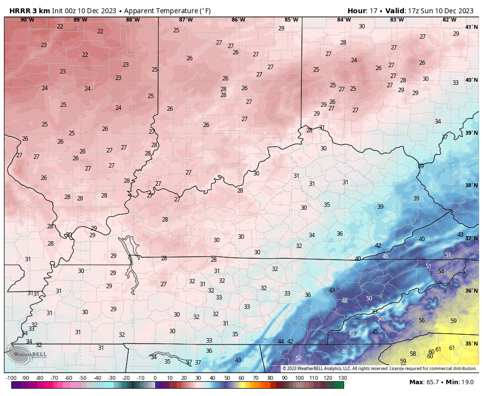
Temps today are mainly upper 30s to low 40s for many this afternoon but the winds make it feel much colder. Wind chills may stay in the 20s for most of the day and then drop even more during the evening. This wind chill animation goes from noon through 11pm today…
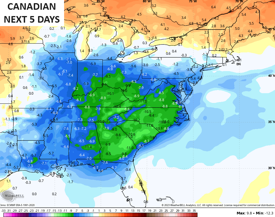
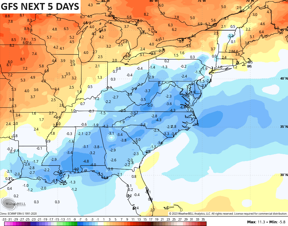
Temps return to near normal by Tuesday with another push of slightly colder than normal temps for the middle and end of the week. Overall, temps look to average below normal for the next 5 days, but the models do disagree on how far below normal.
The Canadian is the coldest…
The GFS is, shockingly, the warmest…
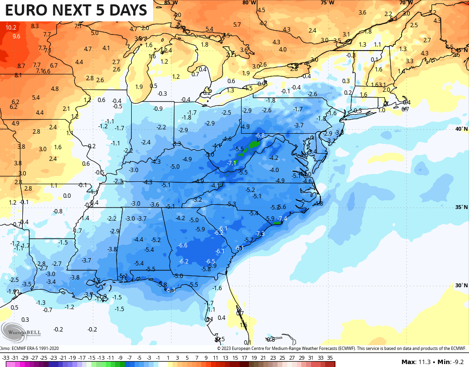
The EURO is right in the middle of the Canadian and GFS…
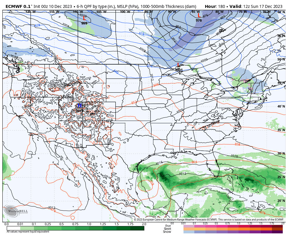
The latest models aren’t as pumped up on the idea of a big eastern US storm system next weekend as they keep the southern system suppressed deep into the Gulf of Mexico then turning it off the southeast coast…
I suspect we will see the models bounce back in the next day or two.
Another update comes your way later today. Have a good one and take care.

TBH – I was expecting MUCH MORE rainfall than what we actually received. Weren’t some of the models predicting like 1.5 to 2.0 inches… I just took a look and we received 0.62 (just over 1/2 inch)… Even the most stingy model run had us above that. Oh well.
.75” at our house. Expected more, as you did. Thought there was more, given the duration, but (in retrospect) “drippiness” was the main feature.
.90 for me.
We received 0.51 ” yesterday. It will help only in the short term. When you have no phasing ( Southern jet stream + merging with the Polar jet stream – ) like you would in an El Nino that carries a positive PDO. An El Nino with a negative PDO ( what we have now ) causes a ‘ Split Flow ‘ across the Country, therefore a weak precipitation pattern continues.
Looking forward to next week’s pleasant late Fall weather.
Here the link to the Tornado that hit Clarksville, Tennessee. I don’t know why GOD allows this to happen in the month of his Son’s Birthday. Here’s the Link :
https://abcnews.go.com/US/multiple-long-track-tornadoes-tear-northwest-tennessee/story?id=105524001
That was so sad. Some of the video I saw I am surprised more people wasn’t hurt.