Good evening, folks. A much colder wind is blowing across the region as some snowflakes join in on the fun. These flakes are coming from the northwest and will mainly impact the eastern half of the state into early Monday.
The Future Radar from the Hi Res NAM shows what I’m talking about…
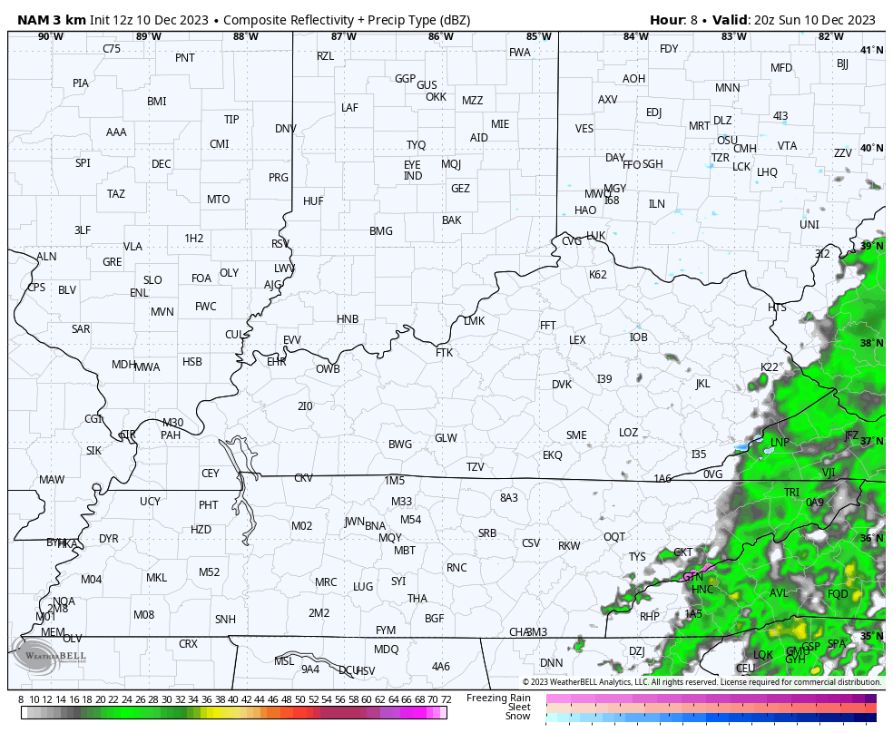
For most, this is nothing but a festive flake or two, but the far southeast can pick up on some very light accumulations, especially in the high mountains.
Here are your radars to follow along…

Monday is a windy and cold day as morning flurries pull away. Temps recover on Tuesday before hanging around in the slightly colder than normal for the rest of the week.
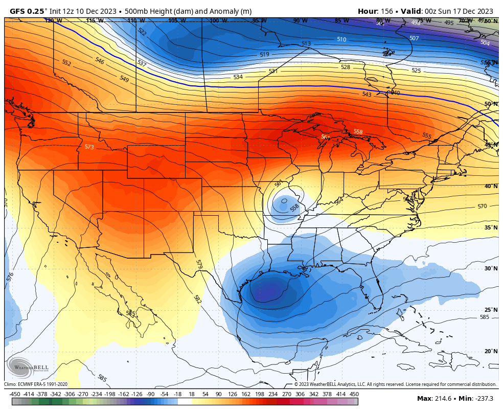
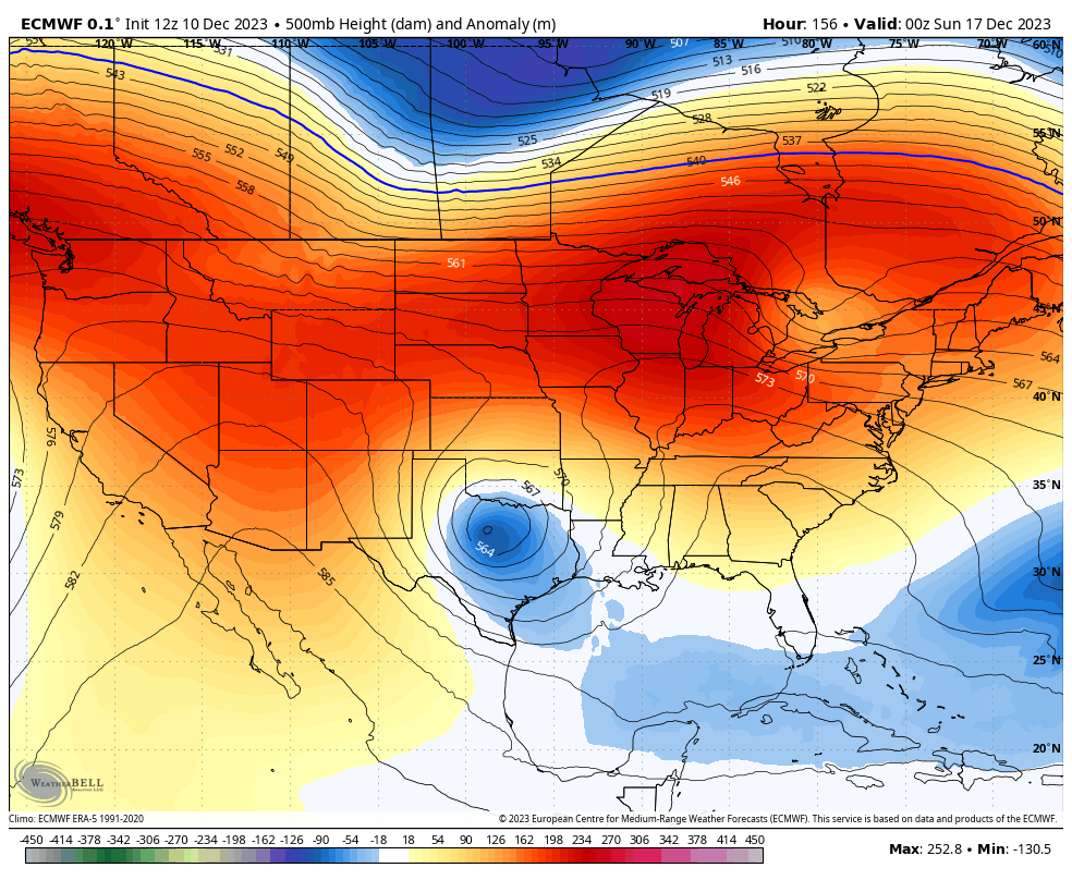
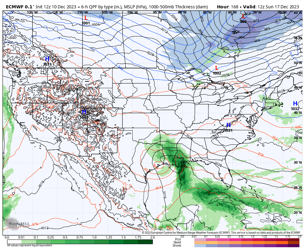
What do we do with the weekend system? The GFS is back to showing this system rolling through the eastern US, while the Euro keeps it in the Gulf. Why? The upper level setup is vastly different.
The GFS has a system dropping in from the north to merge with our cutoff system in the Gulf, lifting it northward…
The EURO doesn’t have this system dropping in…
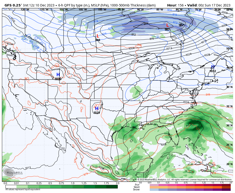
The end result at the surface is a powerful storm rolling up the east coast on the GFS…
The EURO leaves that system in the Gulf, but its trying to lift it out…
As always, time will tell.
Have a great rest of the day and take care.

I have a question where do you look to find how much rainfall you have in a 24 period does anyone have a link to that??? Because it started here around midnight and rain steady for hours. I would like to know. Also on the models and I know it’s just a model but if that happens on the east cost for a storm is that considered a Nor’easter if all that did happen?? I have a feeling someone in that area will get some snow Road trip lol??
KY Mesonet https://www.kymesonet.org/ RIVER forcast rain fall map https://noaa.maps.arcgis.com/apps/MapSeries/index.html?appid=ed433140c2a24b67aa9f19d2e3ea1977
Thanks the best I can find for 24 hours in Pikeville is 1.31 that could be right we had Steady rain
that’s probably right