Good morning, everyone. Christmas is in the rear view mirror and today is usually a down day for those of us who love this time of year, but let’s put a positive spin on things by talking about some snow. 😁❄️Some of us may even see some snow on the ground before the week is over.
Before we get to all that, let’s talk about today’s weather.
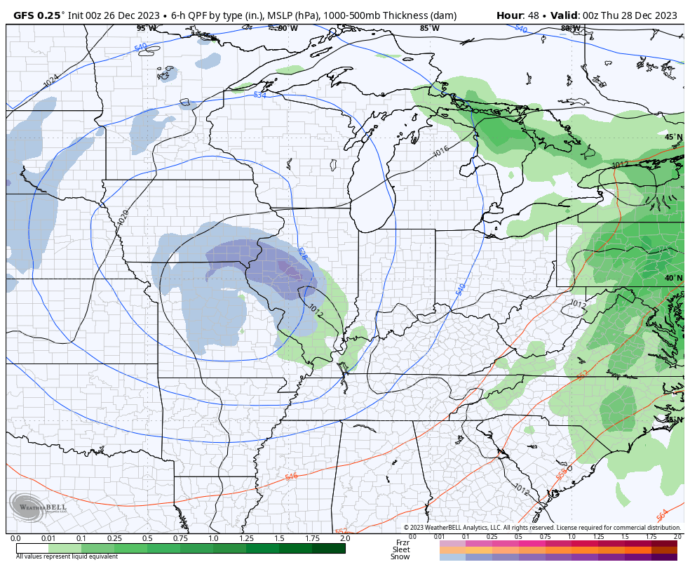
We continue to see showers spiralling around low pressure to our west. These showers are mainly impacting central and eastern Kentucky today and it’s the east seeing the heaviest. As a matter of fact, some areas in the east may pick up another inch of rain today. That could cause some jumps on creeks and streams.
Here are your radars to follow today’s rain…

Temps are deep into the 50s in the east today with the 40s showing up out west.
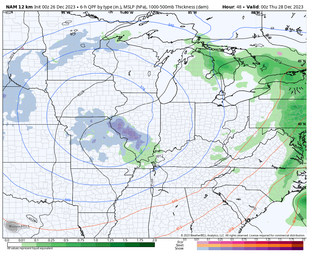
This colder air then spreads east on Wednesday, but it’s nothing out of the ordinary. At the same time, the upper low to our west slowly begins to spin east and should bring some light rain and light snow mix into western Kentucky before the day is over.
The exact track of this upper low is the key to our snow chances in terms of location and intensity. The NAM shows this potent upper level system spinning right on top of us Thursday through 7am Friday…
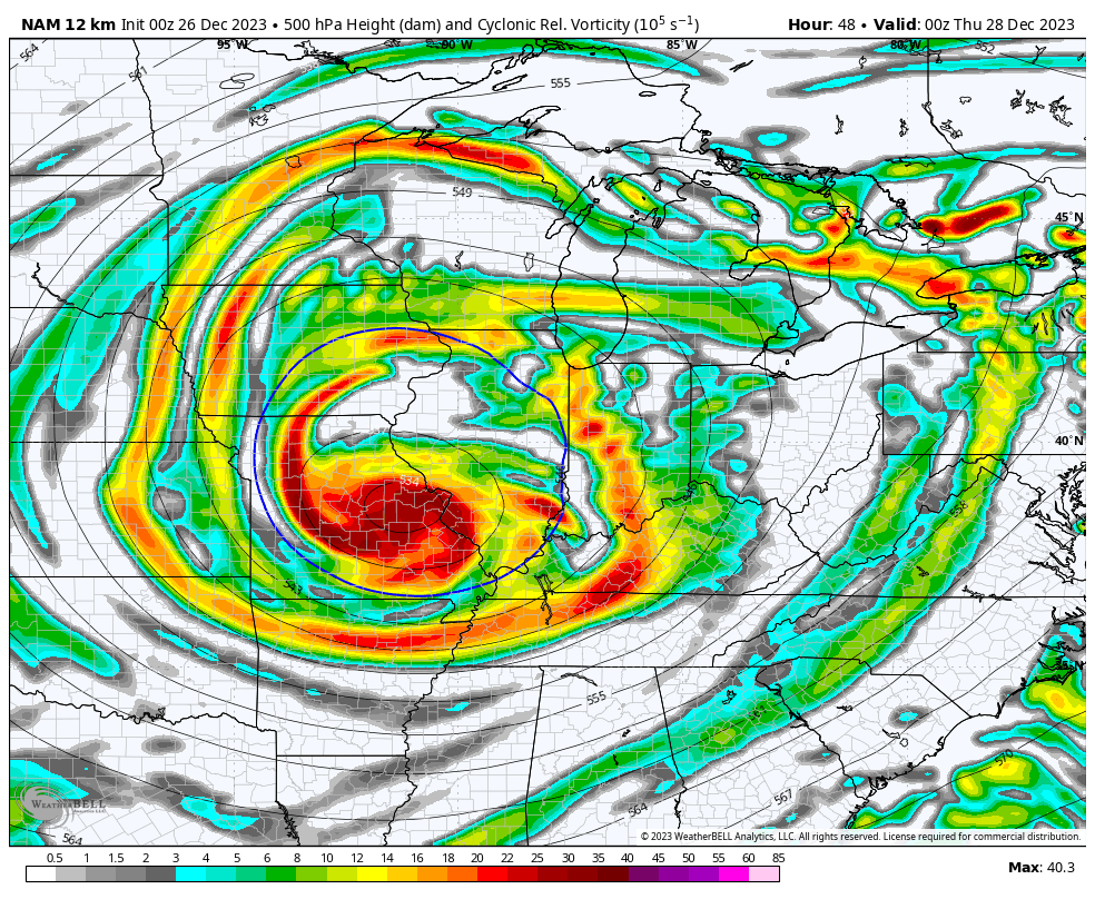
At the surface, you can see how the NAM focuses the snow across the western half of the state during this time…
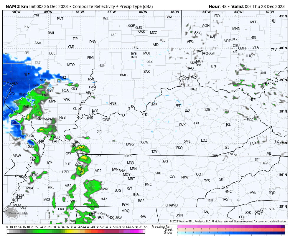
The Hi Res NAM only goes through 7AM Thursday and is picking up on this spiraling band setting up…
A corridor of thumper wet snows has a chance to show up along the track of this upper low, so we have to keep a close eye on that. Outside of the heavier bands of precipitation, we may see a mix of light rain and light snow as temps will be above freezing.
This system will likely require a First Call For Snowfall at some point on Wednesday, but I have to get a better handle on how this evolves.
Additional snow showers and areas of light snow should follow behind this upper low later Friday into Saturday with the potential for a New Year’s Eve and Day clipper with some light snow.
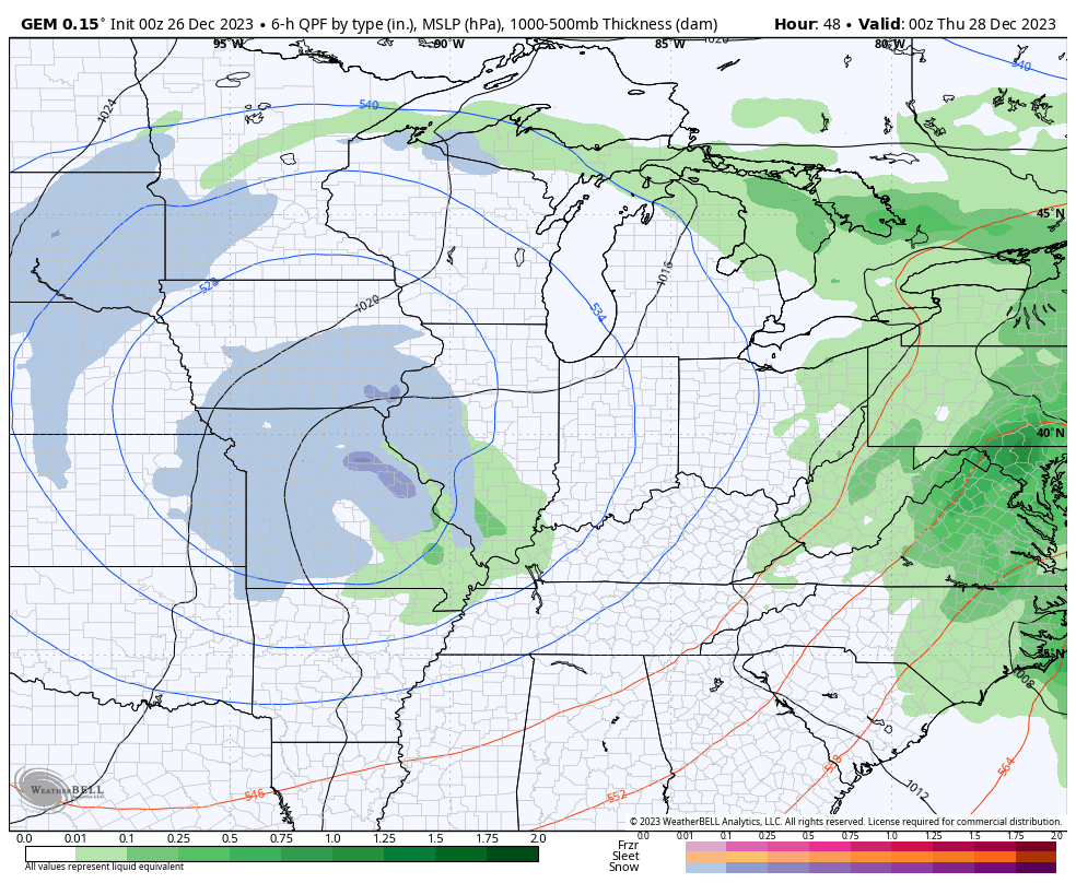
The Canadian Model continues to be pretty steady with the overall look of things from Thursday through the start of the new year…
The GFS continues to have issues. That’s an evergreen sentence, btw. 😜 The model is giving us a completely different solution with each of its 4 runs a day. Here’s the latest version…
We have some interesting analogs showing based on the model forecasts for the first week of January. The numbers in the bottom right hand corner of this image shows the top matching analogs for this time period. The top ten has a lot of late 1970s winters…
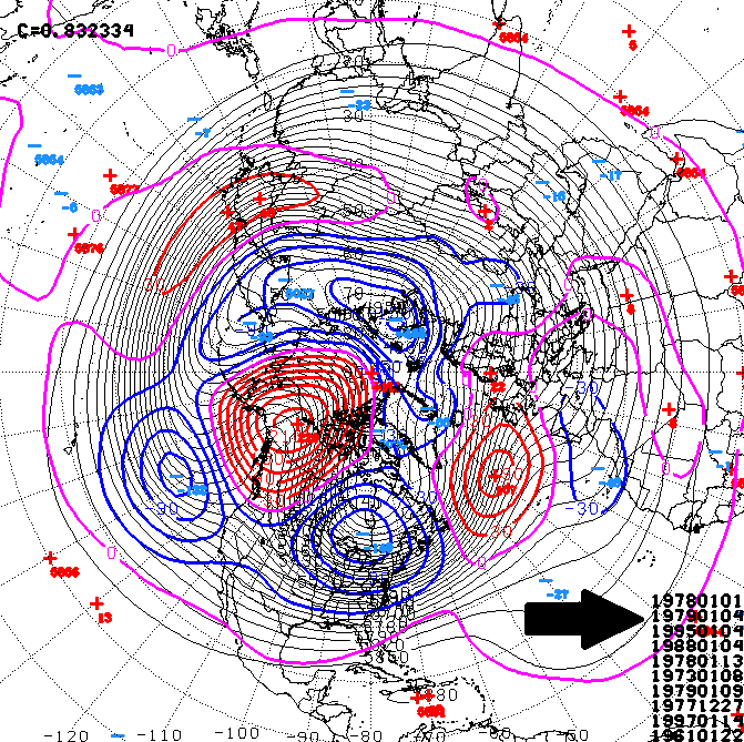
January 1978 shows up twice on that list as does January 1979 with January 1977 also making an appearance. Those January’s were as harsh as you will ever see here. Of course, that doesn’t mean this January will be anywhere close to those, but the fact they’re on the best match list is interesting.
The pattern next week could feature a southern storm system that may impact our weather by the middle of the week.
I will have additional updates later today. Make it a good one and take care.

Chicago’s O’Hare Airport reached a high of 59 degrees on Christmas, making this the second-warmest Christmas ever for the Chicago area, just five degrees short of the 64 degrees set in 1982. In addition, the low of 50 degrees set an all-time record for the highest minimum temperature for Christmas, shattering the previous record of 46 set in 1936.
0.39 inches of rain fell, making this the fifth-wettest Christmas here.
No measurable snow is predicted for the Chicago area for at least the next six days, and even though temps will be considerably cooler in the coming days, they will still be several degrees above normal.
We are way overdue for some serious snow and cold for January/February.
Thanks Chris. I Hope you and your Family had a Wonderful Christmas as did mine. We will have to wait until Christmas next year for that always possible White Christmas. Only 0.26 ” Rain here in Maple, so the dry continues in my part of the State.
Have a Great Day Chris !
444 minutes of precipitation yielded .48” yesterday. The robins were furiously active yesterday, ruffling through the leaves in all the beds and eating the last of the crabapples from the trees out front. In spite of the drizzle, they played in the birdbaths all day.
Just as I posted here weeks ago……MILD December with very little cold. Cold will start rolling in starting in 3-weeks when the oscillation is highest.
Chris said pretty much the same thing.
Chris already said that too. First you criticize his grammar and now try to take credit for his forecast.
If we do receive any accumulating snow it will definitely be wet.(Spring like) The snow is going to have to come down heavy for it to stick on the pavement.
Ground temps will be in the mid 30’s.
A mid major festive event.
Oh yes, I remember them January ‘s in the late 70’s that Chris mentioned. We haven’t endured them type of winters since then. Them winters were brutal cold and snowy that stay cold there were no warm up periods during those winters it stay cold throughout the winter till spring came.
I think 76, 77, 78 and 79 were all pretty bad…. I’m not sure about the others, but ONE of those winters didn’t start until January…. and then it was epic. Not saying it will be like that this time…Just that you can’t give up until March is completely OVER
I remember 1977 Mark we had snow followed by the big flood of 77 in eastern Ky . We lost everything then no one had flood insurance but I won’t ever forget it. I guess that’s why I worry when the river gets up. I hope I never go through that again.
It’s not a down day at all for me. I’m glad when Christmas is over.