Good evening and Merry Christmas! I certainly hope your day was filled with love, laughter and some overall Christmas cheer. 🎄🎅 Our day was also filled with rain, wind and mild temps, making for a gloomy big day.
Looking ahead, we have the threat for some light snow and snow showers working in later in the week as Old Man Winter wakes up.
Before we get to all that, we have more gusty showers spinning across Kentucky through tonight and Tuesday. Here are your radars to follow along…

There’s a lot of ponding on area roads, so please slow down and make sure you get to where you’re going.
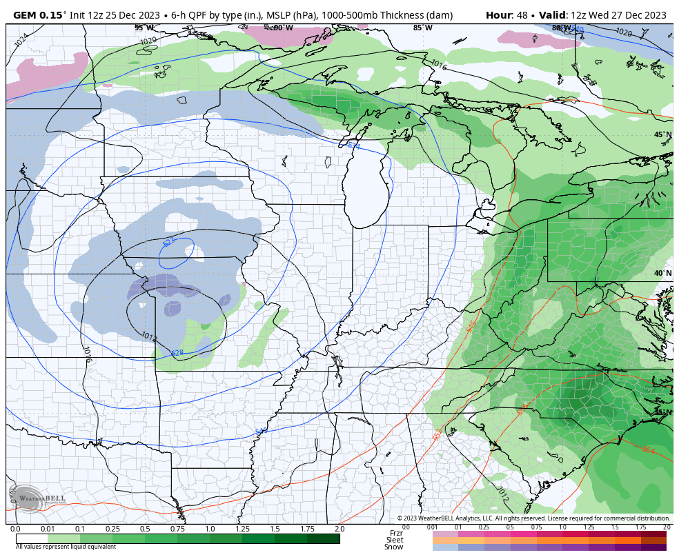
The upper level system spinning at us later this week will bring the chance for light snow and snow showers to the state. There’s also the chance for a little thumper snow along this upper low. How this all unfolds is still a work in progress, but the Canadian continues to be the steadiest of all the models.
Here’s the Canadian showing the upper low snow followed by some light snow and snow showers filling in for Friday and Saturday and a few lingering light snows into Sunday…
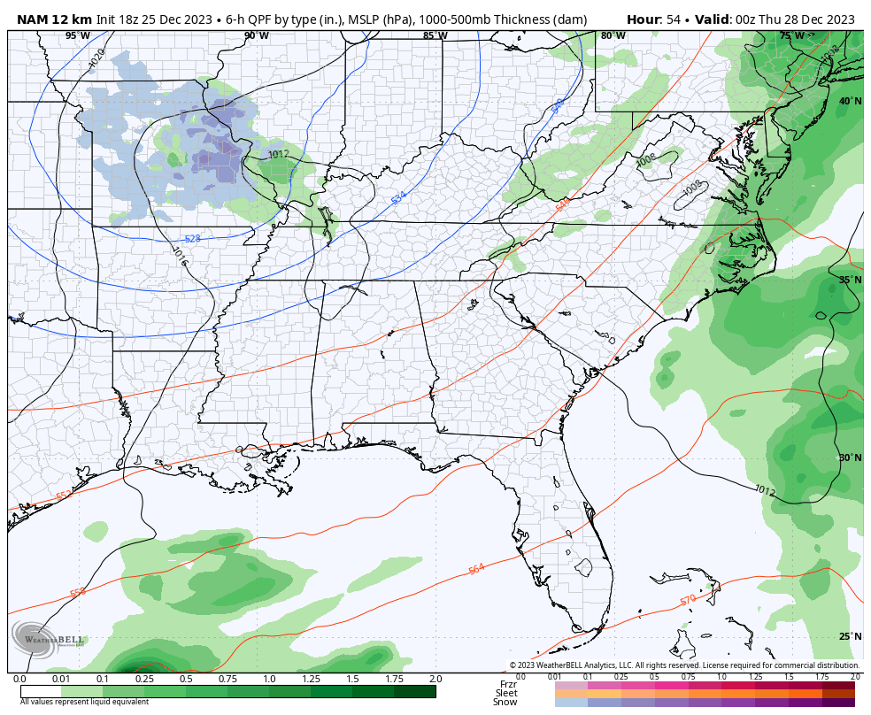
The NAM only goes through 1am Friday, but seems to be matching up pretty well…
The EURO has been lost in the woods on this whole setup, but is slowly finding its way out. The model had no precipitation with this up until a few days ago, but was all rain. It’s slowly finding the light snows with this…
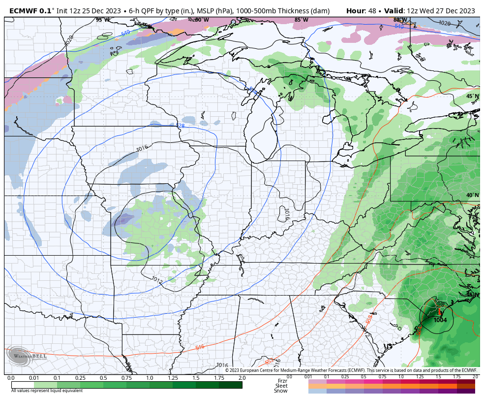
The EURO did the same with the snow squalls and snow showers last week. It had mainly rain until the day before.
Speaking of models having issues… The GFS isn’t worth showing as it’s back to showing something totally different with each run and the model runs 4 times a day.
Luckily, we are getting within the range of the short range models, so this thing will clear up pretty quickly over the next 24 hours or so.
Looking way up in the sky and much farther down the weather road, we find the chance for the Polar Vortex to be disrupted and possibly split. You can see this potential showing up late in week one of the new year…
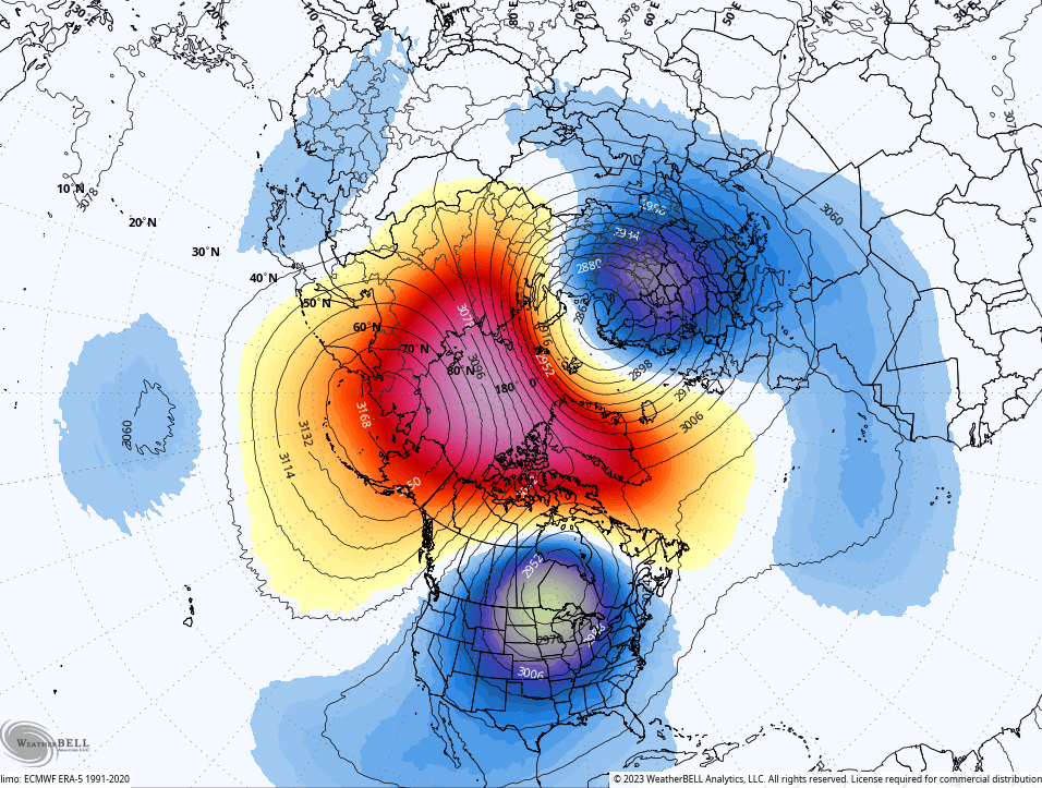
That’s a look at the height anomalies at 10mb level or about 19 miles above the earth’s surface. Interesting look.
Have a great rest of your Christmas and take care.

Happy belated Christmas Chris & all viewers of this site.
I am starting to get excited about the chance of some wet snow.
Merry Christmas Chris and all my weather friends on the blog. Chris thanks so much for all you do. Yes it’s been a mild but rainy day today hoping snow is coming in 2024 that sounds odd to say 2024
Merry Christmas 🙂
Yes…It would have been great to have snow but I can wait until Jan/Feb/Mar and hope we have several snows:)