Good Wednesday, folks. Our upper level low is slowly spinning toward the region and will bring some light snow and snow showers. That may put down some light accumulations by late Thursday and Friday for parts of the region.
All of this is kicking off a very wintry setup as we head into the brand spanking new year.
Let’s begin with today’s weather then move it ahead. Rain across eastern Kentucky is slowly working out of the region this morning with a partly to mostly cloud sky coming in behind it. At the same time, some late day showers may move into far western Kentucky.
Here are your radars to follow along…

The upper low spins in here with a few rain and snow showers on Thursday, mainly across western and north central Kentucky. Once into Thursday night and Friday, bands of light snow and snow showers then impact a wider region.
The best chance for some light accumulating snow is across the western half of the state…
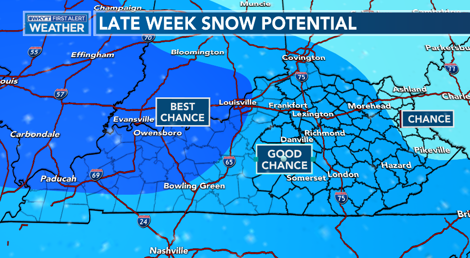
I do expect most of the region to see some light snow out of this, but anything that sticks would likely only be on elevated and grassy surfaces.
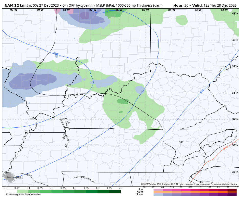
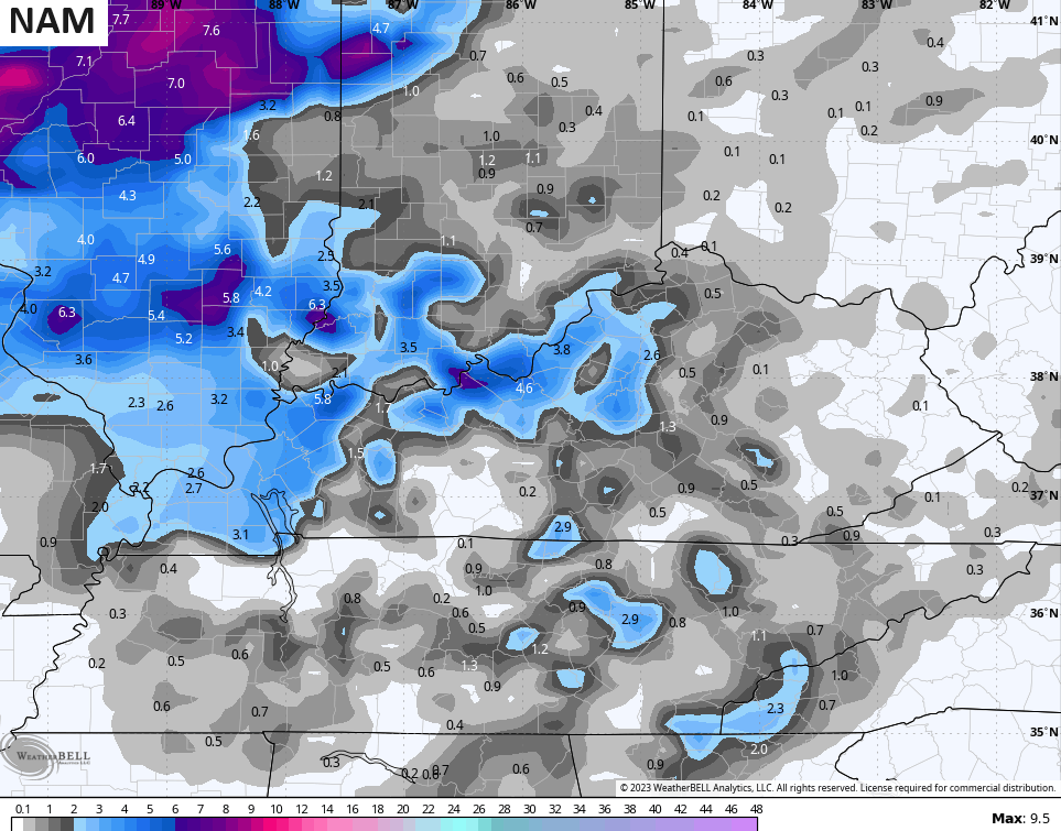
The NAM is the most aggressive with the light snows. Here’s the progression of this system from Thursday through Saturday morning…
The model sees the pockets of thumping snow but is likely overdone…
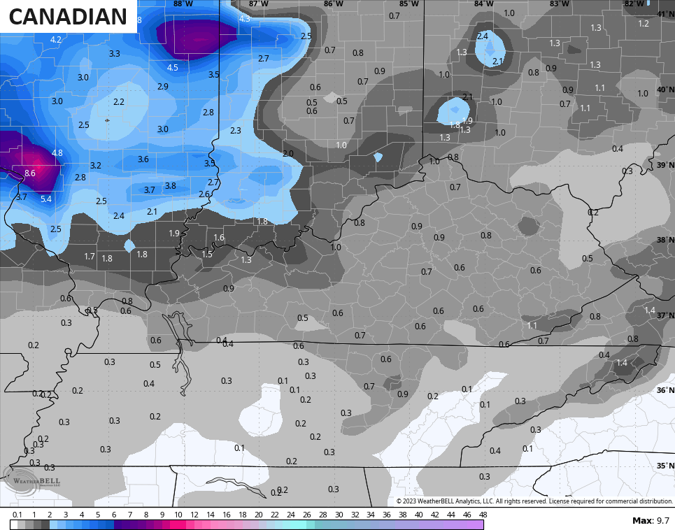
The Canadian Model has much lighter amounts and more in line with the current reality…
So does the GFS, which is finally starting to pick up on the light snow…
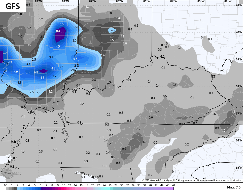
This isn’t a huge deal as temps are marginal and the snow looks fairly light. My concern for a thumper band of snow is still there somewhere in the west, but it’s not as strong of a signal as in prior days.
Another system drops in by New Year’s Eve and New Year’s Day and may bring another round of light snow and snow showers.
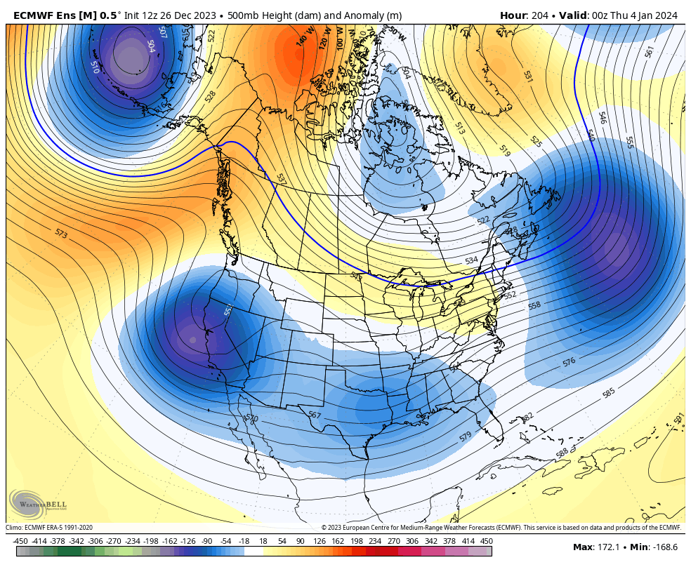
The pattern for the first week and change continues to be one sending storm systems rolling across the country. You can clearly see these on the EURO Ensembles…
The Canadian Ensembles look similar…
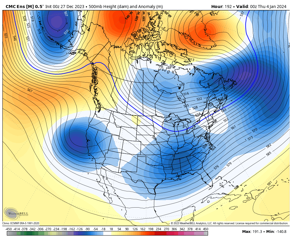
This is the pattern I outlined in the winter forecast setting up for January and February. It’s one likely to bring several snow threats to our region and to much of the country.
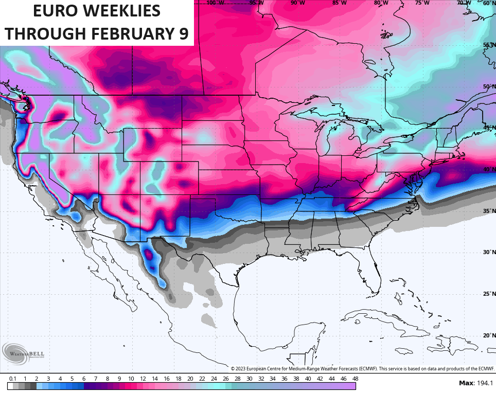
The latest EURO Weeklies through early February show this well…
I will have updates later today. Make it a good one and take care.

Thanks for the update Chris.
Have a Great day !
Another mild December as I predicted weeks ago!
Sounding like a broken record as usual.
You’re far from the only one to say that, Bailey didn’t call for the change till late this month and It’s gonna happen. Almost all Mets called for an above December with a huge flip end of the month into Jan. It’s happening now.
Used to enjoy this blog but people like you make it hard to enjoy…
Your act is getting old. Please stop.
Sure is Jkidd.
Hopefully this pa$$ing act is just a warmup for the main event later on this winter.