Good evening, everybody. Some winter weather is moving toward the region and will settle in for the end of the week into the start of the weekend. This comes from an upper level low spinning into the region with a bit of a mix and some out and out light snows.
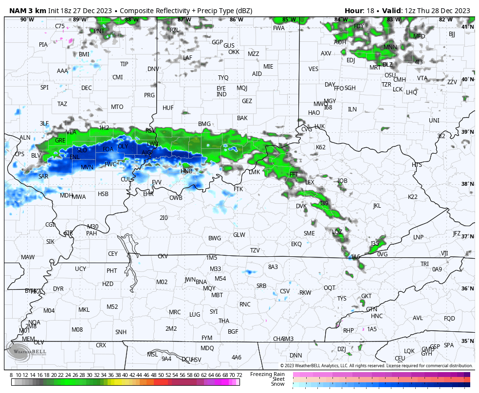
This system is already impacting western Kentucky with a few showers spinning through. These bands of showers lift to the east and northeast and may include a snowflake across parts of western and north central Kentucky by early Thursday.
Here are your radars to follow along…

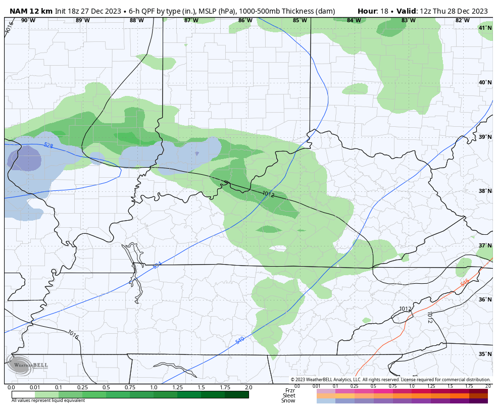
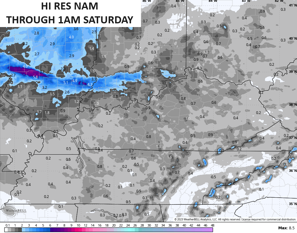
Temps continue to be marginal for snow Thursday and Friday, but some areas of light, wet snow and snow showers is likely. The future radar from the Hi Res NAM shows the flakes spinning in on this animation that starts at 7am Thursday and goes through 1am Saturday…
The NAM goes deeper into the weekend and looks like this…
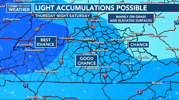
Light accumulations are possible, especially in the west. Whatever we can get to stick would mainly be on the grass and on elevated surfaces…
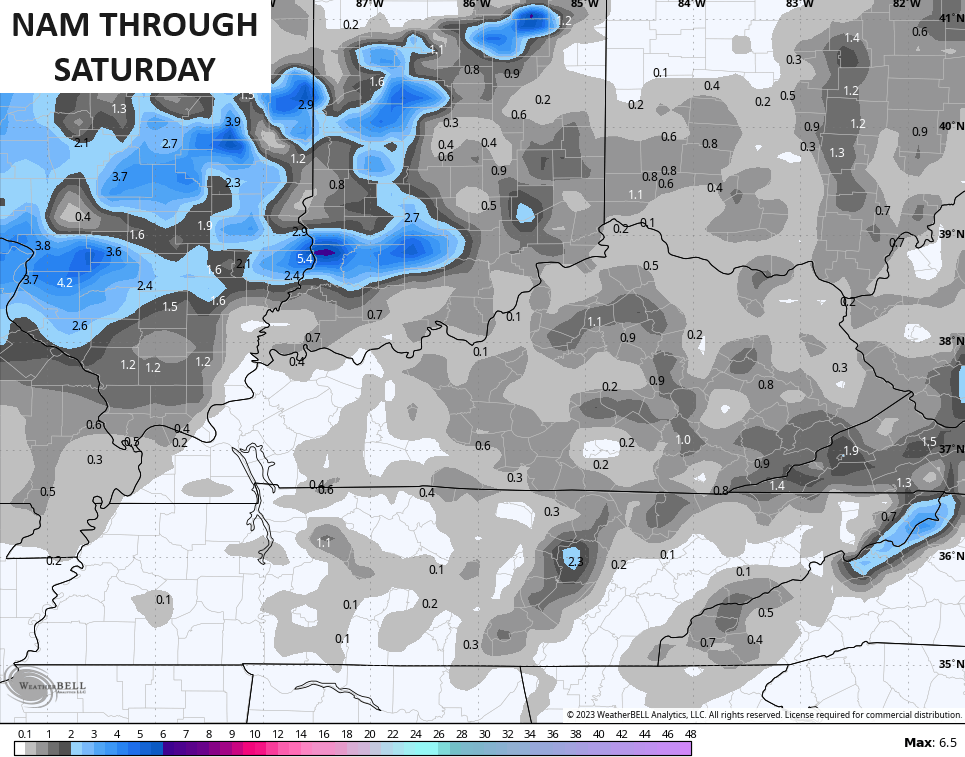
Here’s a look at the Hi Res NAM through 1am Saturday…
And the NAM…
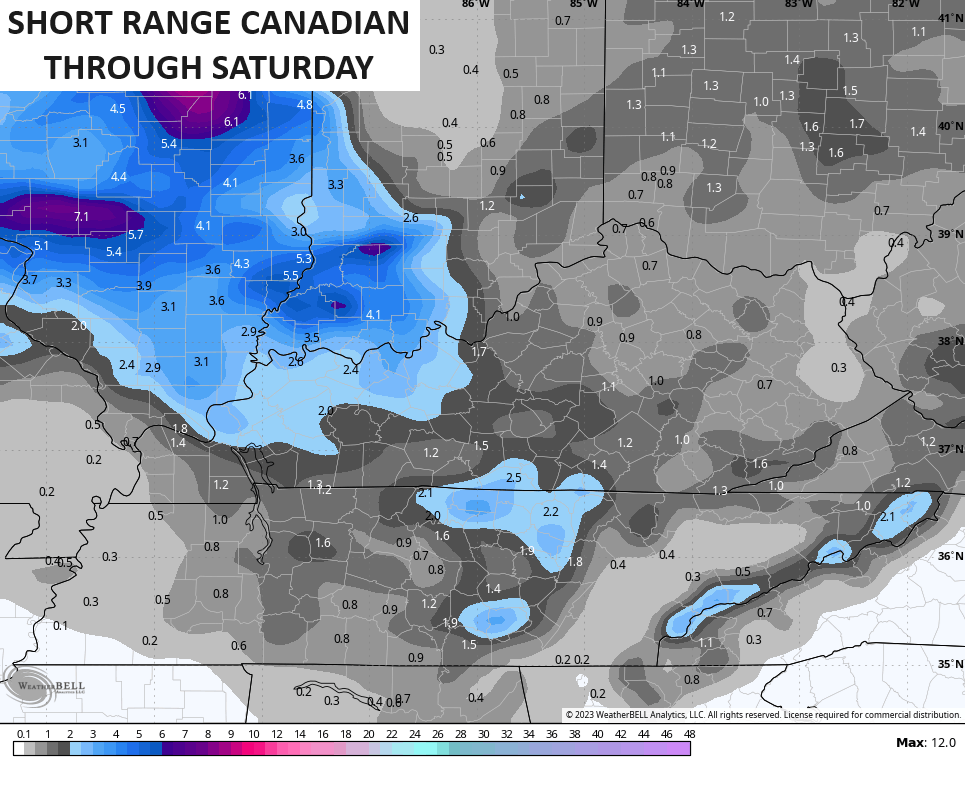
The Short Range Canadian is the most aggressive in the west, but it’s likely overdoing things…
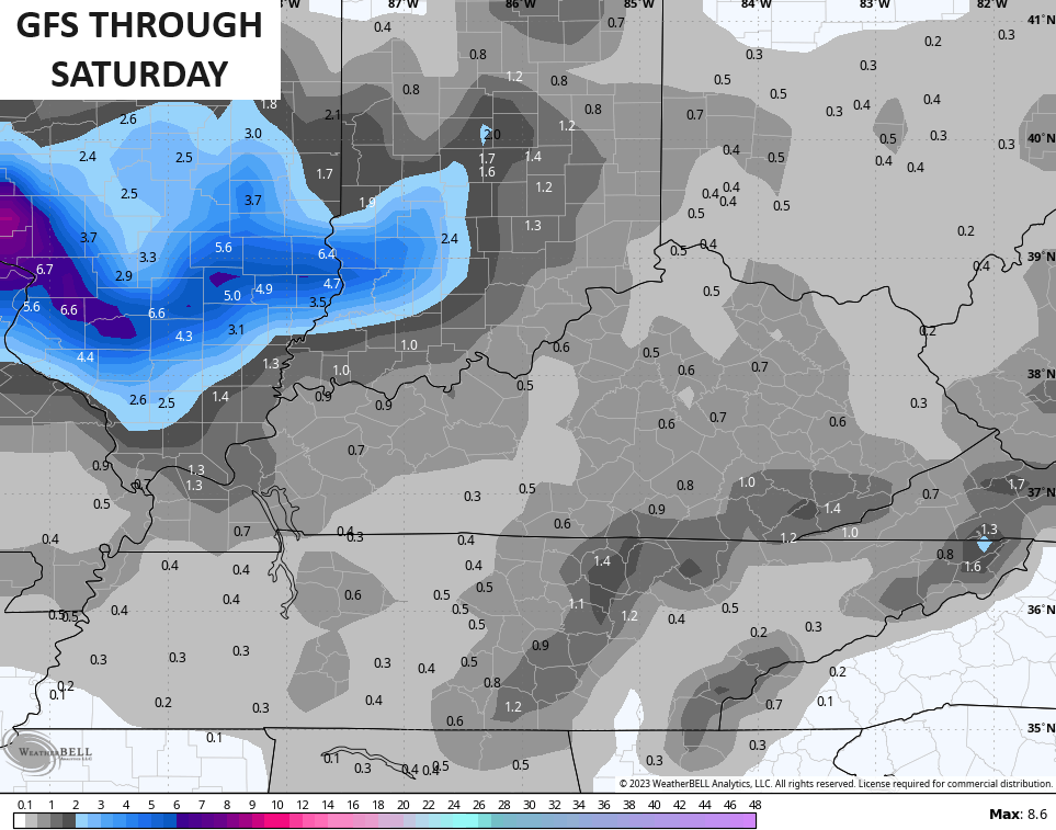
 The GFS took a while to find this system, but has some very light accumulations…
Again, anything that wants to stick is going to have to earn it! With marginal temps, I can even see the lighter precipitation being in the form of light rain or a mix.
Another clipper moves in to start the New Year and may bring some flakes along for the ride.
As we know, the pattern is changing toward a pretty good winter setup as we head into January. This is being reflected on the Ensembles snow maps over the next two weeks…
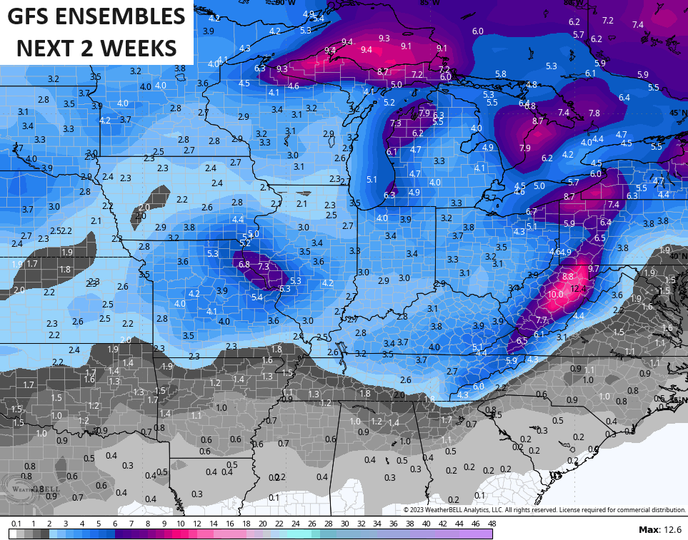
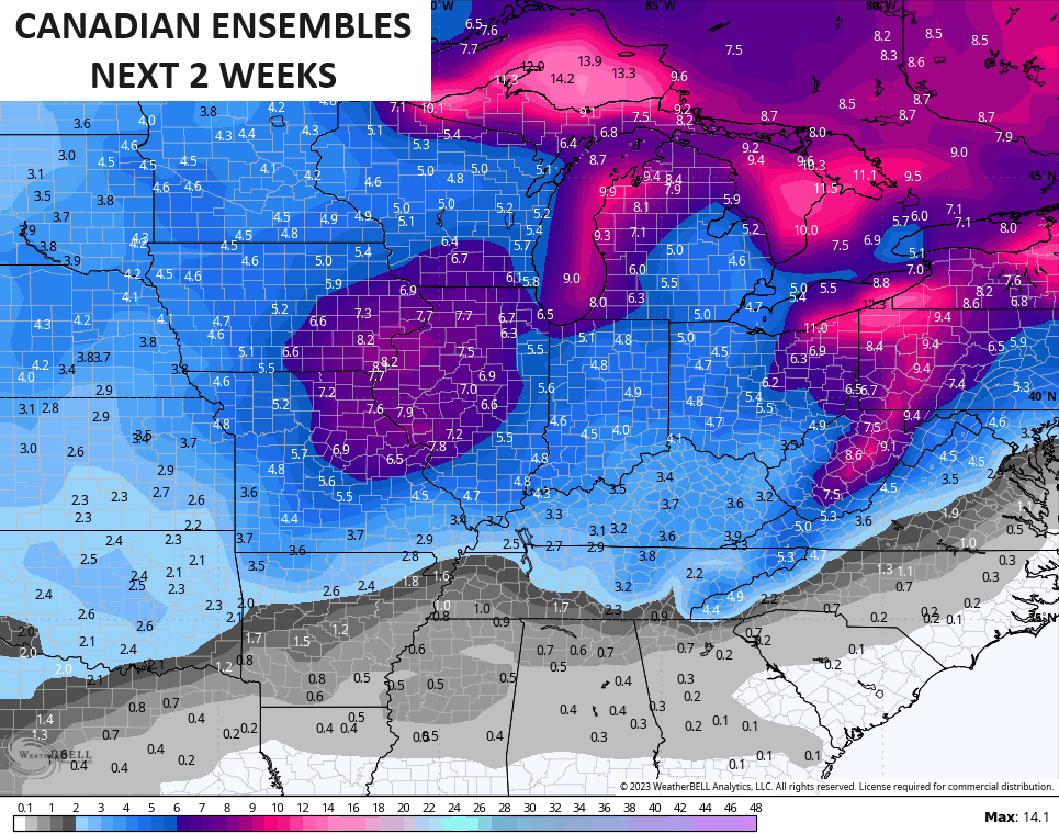
Those are averages from dozens of ensemble members and are only reflecting an active pattern bringing several snow threats to our region.
Enjoy your evening and take care.
