Good Thursday, weather weenies. We finally have a little bit of winter weather to track as an upper level system spins into the region over the next few days. This brings some light snow and snow showers into our part of the world and some of it will stick.
This is the opening act of a huge pattern change leading us into a very wintry January and February.
The upper low is pushing into western Kentucky today and it’s bringing a band of light rain and a bit of a light rain/snow mix. This is mainly areas of central and northern Kentucky early today before a donut hole of clearing settles in for a time this afternoon.
Here are your early day radars to track this initial band of light rain and light mix…

Since you guys like the breakdown style, here ya go:
THIS EVENING
- Light snow pivots into western Kentucky and moves into areas of central and south central Kentucky.
- This looks to increase in intensity by late evening, mainly in the west.
- Farther east, things are fairly calm.
OVERNIGHT AND FRIDAY MORNING
- Light snow becomes more common across the western half of the state.
- Light accumulations are a good bet in this area.
- The snow is working in from northwest to southeast as it spins around low pressure.
- Temps likely stay at or just above freezing, keeping any road issues minimal.
- A few light snow showers may impact the east during this time.
- With marginal temps, any precipitation that’s light may be in more of a rain or rain and snow mix form.
FRIDAY AFTERNOON/EVENING
- Light snow continues to sink toward the south and east.
- A few light snow showers and flurries will develop behind this.
- Once again, some light accumulations will be possible, especially on grassy surfaces and elevated surfaces.
- Temps are above freezing, and this means a little rain will also be possible for areas with lighter precipitation.
FRIDAY NIGHT AND SATURDAY
- Periods of light snow and flurries will be noted.
- The best chance of this is across central and eastern Kentucky.
- Temps may be right at freezing or a bit below late Friday night and Saturday morning. That’s when a slick spot of two may show up.
- Highs are in the 30s with a wind chill in the 20s.
OVERALL
- This is not a major storm system by any means.
- Light accumulations have a better chance to show up across the western half of the state compared to the east.
- Light is the key word in any snow that may stick, with grassy and elevated surfaces being the primary locations to see some slush.
- Travel impact is fairly minimal for most areas, especially during the daytime hours.
Did I mention light is the key word here? 😜 Here’s a look at your First Call For (light) Snowfall that I forgot to save at work, so you get a screenshot from my 11pm weather…
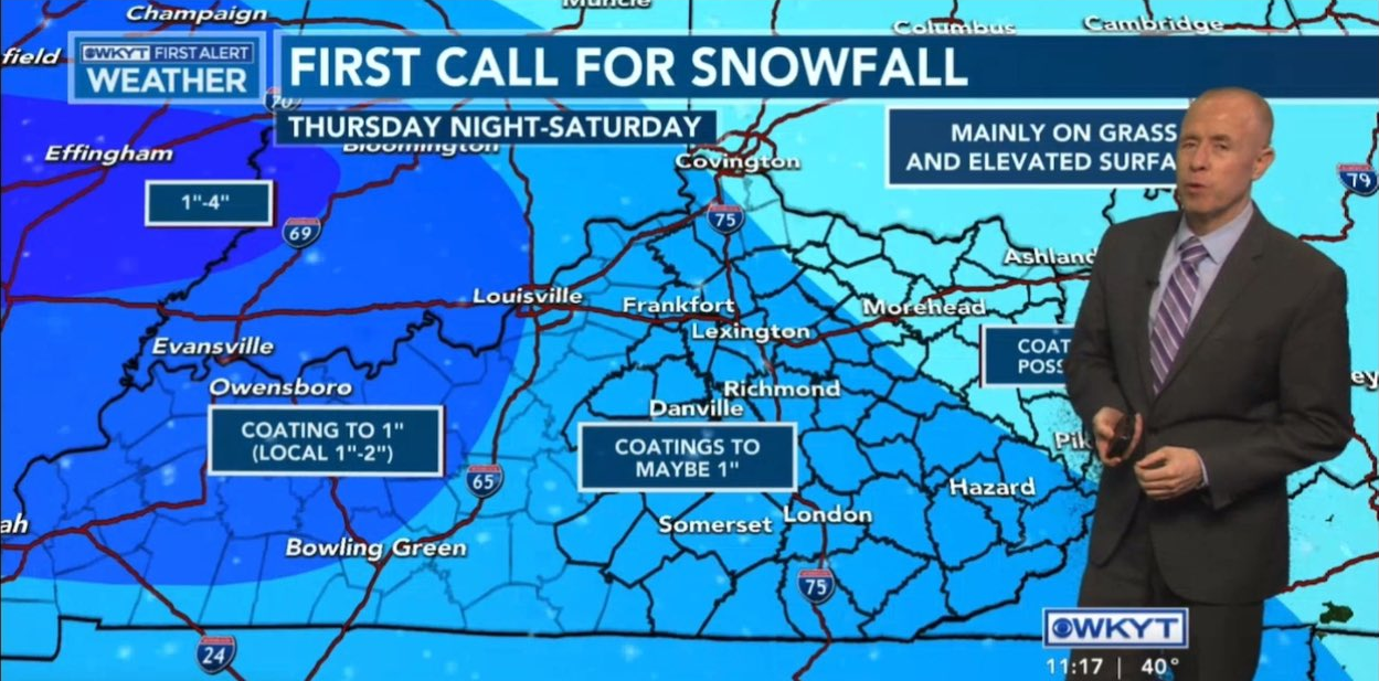
That guy has the perfect face for radio and a voice for newspaper.
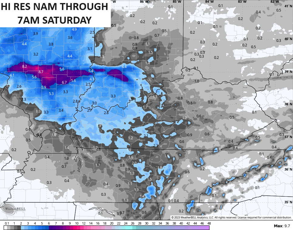
Here’s how the future radar from the Hi Res NAM sees this playing out from Thursday afternoon through Saturday morning…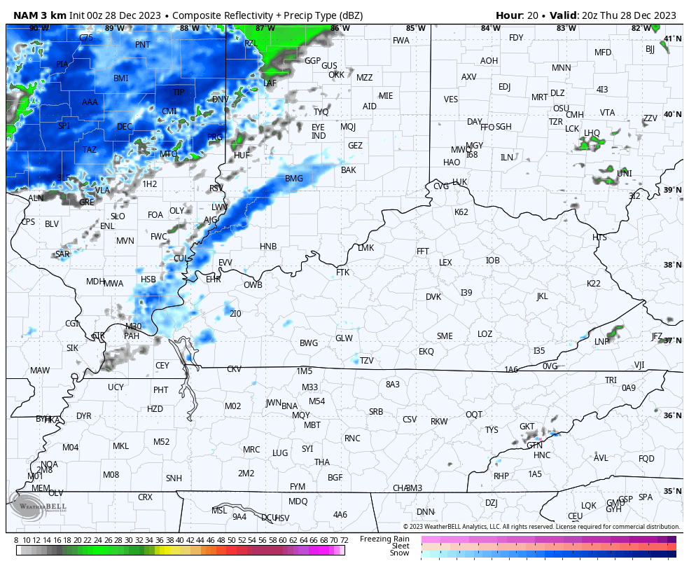
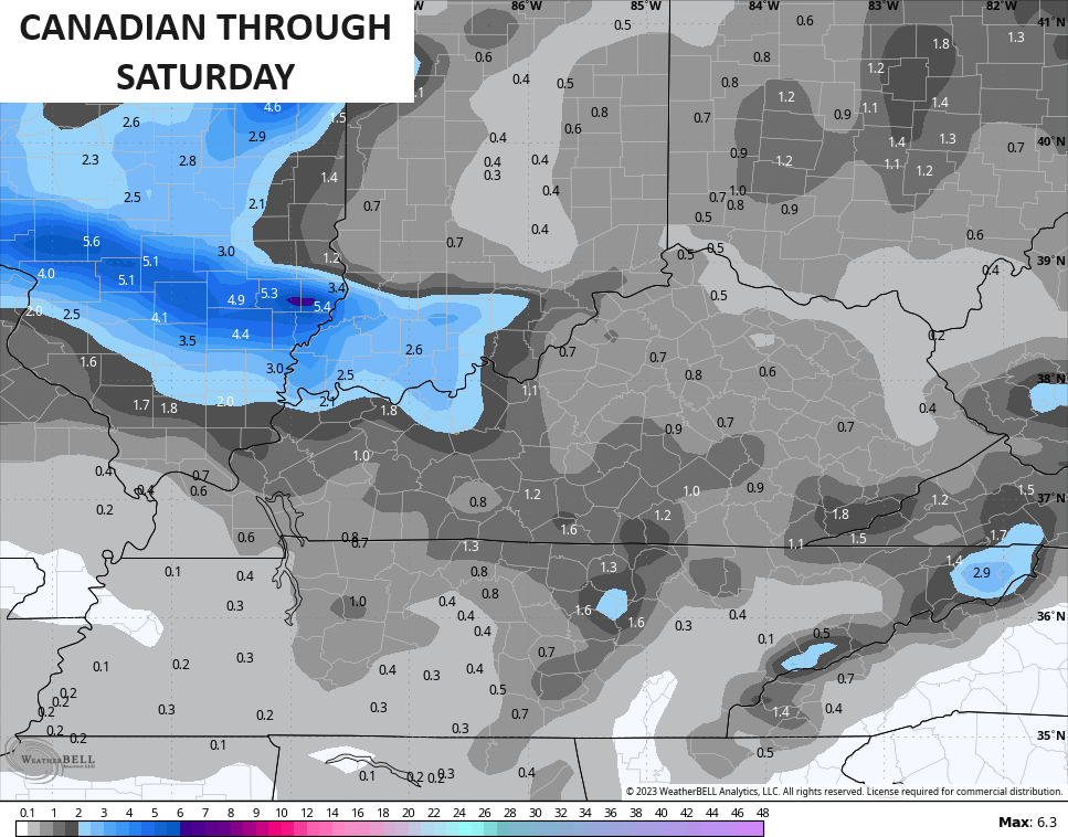
The snowfall forecast from the models continues to be a bit disjointed with the Hi Res NAM being the snowiest…
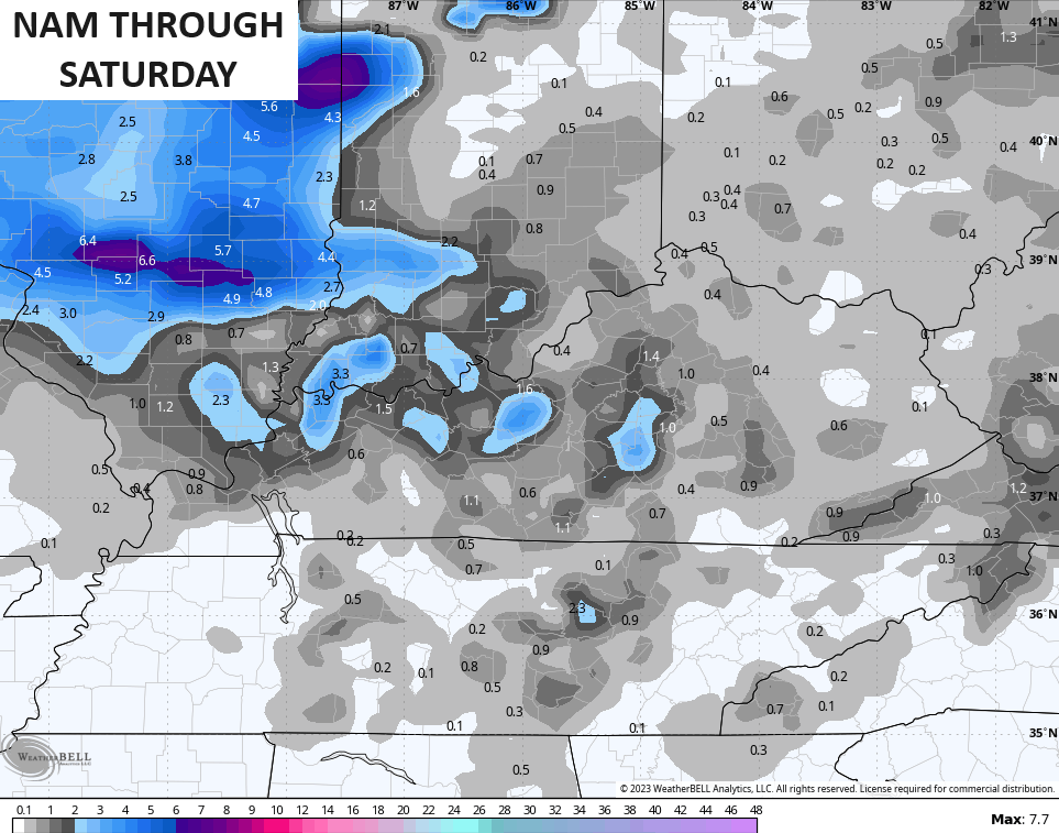
The NAM is a little more disjointed, but still not bad…
The Canadian…
And the GFS…
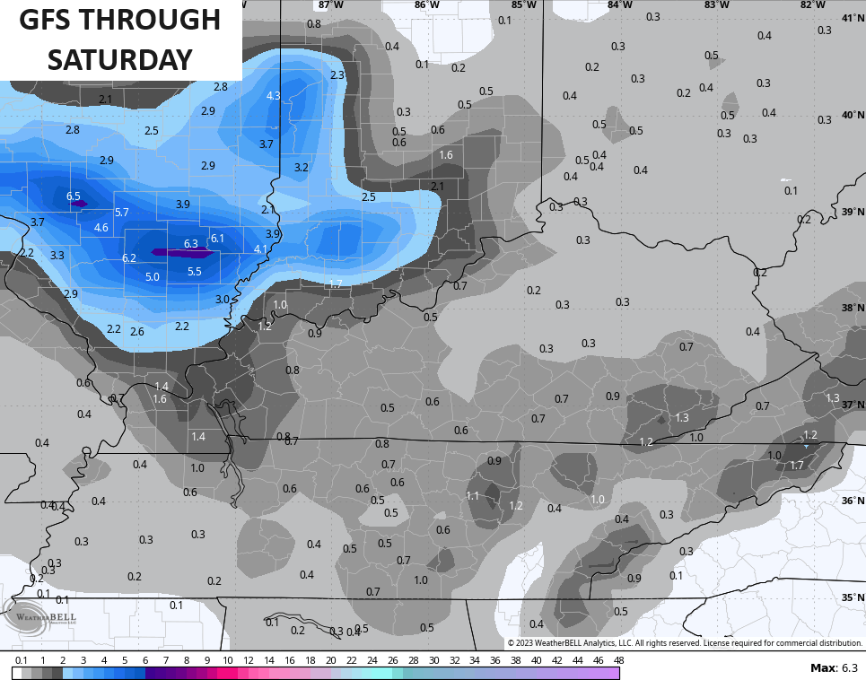
Again… Light, folks.
A clipper brings the chance for some light snow showers and flurries to begin the New Year on Monday. From there, we watch a few systems rolling across the country later in the week with the increasing potential for a harsh winter pattern to develop across much of the country late in week one and into the second week of January.
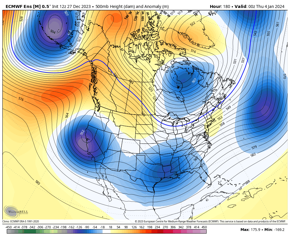
The look from the Ensembles continues to get stronger…
EURO ENSEMBLES
CANADIAN ENSEMBLES
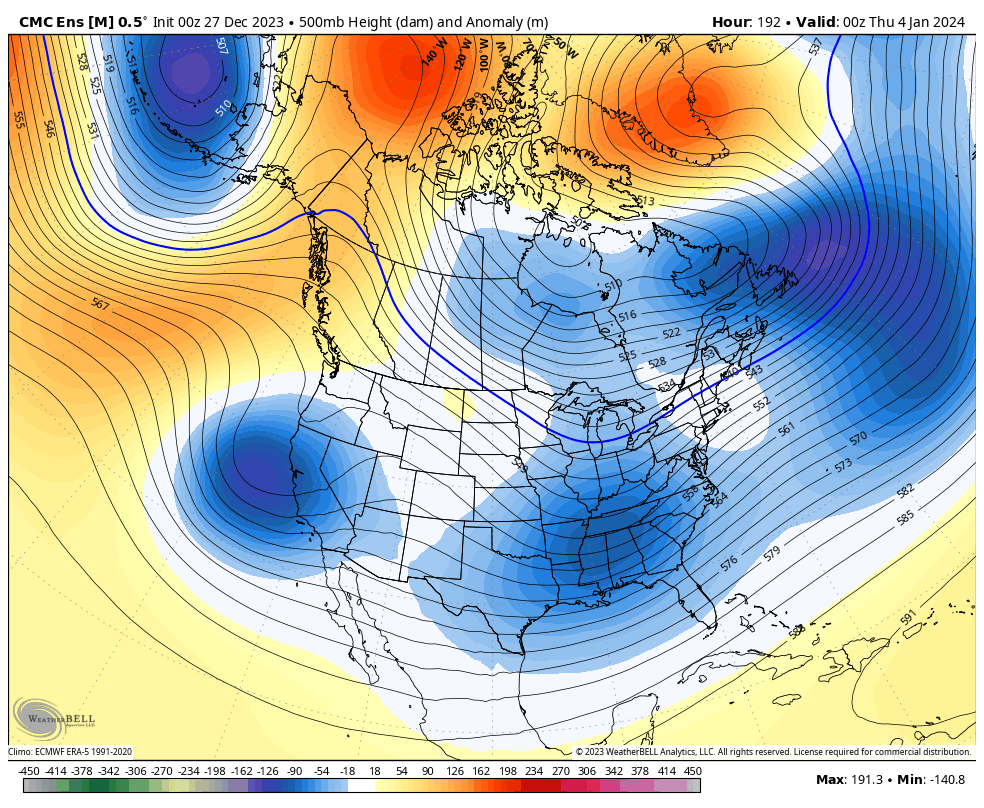
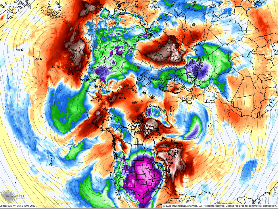
Even the operational models are seeing the potential for some serious cold getting into the country during the second week of the month. The GFS has the coldest air in the Northern Hemisphere showing up in North America…
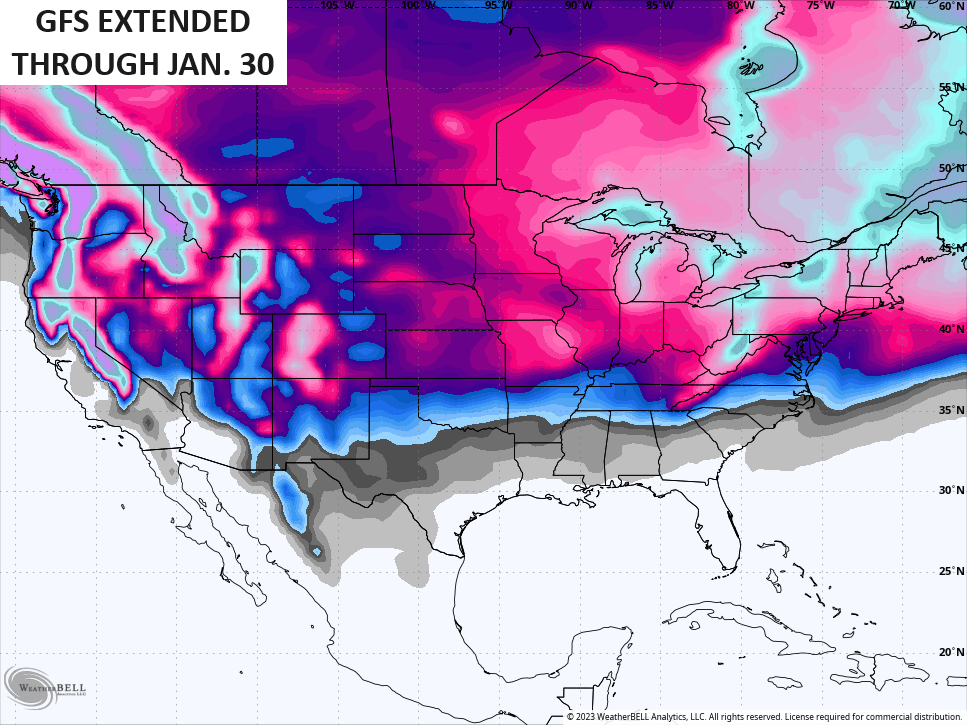
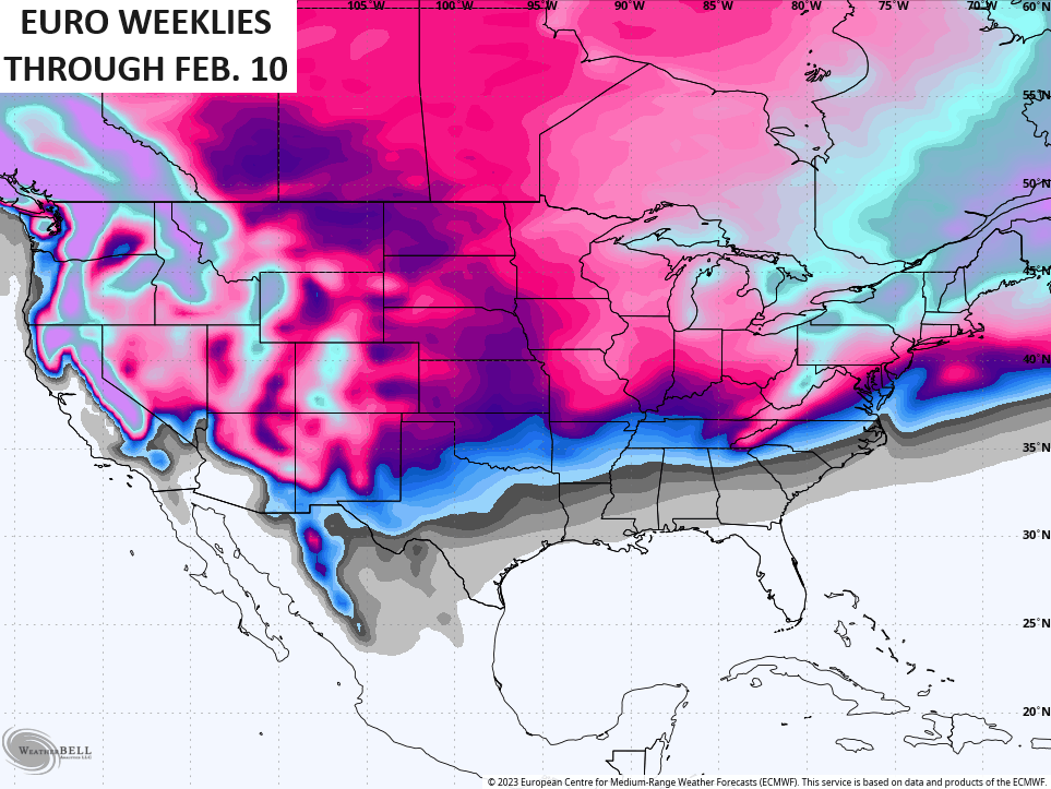
The extended runs of the GFS and EURO are both locking on to snow threats…
Updates come your way later today. Make it a great Thursday and take care.

Thanks for the well detailed forecast Chris. Now I know what to expect through the next few days. Yesterday, I must say was a beautiful late December day. My kind of weather, but really concerned about the lack of moisture as we slowly approach this Spring’s planting season.
Have a Great day Chris !
From a standpoint of energy consumption, this December has been quite a bit easier on the wallet than last year. This month’s electric bill showed that I used 67% less power than in December of 2022. But that’s about to change, temperature-wise.
The big question remains, when will the Ohio/Tennessee Valley see a consistent flow of moisture.
Let’s hope if that accumulation map pans out, ice is not a part of it!