Good Friday, folks. Periods of light snow and flurries are rolling across the region today as we finally get a winter pattern to settle into our part of the world. This includes a clipper that can bring some light snow and flurries for New Year’s Eve and Day.
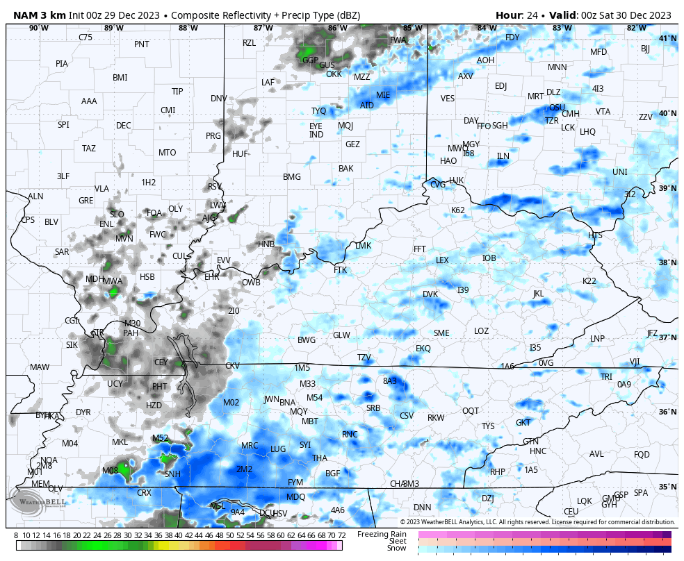
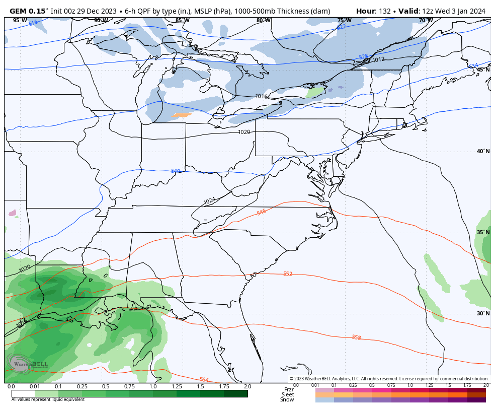
Let’s begin with what’s going on out there today. Our low pressure continues to press across the region with spiraling bands of light snow and a touch of light rain. Light accumulations will be possible on grassy surfaces and elevated surfaces. Here are your radars to follow along…

Another round of light snow drops in overnight and early Saturday, especially across central and eastern Kentucky. That’s when some light coatings may show up once again before snow showers and flurries take us through the rest of the day.
You can see all this on the future radar from the Hi Res NAM from 7pm this evening through 1pm Saturday…
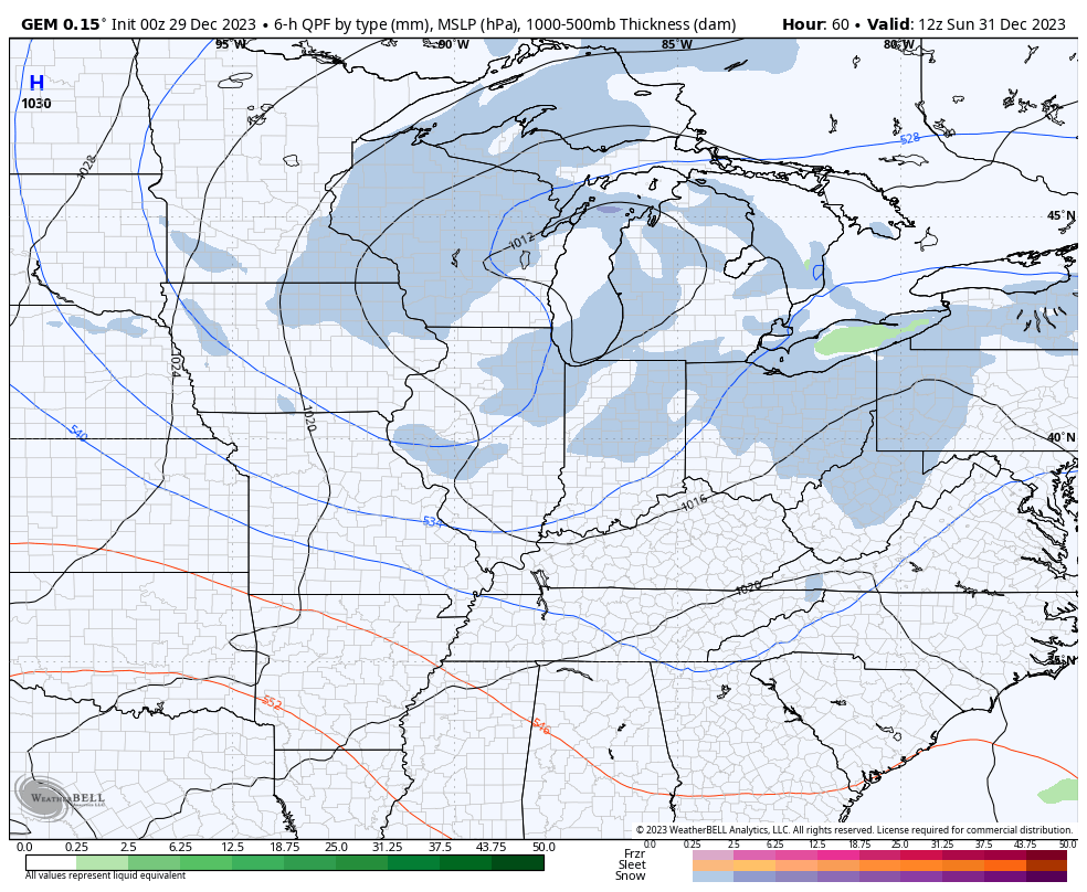
Winds gust up on Sunday ahead of a clipper dropping in here for New Year’s Eve and Day. This can bring areas of light snow and flurries to start the brand spanking new year…
The next system to keep an eye on rolls in here by late Wednesday and Thursday. We have a cold front dropping in from the northwest as a southern storm system cranks and lifts to the northeast. There’s a chance these two team up for rain and/or snow for our region.
The EURO has had the strongest signal for some time and continues to do so…
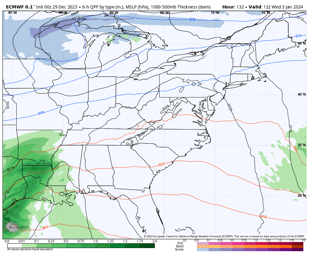
The other models are getting closer…
GFS
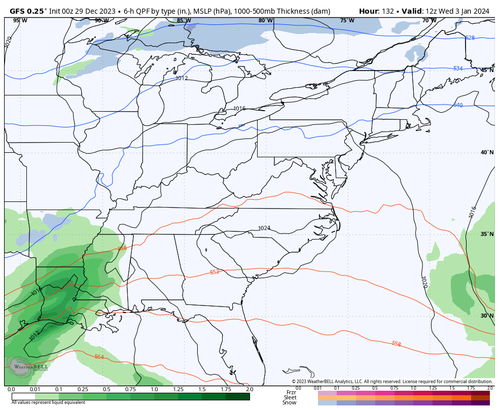
CANADIAN
This is my first “Hmm” storm of the season. 🤔
This is all part of a pattern featuring a lot of winter developing across the country as we watch this setup take place…
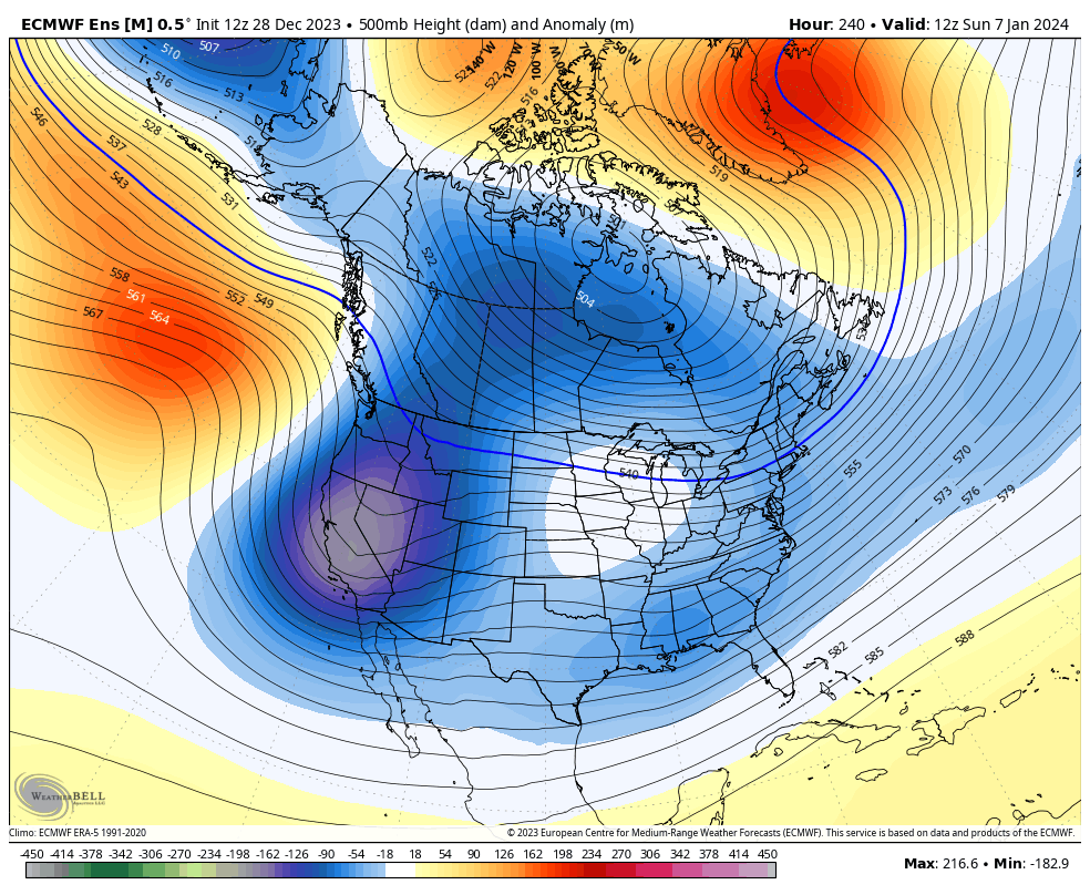
Hang tight, snow lovers. This is a good pattern for January and February.
I’ll drop by for another update or two later today. Have a good one and take care.

Thanks Chris What is causing our lack of moisture??? Did I hear Bubba say the nasty I word???
Yes, he did! I hate that word!
Thanks Chris for the update. As long as we have normal temperatures and weekly chances of Rain or Snow, I can’t complain. Hoping the Frigid Arctic Air stays where it belongs. I don’t like Frigid, Dry Arctic Air with the high heating bills.
Crystal, the lack of moisture could be one of El Nino’s impacts. Don’t really Know, but I hope the precipitation pattern changes for the wetter before Spring arrives in March or April.
Bowling Green will close out 2023 with a total snow accumulation of a Trace, which sets a new yearly record.
I think we will have enough cold air to work with but will we have the moisture? (snowfall 2024)
Where can I find the year to date rainfall amount for Lexington? I’m just curious as to how much below normal we are now.
Dottie, here’s the link to yearly precipitation totals :
https://www.kymesonet.org/yearly_summaries.html?choice=prec_accu&year=2023&system=english
Thanks Schroeder.
Thanks Schroeder that’s a handy site I put it in my favorites.
We may have our first decent system to track soon 🙂