Good Thursday, folks. It’s full steam ahead toward a developing storm system set to bring winter weather to the region this weekend. That storm kicks off a very active setup as we roll through next week and, really, through the month of January.
Let us begin with a quick word on today. A few flurries and snow showers may be noted across the region with the greatest chance of seeing flakes in the southeast. This won’t really show up on radar, but some flakes may be dancing about the sky. A little sun shine then shows up by this afternoon.
My overall thoughts on the weekend system really haven’t changed much at all. The area I’ve been highlighting for the best chance of snow continues to look like the area most favorably for a quick-hitting wet snowfall late Friday night into the first part of Saturday…
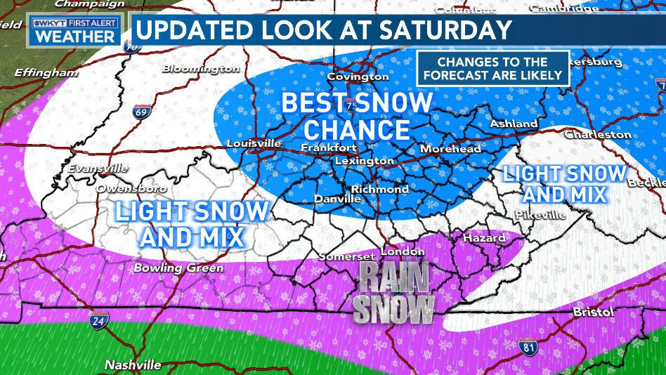
Most of the available models are now joining supporting my general area for the best chance to put some snow on the ground. The EURO is consistently on the high end in terms of snow totals and is also consistent in targeting the Bluegrass Region and the Lexington Metro with these higher totals…

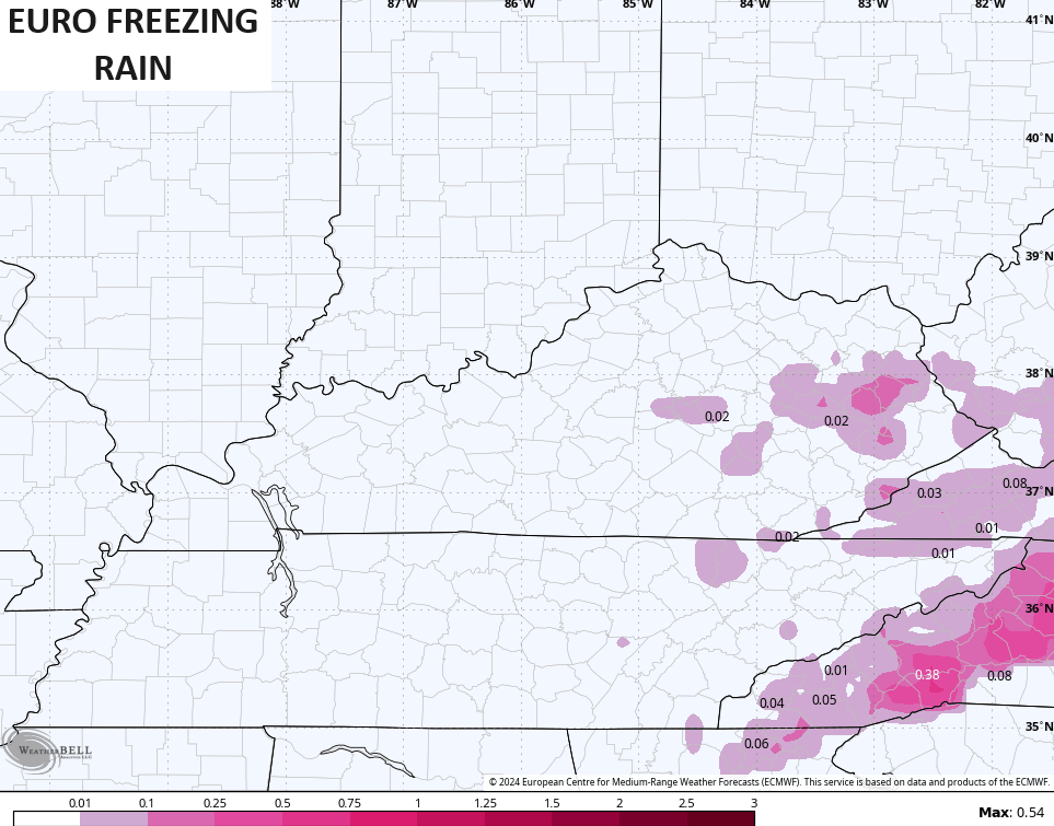
Another trend showing up is for a touch of freezing rain in some of the valleys in the east. The EURO is pretty light with this…
The Canadian family of models has lower snow totals than the EURO, but we see more freezing rain…
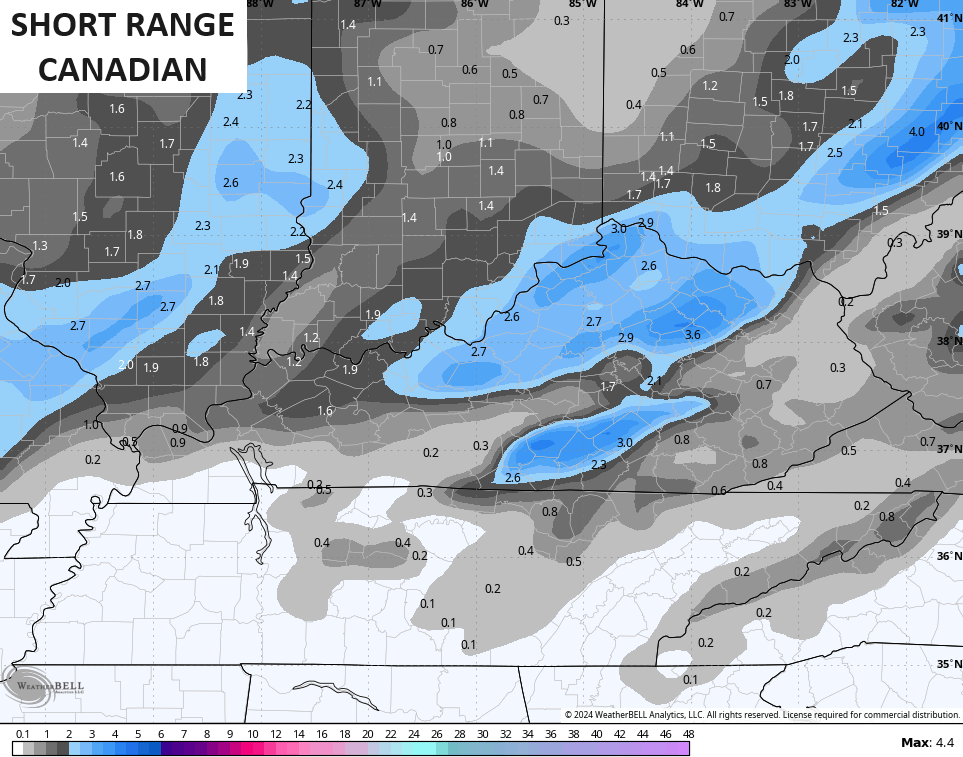
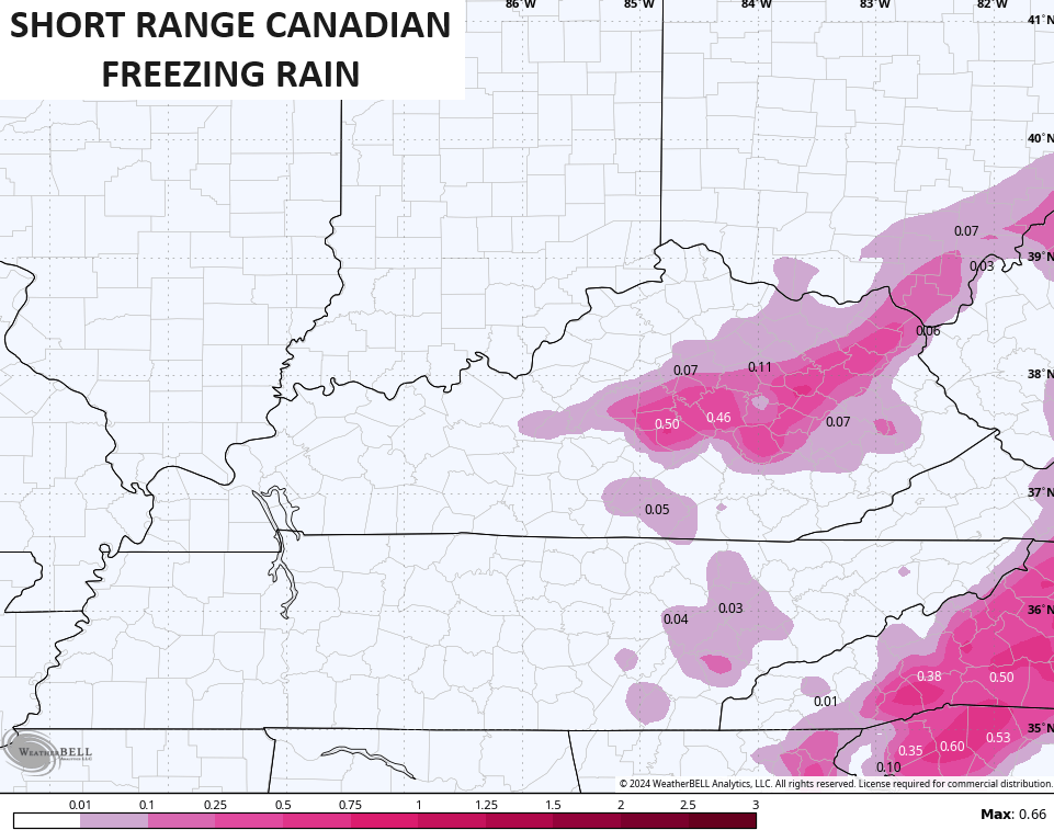
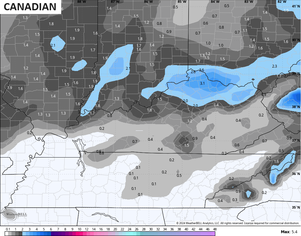
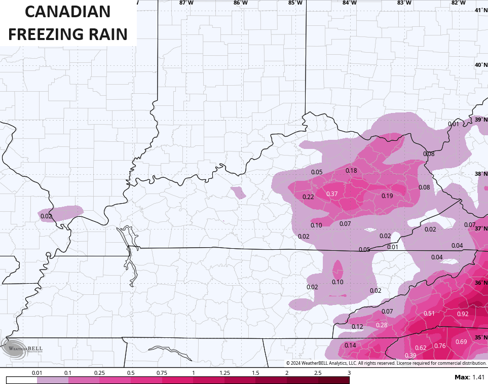
The freezing rain is very likely overdone on those models!!
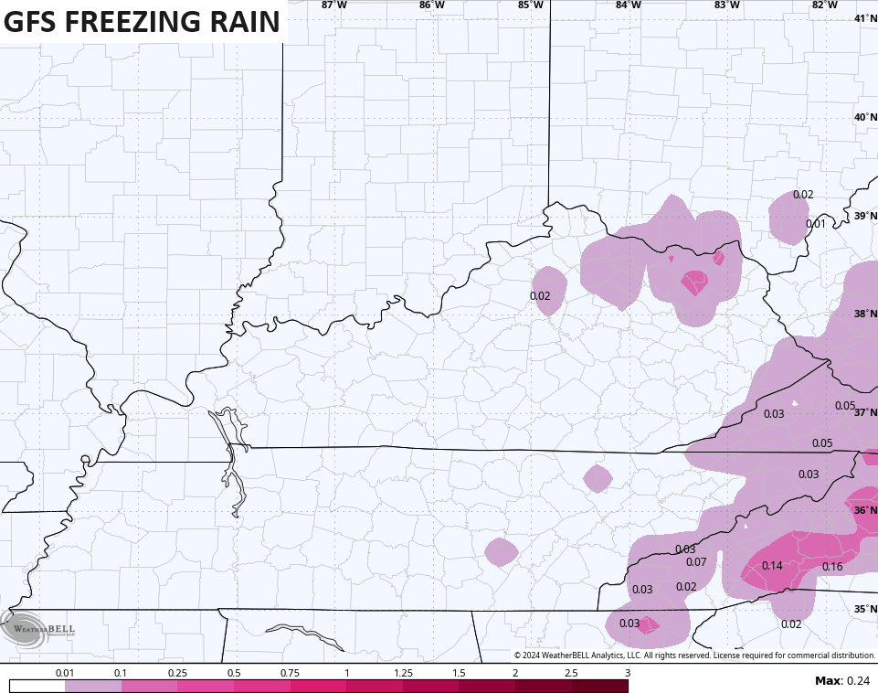
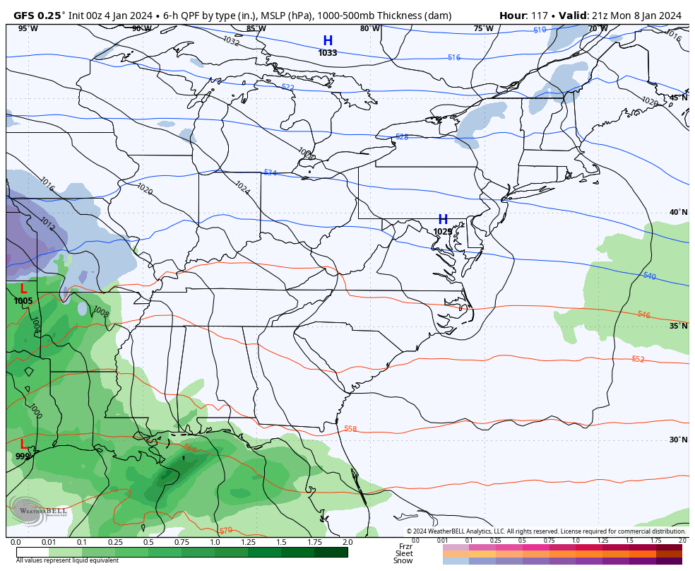
The GFS is a little north of the EURO with the accumulating snow…

It also has a minimal amount of any freezing rain…
In the overall scheme of things, I’m not overly concerned about the freezing rain potential, but it would just take a little bit to cause some small amounts of ice on elevated surfaces for a time early Saturday.
I fully expect a wide chunk of real estate to be under a Winter Weather Advisory Friday night and early Saturday. I suppose there’s an outside chance for this to overachieve in a few spots, so that’s something to watch.
I will likely have a First Call For Snowfall map out with the midday update.
Another system brings the chance for some light rain and light snow for Sunday. That system gets pushed through fairly quickly as we have a monster of a storm coming behind it early next week.
Here are some headlines for that system:
- A wintry mix may show up on the leading edge of edge of the precipitation shield Monday night and Tuesday morning.
- There could even be a period of snow in the north.
- As our storm cranks, milder temps push in from the south with heavy rain taking control on Tuesday.
- That doesn’t last long as the low passes to our north, cold air rushes back in Tuesday night with a quick change to snow.
- With a lot of water around, we will need to watch for a quick freeze up.
- Periods of light snow continue on Wednesday with light accumulations a pretty good bet.
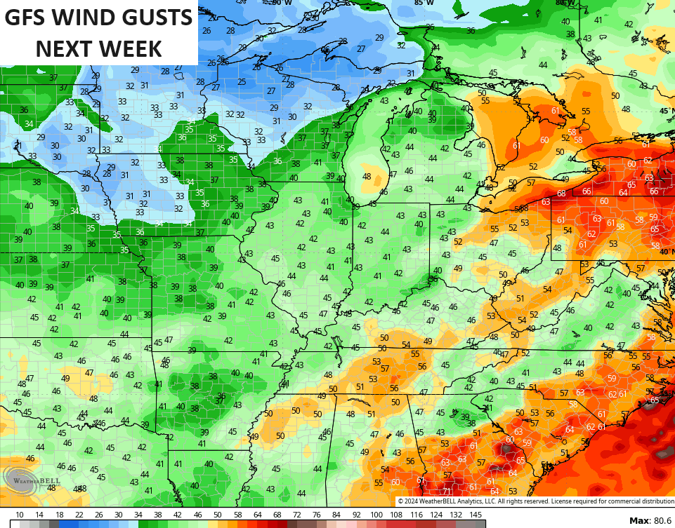
- Winds Tuesday and Tuesday night may top 40mph at times.
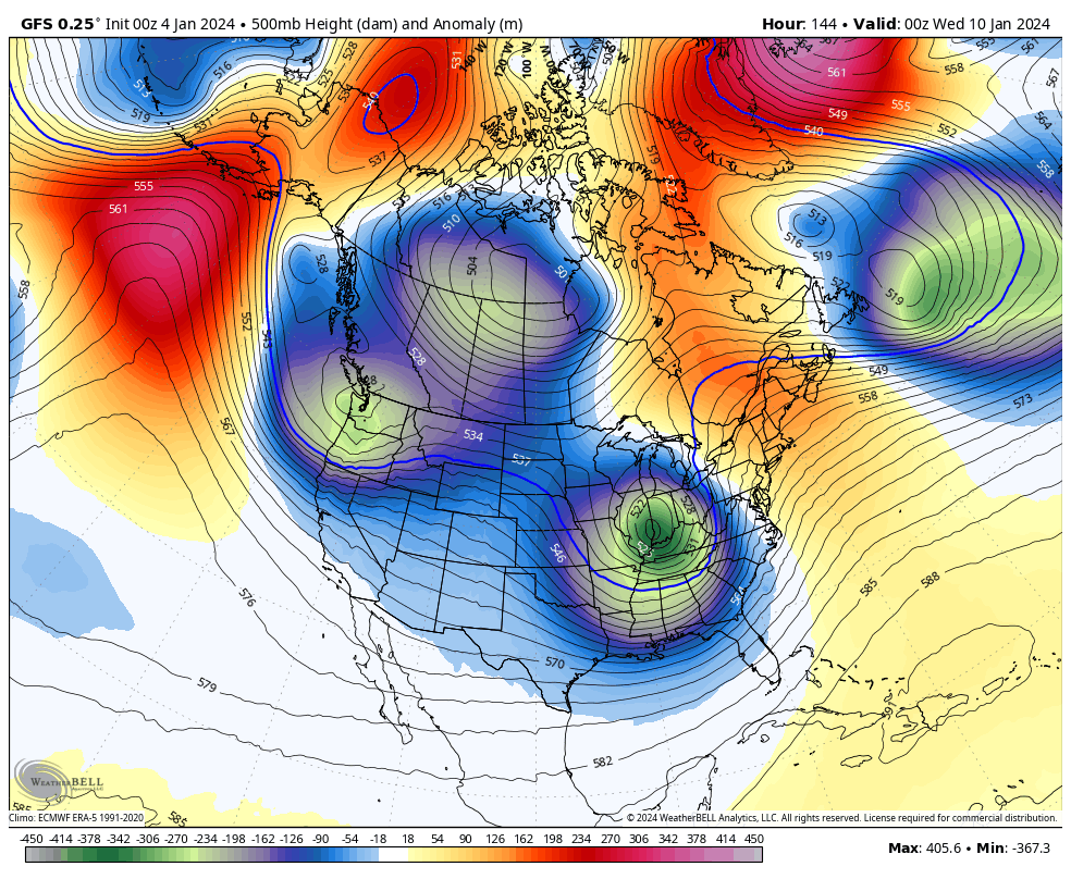
Several days ago, I said watch the models press farther east with the track of this system and they have indeed been doing that.
Here’s the Canadian…
And the GFS…
Check out the peak wind gusts from this storm…
We may very well see a few more systems similar to this one crank from late next week into early the following week, but these may wind up being farther east, putting us more on the winter side. The amount of blocking going up from Greenland through the North Pole and toward Alaska is pretty wild to see. That blocking means look out across the United States as a harsh winter pattern likely unfolds…
I’ll see you guys back here for the midday update. Until then, have a good one and take care.

Yeah the last thing I am concerned about in Louisville is freezing rain. Although I will probably see more plain rain on Saturday than snow.
Thanks for the update Chris and the forecast breakdown of what may occur.
Have a Great day !
FWIW, we certainly need moisture during this season of dormancy, but when I was working alongside Four Mile Creek (Clark County) last week, it had more water than any time since last June (maybe early July). That’s a good sign.
Lower 50’s next week. Still waiting for the cold as predicted in November and December.
Still waiting for you to make an intelligent comment.
Dude just stop .
Models showing PV spilt again, of course it could be gone next run. We needed a hail mary with MJO moving into warmer phases, and that’s exactly what models show. Grain of salt, we shall see.