Good evening, folks. A wintry mix of rain and snow is moving into the region overnight and early Saturday and some of us will see a light snowfall. This system kicks off a very active weather pattern over the next few weeks, at least.
A Winter Weather Advisory has been issued for late tonight and early Saturday. Here’s a look at the area currently included…

I think that should include northern Kentucky and the northeastern corner of the state.
My Latest Call For Snowfall looks like this…
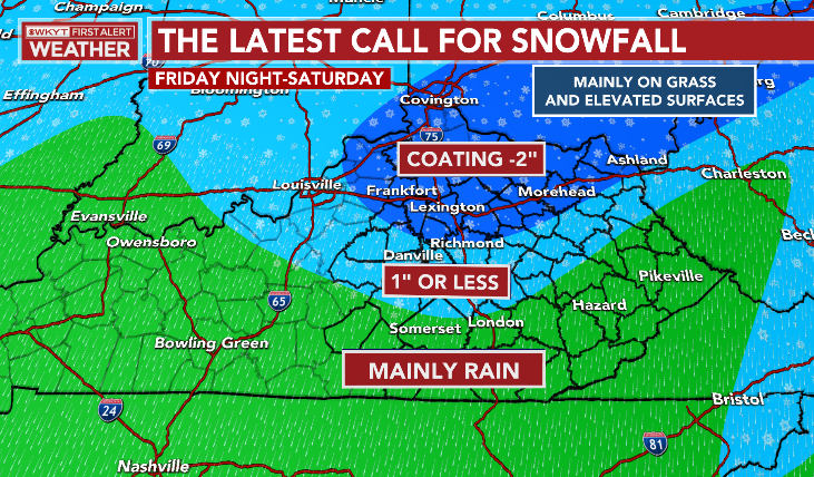
There’s a chance for some areas to overachieve in the north with a chance to underachieve around I-64 and south. That’s why I have pretty low totals. You only have a few hours window to get in on sticking snow and that’s early in the morning.
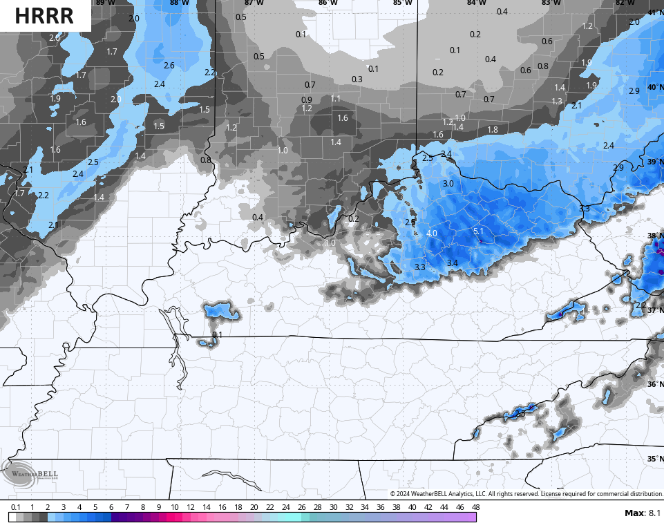
The future radar from the HRRR continues to be the most friendly to snow lovers…

Here are the totals from that run and, once again, this is likely overdone…
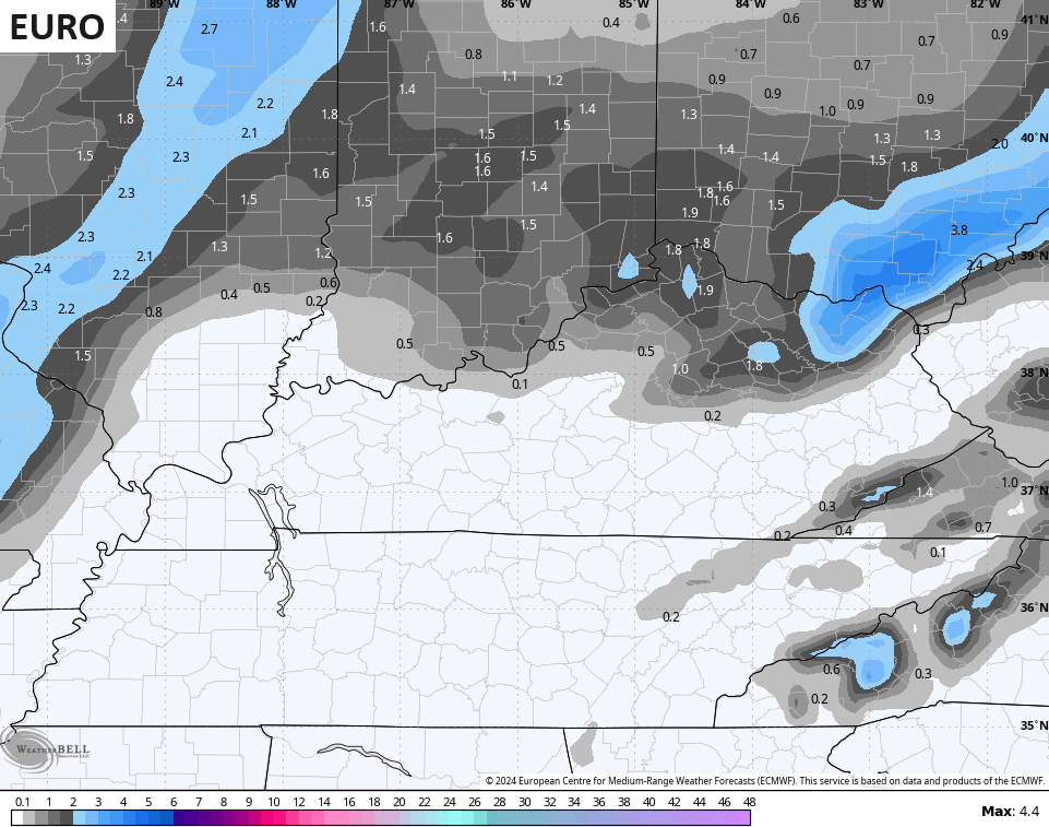
The EURO looks like this…
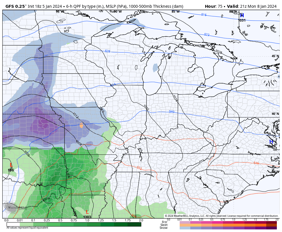
The GFS is also on board for a little thumper snow for some…
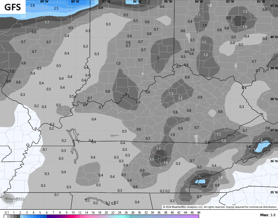
Obviously, I’m not buying into these higher totals, but it would only take one degree colder air to give us those numbers.
The next storm system is a doozy for Monday night through Wednesday…
A mix to heavy rain with 50mph hour wind gusts will be possible Monday night and Tuesday with a switch to some accumulating snow Tuesday night and Wednesday.
I will throw you another update late this evening. Until then, here are your radars to track the wintry mix into the region this evening…

Enjoy the rest of your Friday and take care.

Thanks Chris. Just plain cold Rain in my local forecast. As dry as it is we will take any amount. The chance for better Rains come next week. Accumulating Snow in my area is still in question this Winter.
Have a good evening Chris.
It is what it is! Just as long as ice is not what it is.