Good afternoon, folks. Rain and snow showers are rolling across the Commonwealth as we get set for a monster system to impact us over the next few days. That will be followed up by another big system later next week as arctic air gets involved in the overall pattern.
Today’s stuff is fairly light, but it’s making for a very dreary day in the region. Not much of the snow is really sticking, but a coating can’t be ruled out after sunset in a few spots. Here are your radars to follow along…

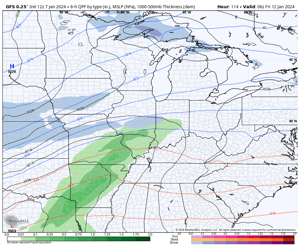
I have no changes on the storm coming at us for the next few days. Here’s a quick breakdown:
- Rain moves in Monday night and may start as a mix in the north.
- Heavy rain of 1″-2″ is likely through Tuesday.
- High winds are LIKELY. Gusts of 50mph or greater will take place Monday night and Tuesday. Wind damage is possible.
- Cold air crashes in from the west Tuesday night and Wednesday.
- Periods of light accumulating snow is likely during this time.
Here’s our storm showing up on the GFS…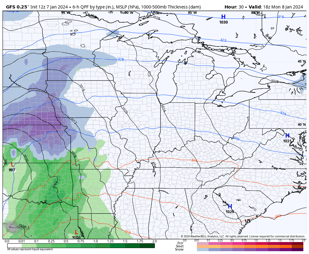
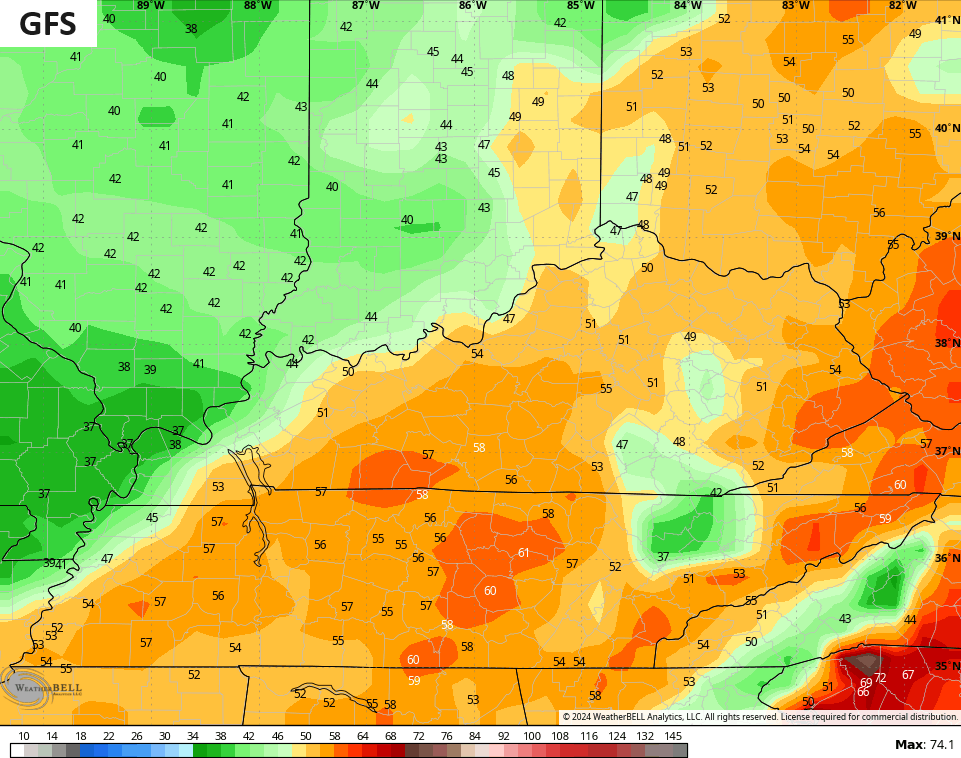
The GFS continues to show widespread 50mph+ wind gusts…
The NAM and Hi Res NAM are throwing 60mph+ winds our way…
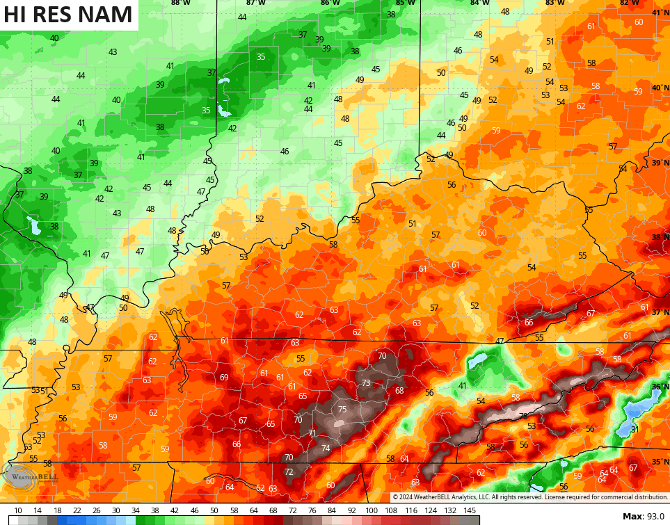
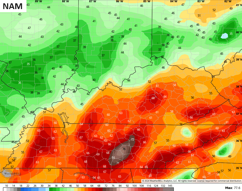
Again, wind damage is a real possibility.
The next system rolls in a few days later by Friday and into Saturday. The models continue to figure out the track of this system, but with arctic air getting involved, one has to wonder if we don’t see this track trend farther south and east.
As it’s currently shown on the GFS, we get another high wind and heavy rain event with a quicker switch to snow. That’s still followed up by a snow maker by Sunday and Monday…
I’ve been warning you guys this pattern is going to take a walk on the wild side and we are seeing that starting.
Another update comes your way later today. Have a good one and take care.

Not a good situation for aging trees.
1-2” rain/50-60 mph winds.
LGE has done a lot tree clear cutting around power lines over last few years.
I hope their work pays off.
I lost my electric 4 times last year due to high winds.(tree falls in my neighborhood)
Those winds gust on map are starting to get scary looking. I am afraid someone will get power knocked out. Not to mention the rain we will be having. Mike you sound like you might have a big snow coming your way in your area. I hope someone gets one been reading about the cold that’s coming too looks like Chris will be busy but what else is new?? Chris thrives on busy and pressure lol.
Crystal, Monday night/Tuesday morning and Tuesday afternoon/night are the two time frames for heavy precipitation for NE IL. There’s still a big question of where the rain/snow line will be Tuesday afternoon, but it should be all snow for the area on Monday night.
Thanks for the update Chris. Have a relaxing and peaceful Sunday evening.
Wind worries me more than any other weather condition, and I was right in the middle of the July,2022 flooding.
I just saw the drought update on NWS Louisville.
Gee – I know we haven’t had tons of rain… but I just don’t feel like it’s that horribly dry… Yes it’s below normal but we’ve had a few decent rains… it’s not like it’s gone weeks without raining…
https://www.weather.gov/media/lmk/DGT/DGT_LMK_01042024.pdf