Good Sunday, everyone. It’s another raw day across Kentucky with periods of rain and snow showers rolling through here. The focus going forward is on a HUGE storm system set to bring heavy rain and high winds before some snow kicks in.
Let us start this party out with what’s going on today. It’s gloomy with those pesky rain and snow showers that aren’t amounting to a whole heck of a lot. Temps are generally in the 30s.
Your radars…

Ok, let’s break down the storm system ahead of us:
MONDAY
- Clouds increase quickly as low pressure cranks to our southwest.
- Some afternoon showers may move into the west.
- Highs range from the upper 30s to middle 40s.
- Winds start to increase with gusts to 25mph
MONDAY NIGHT
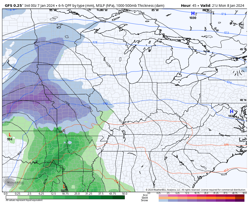
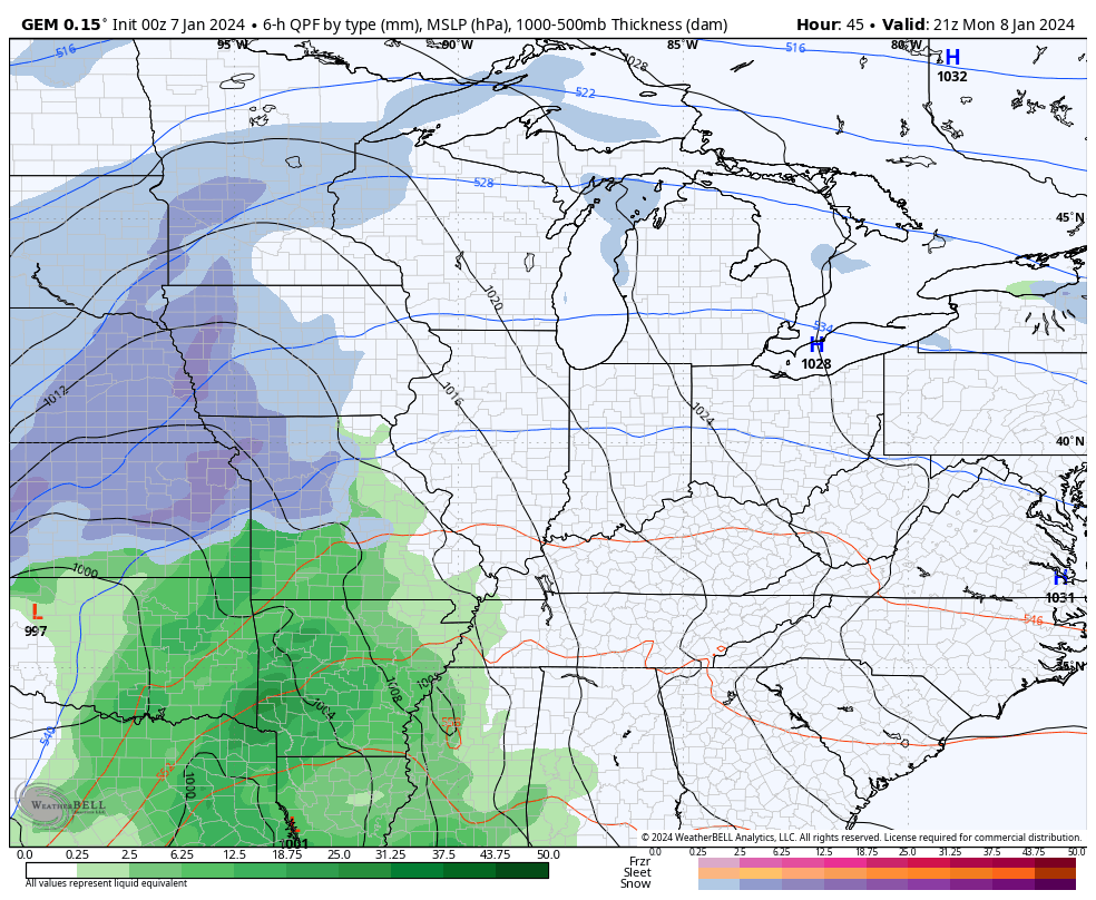
- Low pressure lifts northward from Tennessee/Arkansas toward Western Kentucky.
- Heavy rain overspreads the region.
- A wintry mix may be noted at the start in the nroth.
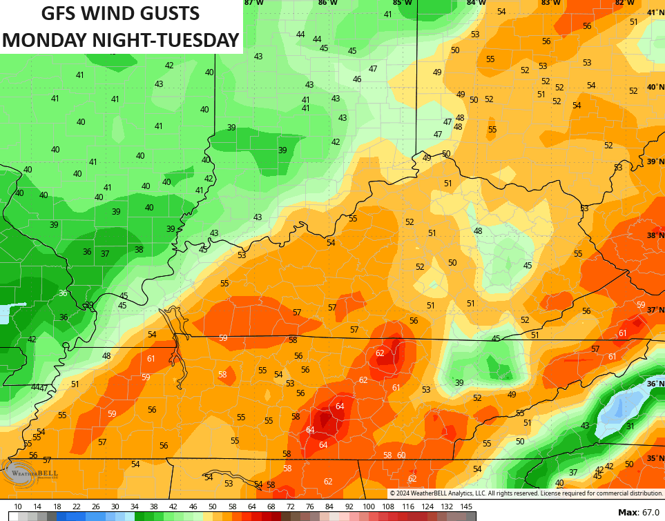
- Winds become a MAJOR player. Gusts of 50mph or greater will be noted.
TUESDAY
- High winds continue with gusts potentially hitting 50mph or a bit higher in some areas.
- Heavy rain pushes through. Rainfall totals of 1″-2″ will be possible.
- I can’t rule out some rumbles of thunder as temps spike into the 50s for the eastern half of the state.
TUESDAY NIGHT
- The strong low passes to our north and northeast.
- Temps crash through the 30s from west to east.
- Periods of light snow quickly develop with light accumulations by morning.
- Winds are still cranking with 40mph gusts.
WEDNESDAY
- Light snow favors central and eastern Kentucky.
- Accumulations are likely during the first half of the day.
- Setups like this usually produce an inch or two of snow.
- Winds are still gusting between 30-40mph.
- Temps stay in the upper 20s and low 30s with wind chills in the teens at times.
The models have some subtle differences with the GFS somehow taking this storm north of Chicago…
The Canadian takes this on a more than likely track toward Detroit…
Either way, you get the wraparound light snows and high winds.
Some of the wind gusts are way up there, including the Hi Res NAM showing a few 60mph+ gusts by Tuesday morning…

The GFS has a fairly widespread 50mph wind field for gusts…
A weak cold front slides in for Thursday and lays down a boundary for another major storm system for Friday and Saturday. Odds favor this being farther south and east than the one over the next few days. That means the models are going to be giving us some wild solutions in terms of track deviations.
The latest GFS has this storm cutting farther north than the earlier run with another snow maker behind it a few days later…
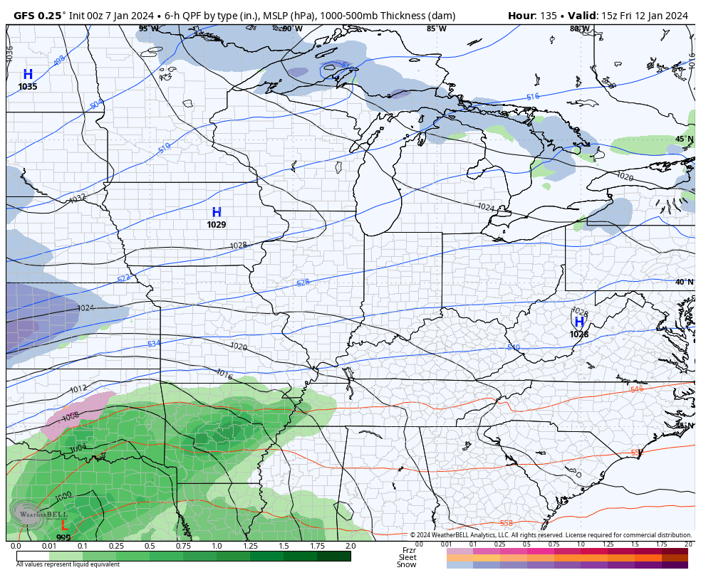
Other runs will likely show this going to our south, then back to the north, then back south… You get the idea.
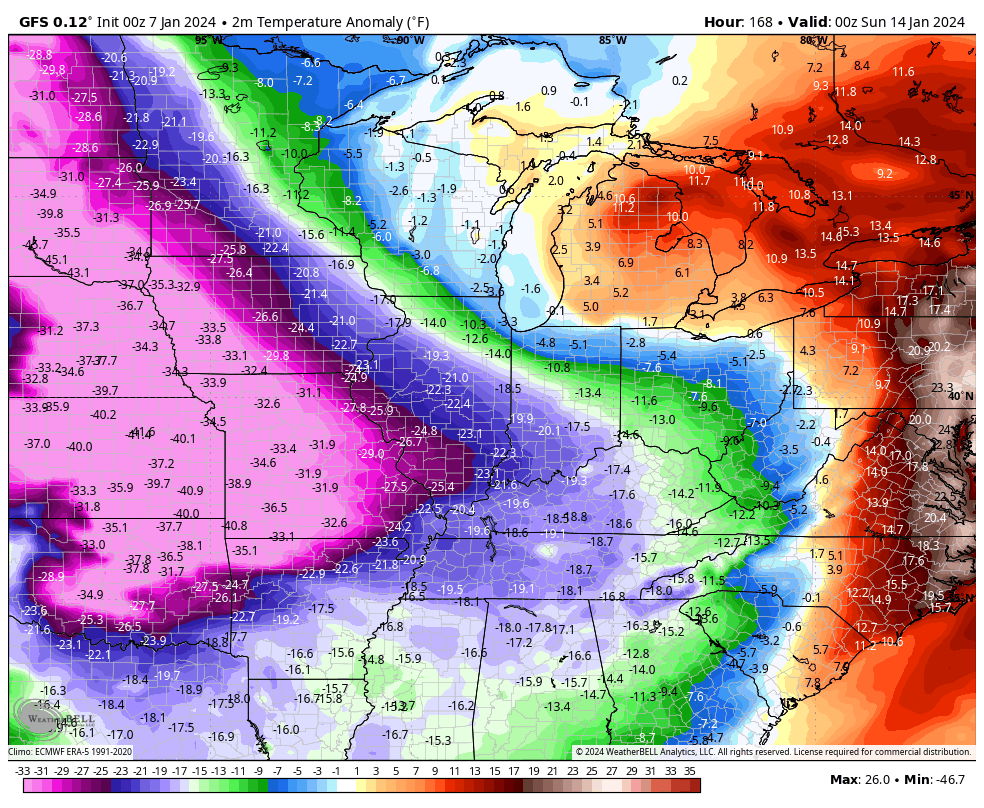
Bitterly cold air is pushing these systems farther south and the cold can get crazy for much of the country, eventually taking over around here. The GFS numbers are crazy below normal and I don’t think these are cold enough. This animation goes from January 13-22…
There’s a real chance of our temps going below in this type of setup. There’s also the real chance for a smackdown winter storm, too.
I’ll have updates later today. Have a good one and take care.

I hope I don’t lose my electric next week.
That’s a given in my area.
This.
Thanks for the update and the detailed breakdown Chris. No comment on the weather for next week until all the storm systems have past.
Have a Great Sunday !
Sure are a lot of these on the weather maps..Far as the cold temps hope there wrong..Nothing worse than cold and dry..
https://www.hollywoodreporter.com/wp-content/uploads/2015/09/break_away_still_-_h_2015.jpg
My local 10 day forecast for South Central Kentucky, which is based on the GFS, is showing the bottom falling by the 15th/16th of the month, with lows in the upper single digits. Worse is the fact that it’s indicating sleet and freezing rain as the polar air makes its move. Like I said, it’s based on the GFS, so the precip type will almost certainly change numerous times over the forecast period. But the cold looks like it’s the real deal, and temps could be underdone if the ground is snow covered as it makes its entry.
Buckle up!
Looks likes we’re the fringe of the main snow action, unless the the actual systems differ from the models. Will be interesting if CB sees any indication of this over the next day or so.
Wait and see instead of pontificating is my philosophy.
The fact that the GFS Model is taking the low pressure north of Chicago is giving forecasters here a very difficult time pinpointing which part of the Chicago Metro Area will receive the heaviest snow. Right now, the NW Suburbs are expected to receive around a foot of snow Monday night through Tuesday night, with the rest of the area receiving 3 to 6 inches, with rain possibly mixing with the snow. That could change though, especially if the Canadian Model is correct, which would give the entire Chicago Metro Area heavy snow with no rain involved.
Winter Storm Watches are currently in effect for Monday night through Tuesday night as close by as NW and Western IL, which will no doubt be extended eastward by tonight’s forecast.
Best looking snow mean on the gefs so far this winter 🙂