Good evening, folks. Our ugly rain and light snow maker came and went with very little fanfare, but the pattern is now getting ready to really crank. It’s a setup that will throw several big systems at us over the next few weeks with two for the week ahead.
Before we get to that, we continue to watch a light rain and light snow maker working through here tonight and Sunday. This shouldn’t cause any issues in terms of sticking snow, but I suppose there’s an outside chance for a coating in a few spots in the north.
The future radar from the Hi Res NAM shows the action moving through…
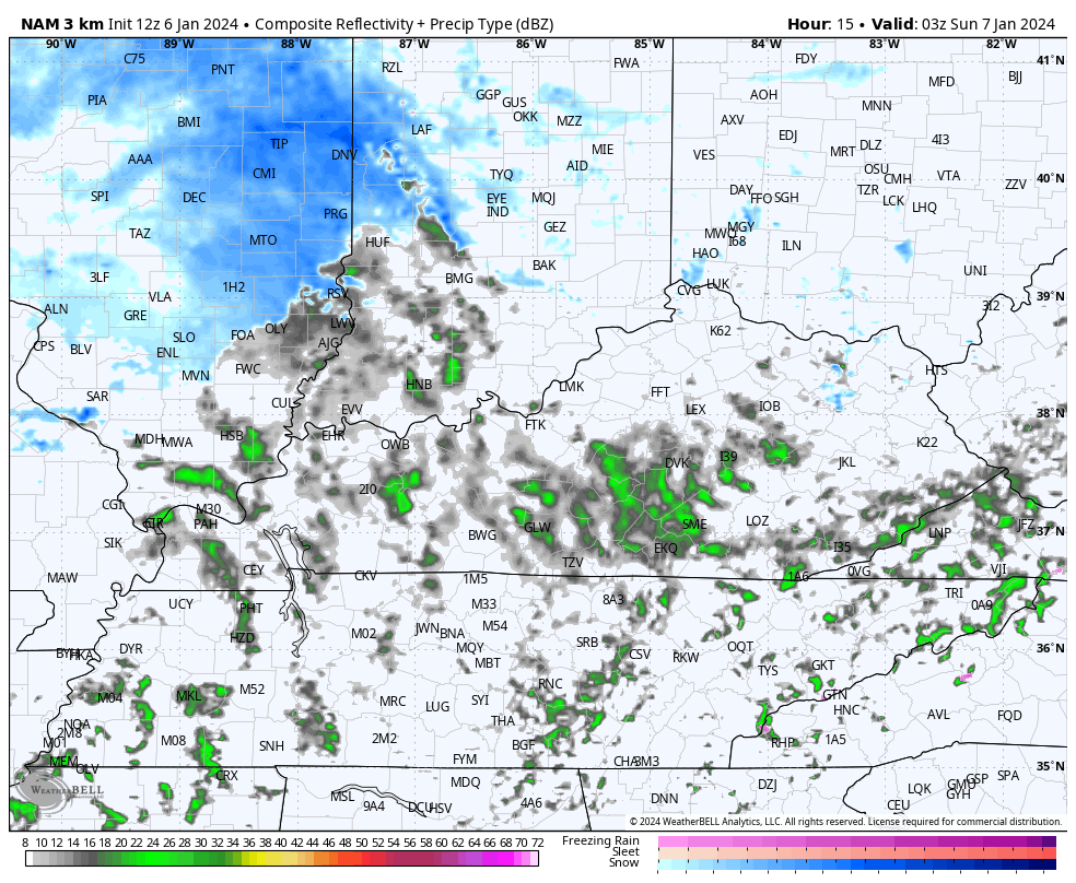
Here are your radars to keep you company on a cold and dreary Saturday evening…

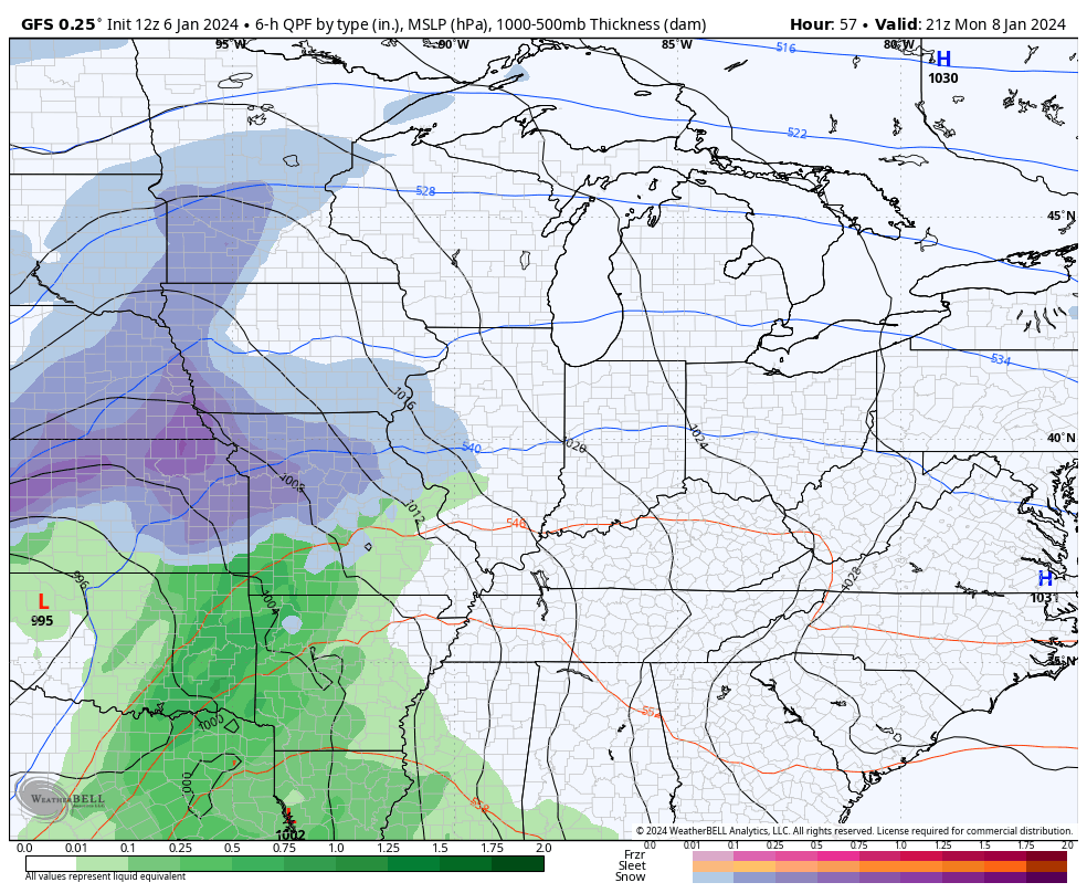
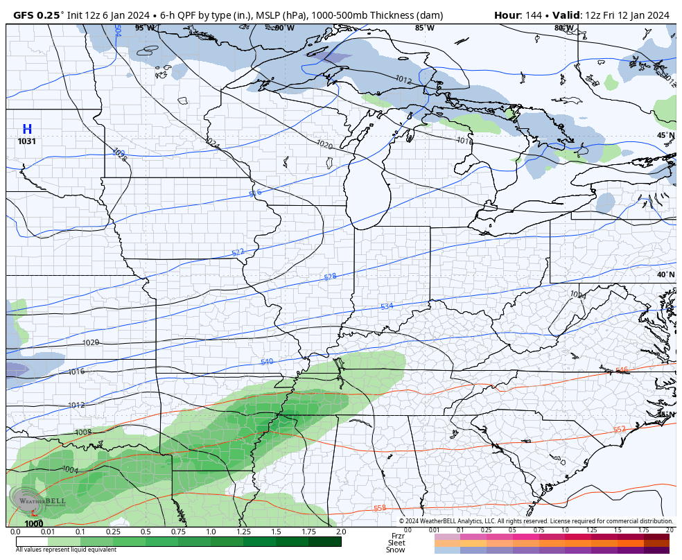
Our big storm system then targets our region late Monday through Wednesday. Here’s what to expect:
- Rain and a mix pushes in Monday night. There’s a chance for a quick-hitting snow in the north.
- Heavy rain and some thunder then take over on Tuesday. 1″-2″ of rain look likely.
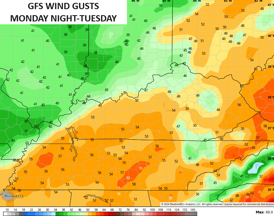
- High winds are a problem. Gusts of 50mph will possible Monday night through Tuesday.
- Cold air crashes in from west to east late Tuesday and Tuesday night.
- Snow develops in the west and moves across the state Tuesday evening into Wednesday. This still looks like a 1″-3″ snowfall for many with a snow day possible Wenesday.
Here’s the GFS seeing our system…
The winds with this may top 50mph…
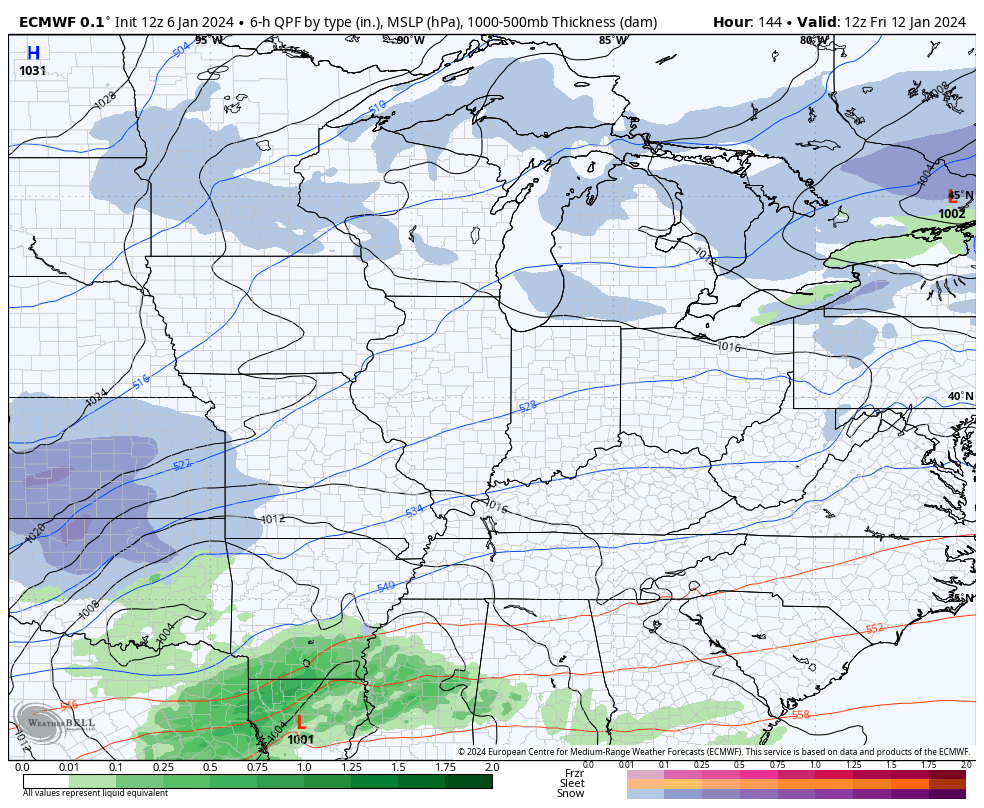
A cold front then moves through on Thursday with a quick hitting rain or snow shower. We want this front to push far to the south and have a good bit of cold air behind it because that would force the storm track just to our south. That’s important for the big storm system moving in here next Friday and Saturday.
The models are seeing this farther south track. Here’s the EURO that would make snow lovers happy…
The GFS is a bit north, but would make snow lovers happy with that and a storm coming right behind it…
Another reason the storm track is likely to focus farther south and east is the amount of arctic air coming into the western and central parts of the country late next week into next weekend. This brutally cold air gradually slides in here…
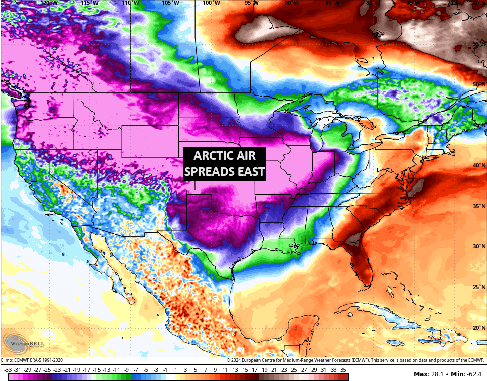
History shows that it’s common to get healthy winter storms on the leading edge of these kinds of arctic air outbreaks. If we can get this arctic air to stay JUST to our west, then it’s game on for snow season around here.
I like my team and I like my winter forecast. 😜😎
I may drop by later today so check back. Have a good one and take care.

Definitely looks like all the players are on the field.
Let’s see what the naysayers in here think! /s 🙂
All it takes is an event to change the trend. Big difference between just being negative and respecting the trends and model bias….. Now hoping CB does not put the word, “ice” in anything except his beverage.
Meh
Bring it on!! Break this mega snow drought