Good Monday, everybody. We have a monster storm system rumbling into the region tonight and Tuesday, bringing some big time wind and rain. Behind it comes the chance for snow as we watch another major storm system arriving by Friday.
Let’s break down the active setup for the next few days:
TONIGHT
- Low pressure lifts northward into the western Ohio Valley.
- Heavy rain overspreads the region.
- A wintry mix may be noted at the start in the north, but this doesn’t look like a big deal
- Winds become a MAJOR player. Gusts between 40mph and 50mph will be possible from south to north by morning.
TUESDAY
- High winds continue with gusts potentially hitting 50mph or a bit higher in some areas.
- Wind damage may show up, especially across central and eastern Kentucky where the core of the winds will be
- Heavy rain pushes through. Rainfall totals of 1″-2″ will be a good bet.
- I can’t rule out some rumbles of thunder as temps spike into the 50s for the eastern half of the state.
TUESDAY NIGHT
- The strong low passes to our north and northeast.
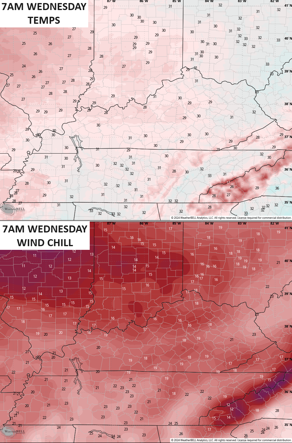
- Temps crash through the 30s from west to east and wind up in the upper 20s by morning.
- Periods of light snow quickly develop with light accumulations showing up.
- Winds are still cranking with 30mph-40mph gusts a safe bet.
- Wind chills will be in the middle teens as we hit morning.
WEDNESDAY
- Light snow favors central and eastern Kentucky early in the day.
- Light accumulations are likely during this time and we may have a snow day or two.
- Setups like this usually produce an inch or so of snow, depending on just how fast this moves through.
- Winds are still gusting to 30mph or a little better.
- Temps stay in the upper 20s and low 30s with much colder wind chills.
Here’s our system…
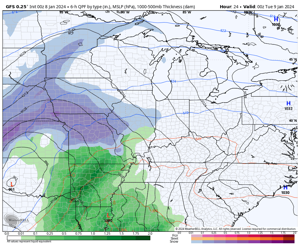
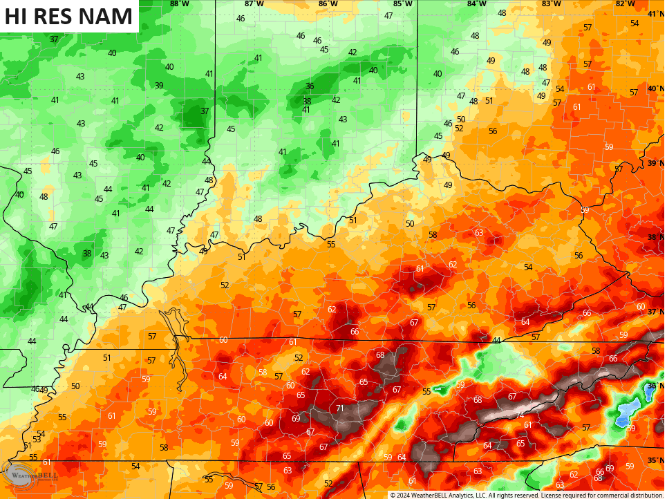
As mentioned, wind gusts of 50mph or greater will be possible late tonight and Tuesday. Some of the recent runs from the NAM and Hi Res NAM have been spiking gusts to better than 60mph…
For now, I’ll say those numbers are too high, but high wind events are becoming much more common around here over the past few years.
Can we get a snow day for some kiddos and teachers Wednesday? That’s certainly possible with periods of light snow likely impacting the morning commute as temps drop into the upper 20s with a wind chill in the mid teens…
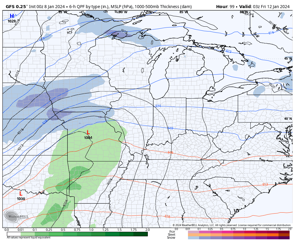
The next storm system arrives by Friday and will also be another monster system, but this one is likely to track farther south and east than the one over the next few days. The models are still going back and forth with the track of the low so you cannot take any one model run as the gospel.
Let’s think of the models as a snapshot in time of what they “think” the storm will look like this weekend. The current snapshot of the GFS is taking a deep low right on top of us with heavy rain and high winds to snow, bitter cold and high winds from Friday into Saturday…
The GFS is unlocking the first surge of arctic air behind this system. This animation shows the temps from 10pm Friday through 7pm Sunday…
Wind chills during the same time are brutal…
Again, that’s the current run and it’s all I have to analyze. Future runs will change until we get this first storm out of the way, but I suspect the GFS is too fast by a few days with the true arctic air this weekend.
The GFS then continues to take the next storm farther south with much more of a snow threat late Sunday and Monday…
The EURO has a similar look but a day later.
I think that system is the one that unlocks the true arctic air for our region and may very well send our temps below zero at some point next week.
This is a VERY harsh winter pattern ready to engulf much of the country and it’s going to be a headline maker and likely cause a lot of issues. The direct impact it has on Kentucky remains to be seen, but this week is a wild one with high winds, heavy rain and some snows. This weekend and next week could very well be much more of a wintry beast!
I will drop by for updates later today. Have a great Monday and take care.

Thanks for the update and the breakdown of what may happen Chris. In my local forecast there is a wind advisory for tonight and tomorrow with about 0.7 ” of rain. The weekend looks very interesting as there is a prediction of a eleven inches of snow predicted for Maple with Arctic Air invading. Quite a change from what we have presently. We shall see.
Have a great Monday !
Right Chris! What’s with the increased wind events over the years?
None of us know what this winter will bring… but I wouldn’t be surprised if it goes from boring to crazy….especially since we’ve had a mild winter so far…sometimes it can even wait until Feb to let us have it… Of course, sometimes nothing at all…
Truth. Looks like the models are A BIT more north with snow, even for the places that were showing to get the main action.
Kentucky appears to be the meat in a few system sandwiches, which means most bets off for what can happen. Wind and rain could be gnarly!
Good luck forecasting any frozen stuff with this wild set-up, CB!
Accumulated Snowfall the next 10 days GFS prediction :
https://weatherstreet.com/models/gfs-acc-snow-forecast.php
Wind gust predictions have been overrated for the past 2-3 years. I called POLAR VORTEX last week! I win.
Half our county lost power last year to “overrated wind gusts”.
Truth
You continue to lose, actually.
Dash just stop. CB has been calling for the Polar Vortex for a couple of weeks. In fact a lot of people have, not just you. You weren’t the first and you weren’t the only one, so please stop bringing this I was right and CB was wrong BS to the board. It’s very tiring.
Cumberland Valley Electric hasn’t trimmed right of way for about 10 years here, we have trees growing into the fiber and power lines. GFS has been showing the 3rd system consistently and the Euro finally jumped onboard. Hard to take any modeling serious, this far out.