Good afternoon, gang. Our big storm system is pushing closer and closer to us and is set to unleash high winds and heavy rain tonight and Tuesday with light snow and crashing temps to follow. This is pretty straightforward forecast from today through Wednesday.
I have no changes on the storm coming at us for the next few days. Here’s a quick breakdown:
- Rain moves in tonight and may start as a mix in the north.
- Heavy rain of 1″-2″ is likely through Tuesday.
- High winds are LIKELY. Gusts of 50mph or greater will take place tonight and Tuesday. Wind damage is possible.
- Cold air crashes in from the west Tuesday night and Wednesday.
- Wind chills will be in the teens.
- Periods of light accumulating snow is likely during this time with some snow days possible Wednesday.
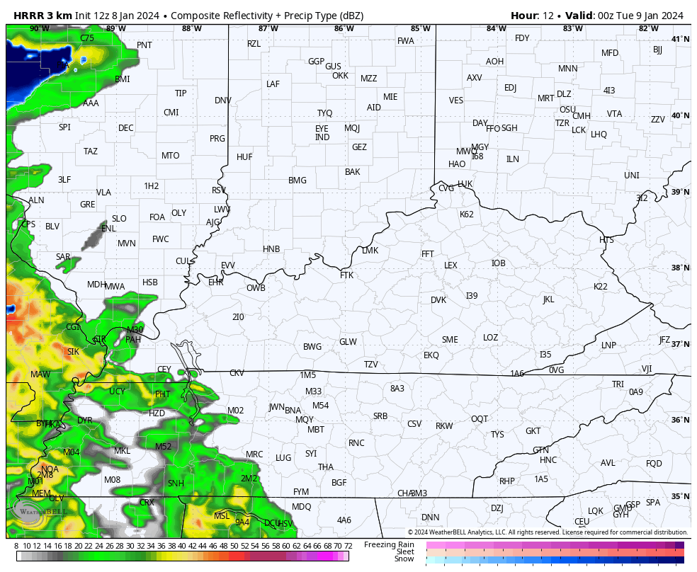
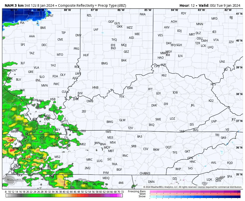
The future radar from the HRRR and NAM are very much alike in handling this system. From the heavy rain to transition to light snow Tuesday night into Wednesday morning.
HRRR
Hi Res NAM
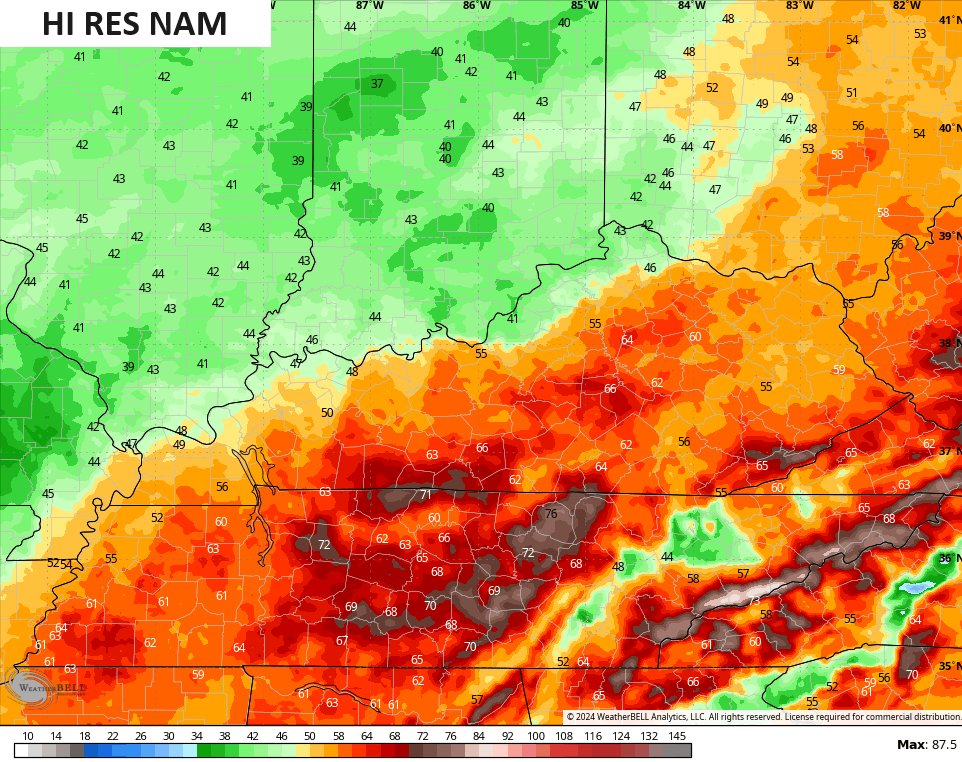
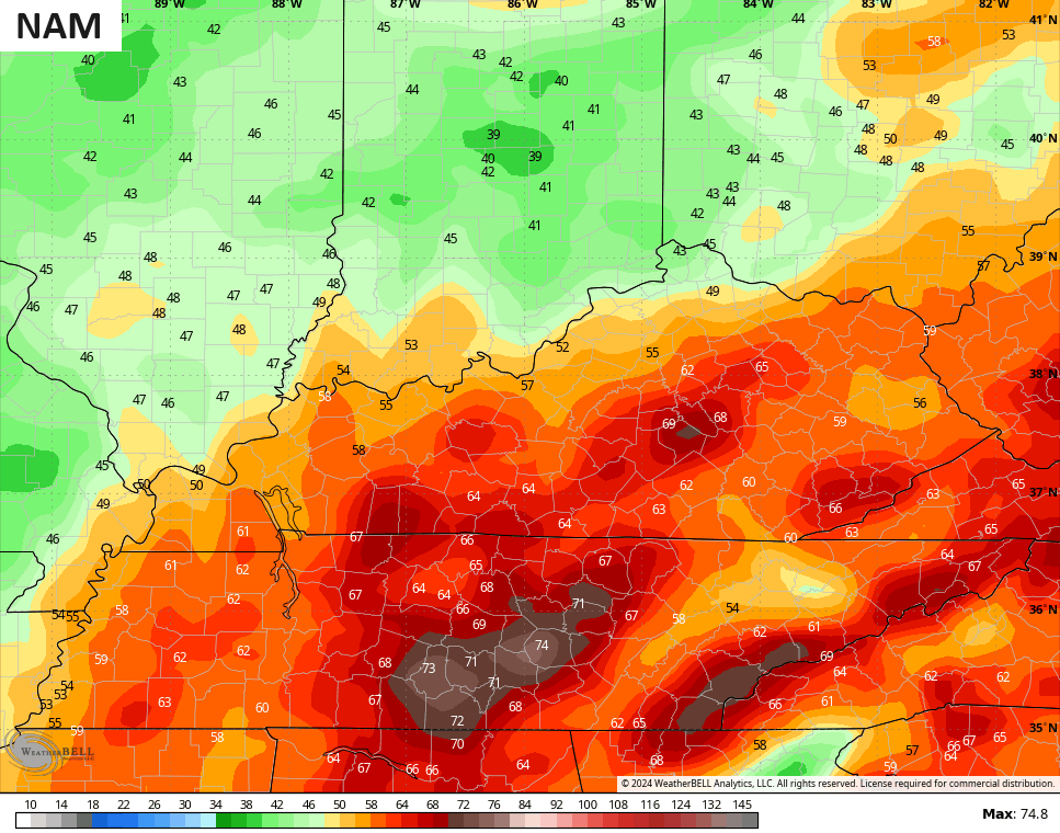
High winds on the NAM fam are an issue. If these verify with a wet ground, some trees are going to come down as the models have 60mph+ numbers for many…
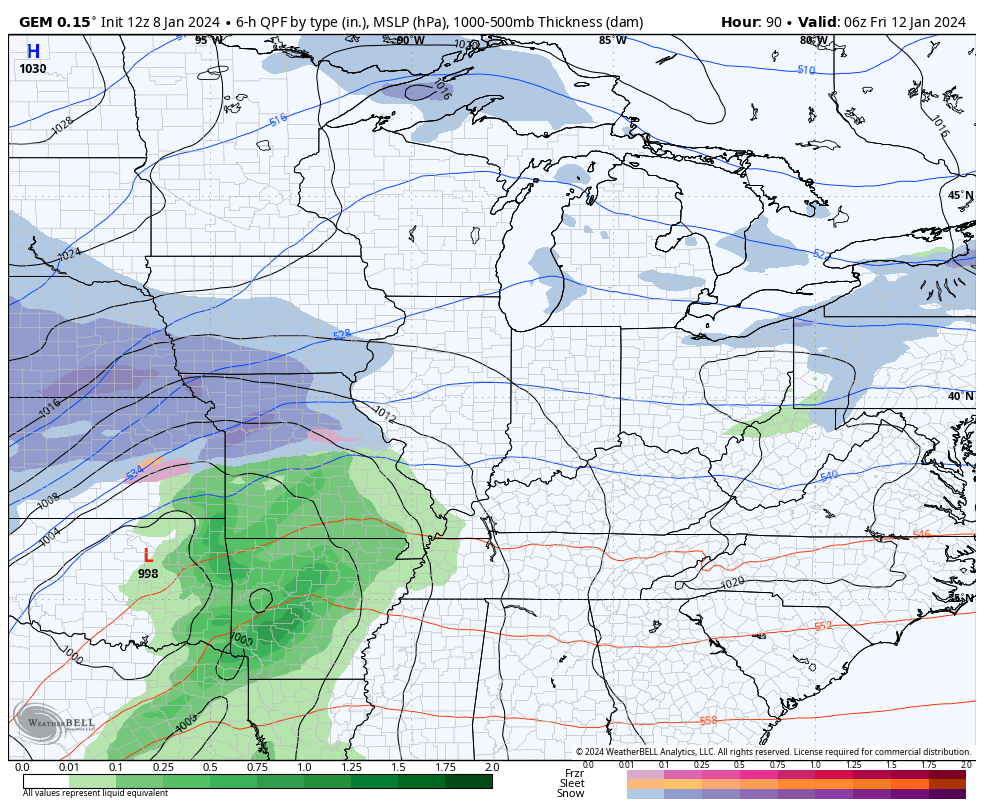
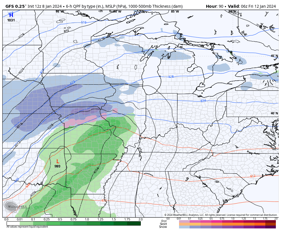
Our next storm rolls in here Friday with another round of high winds and heavy rain to snow as our storm tracks farther south and east. I still think we have room for the models to trend a bit more to the east with the track.
As is, we could be looking at another 50mph-60mph wind maker with 1″-2″ of rain before a quick freeze up with snow on top by Saturday.
Here’s the Canadian…
The GFS…
With a shot of arctic air coming in behind that system, it should force the next storm to take a farther south track. This is something the models have been indicating fairly regularly and it fits what the pattern should bring…
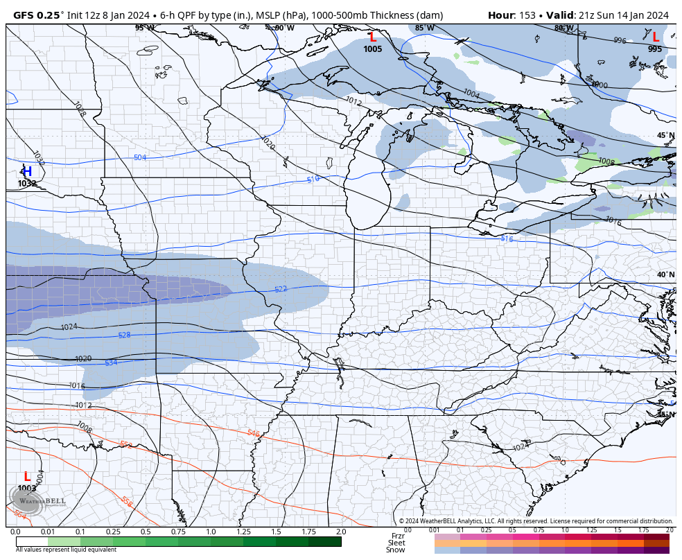
That would be something as bitterly cold air grips our region behind it. There’s an increasing chance for temps to reach zero or below next week.
I will have the very latest on WKYT-TV starting at 4pm and then again here on KWC this evening. I leave you with your Kentucky radars to track the system to our west and southwest. Dont forget to take our exclusive interactive radar for a spin and check out the snowstorm/blizzard in the plains. I bet a few of the live storm chaser cams will be up and running…

Make it a great rest of your Monday and take care.

Those wind events we had were not underrated… I even mentioned on this blog in the comments section to Chris a long time ago asking him what was up with all of these wind events….Non-thunderstorm wind events… I think there were a couple where KLEX hit 70(s) MPH and one 80 (I THINK?) and several 50’s and 60s MPH gusts… all different events.
True dat. I expect the wind to get gnarly.
That guy just likes to troll
Next Monday looks good.
A nice dry snow event.
Snow ratios could be high.
The only bummer could be if the Arctic air pushes the system further south.
Prepare for this website to crash all weekend long.
It will be hard to make up to date comments.
Snow in the forecast makes for total insanity.
Thanks, CB! Looking like the stars might align for snow fans, a few systems from now.
I have a big event Saturday, so please no snow until the Sunday/Monday system. Thanks
Looks like another major snowstorm is on tap for the Chicago Metro Area Friday through Saturday!
Heavy, wet snow is on the way here for tonight through Tuesday morning before mixing with rain.
You have to share Mike lol