Good evening, folks. Rounds of heavy rain continue to push across the region and this trend continues into the upcoming weekend. This is why we are still on guard for some high water issues.
Most areas of western and central Kentucky have already picked up 1″-2″ of rain with the focus shifting to central and eastern tonight and Thursday.
We catch a break on Friday before more heavy rain surges in Saturday and Saturday night.
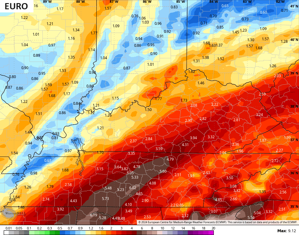
The forecast models are highlighting the southeast for the highest additional rainfall numbers. Numbers that could cause some high water issues.
The EURO has some 4″+ amounts…
The ICON is more bullish on a corridor of torrential rains…
![]()
![]()
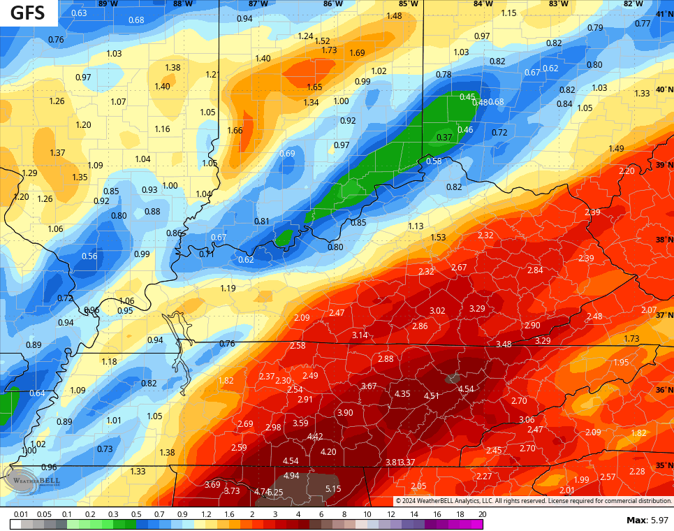
The GFS also likes the idea of a widespread heavy rain event in the east and southeast…
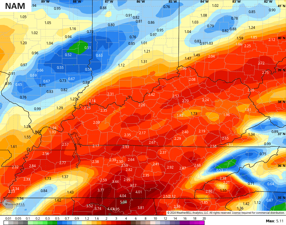
The NAM only goes into Saturday evening, but it’s not as concentrated in the southeast…
The chance is still there for us to end this with some rain and snow Sunday and Monday.
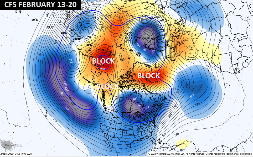
Winter is likely to fully crash back in as we get later into week one of February with the potential for another period of harsh winter by the middle of the month. The latest CFS continues to see the blocking in higher latitudes, leading to a cold and wintry look across the country…
I’ll get more into that with my post later tonight. Here are your radars to follow the heavy rains of this Wednesday evening…

Have a great day and take care.

There’s more evidence EURO’s 500mb height anomaly fcst for mid-February plays out, another shot of very cold air could make its appearance. Dr. Judah Cohen’s latest AO & PV Analysis/Forecast reinforces that thought, plus points to a possible stretched PV incursion.
Here’s the report:
https://www.aer.com/science-research/climate-weather/arctic-oscillation/