Good afternoon, everyone. A Winter Weather Advisory is out for much of the region through tonight as snow moves in from this west. This quick-hitting band of snow will put down accumulations for many with the southern third of the state struggling because of rain.
Here’s a look at the Winter Weather Advisory…
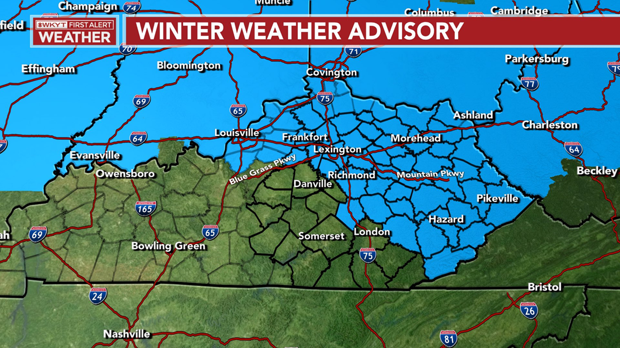
I would probably add another county or two to the southern edge of that from Garrard County to Owensboro.
Rain and snow develops from west to east by late afternoon with the best chance for accumulating snow coming this evening.
My snowfall map appears to be in pretty good shape right now…
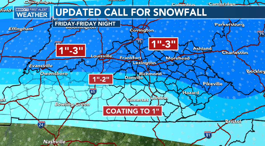
There is the chance for a local 3″-4″ stripe showing up in this band of 1″-3″ and the models are seeing this potential.
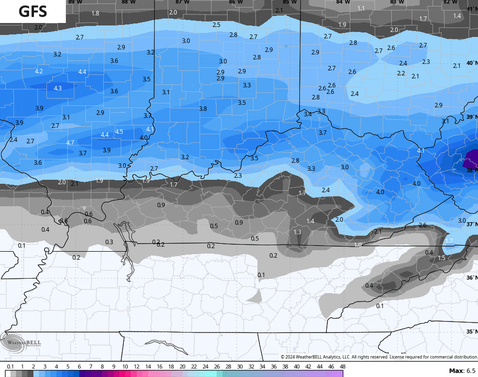
You can see some 4″ pockets on the GFS…
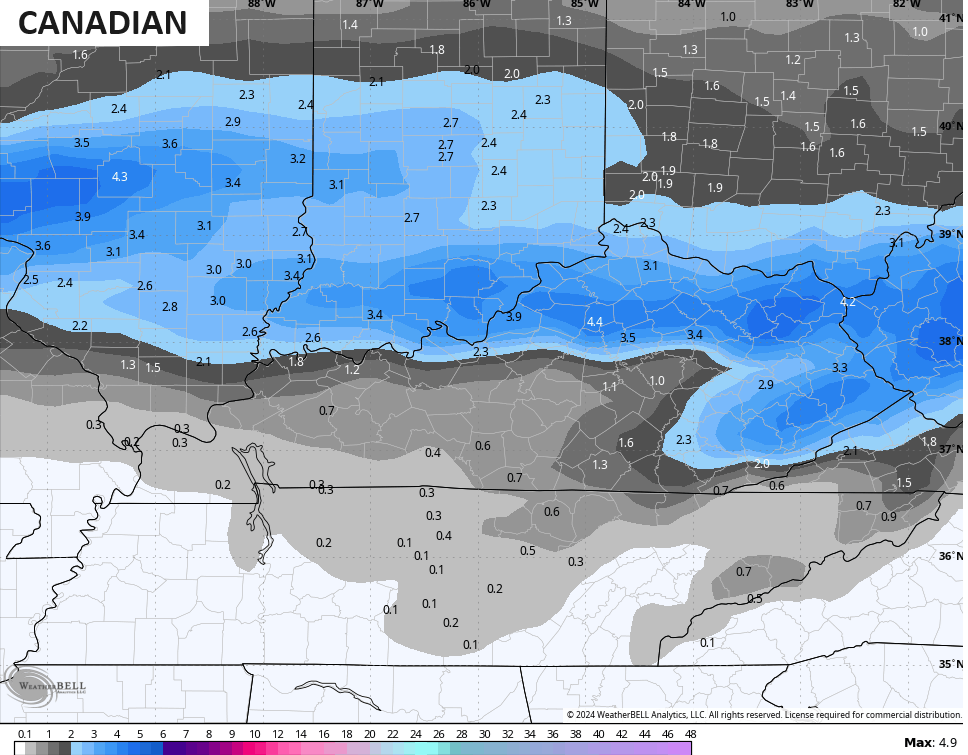
The Canadian has it…
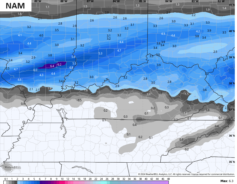
Even the NAM has come around to this idea…
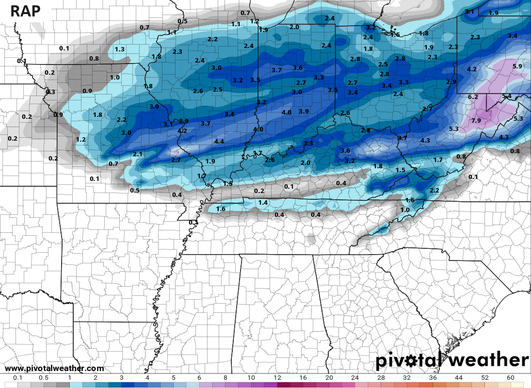
The RAP is also seeing it…
Roads will become slick later this evening, so keep that in mind if you’re travelling.
Wind chills will be frigid from tonight through early Sunday.
Temps bounce back into the first half of next week before another big blast of cold dives in late in the week into next weekend. This is another one to watch to see if the storm ahead of it trends farther south, bringing more of a winter weather threat with it.
I’m actually enjoying a long ago scheduled day off from WKYT-TV, but I’ll be checking in with updates here on KWC through the day so check back.
I leave you with your radars to track the rain and snow across the state…

Have a great afternoon and take care.

Thanks Chris. Not expecting any precipitation here in Maple at this time. Too close to the southeast ridge. Not looking forward to cold / frigid wind chills, and dry weather through the weekend. Very depressing !
Thanks Chris! Enjoy your day off!
Insane the differences between the 12z euro vs 12z GFS, less than 24 hours out.
What is the difference? May I ask.
The Chicago area is on the far northern boundary of the snow, which has produced only a dusting here this morning and afternoon. It is cold though (finally), with temps only in the upper 20s. Wind chills tonight and Saturday morning are predicted to be around zero.
Mike, we are on the southern end of this pasing short wave. Now 42 degrees with light rain. Not expecting any accumulating wet snow. I remember we use to get major snows 12 + inches this time of the year up in my home town in Indiana. It would shut every school and business down. It would melt some and then we would get another big snow. Not the way it works here in Kentucky.
I know Schroeder it is so frustrating it looks like I will get mostly rain because of the temperature I don’t know what it is about the temps here hard to get it cold enough.