Good Sunday, everyone. After a frigid start to the day, better weather moves in this afternoon and kicks off a milder stretch of weather. Temps look to surge ahead of another storm system and cold shot coming later in the week.
Temps today top out in the 40s after a frigid start in the teens with single digit wind chills.
Highs reach the upper 40s and low 50s on Presidents’ Day. The 50s show up on Tuesday with temps making a run at 60 or better on Wednesday as a strong southwest wind kicks in ahead of low pressure working through here on Thursday.
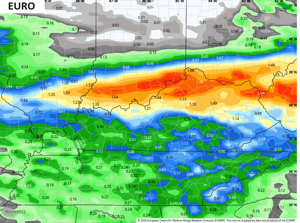
This brings rain and some thunder to much of the region and the models are spitting out some decent totals.
The EURO has an area of 1″-2″ rains…
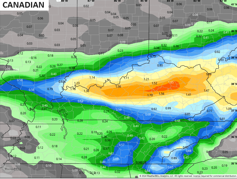
So does the Canadian…
And the Icon…
![]()
![]()
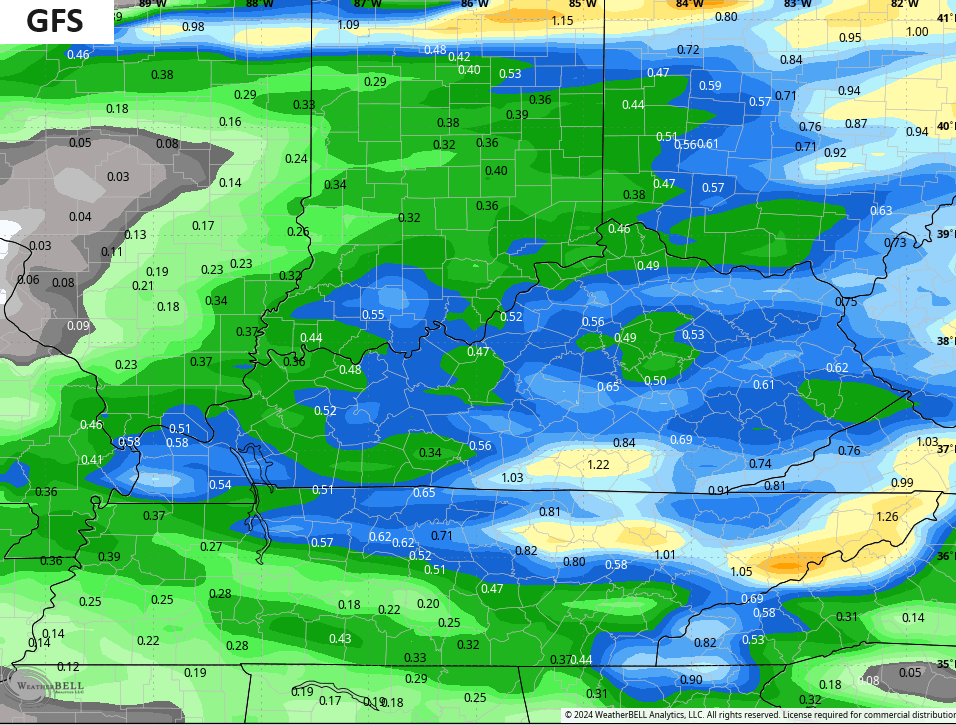
The GFS isn’t as robust…
Temps crash behind this for Friday into the weekend and there’s the chance for some winter weather right behind the departing low.
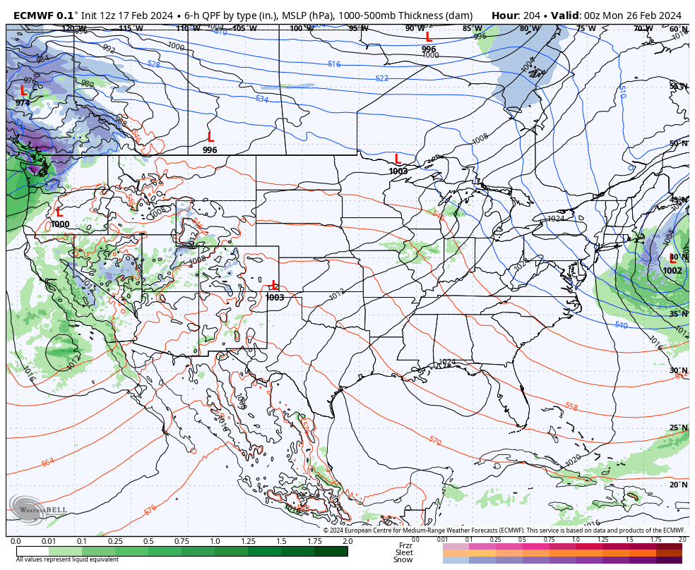
The pattern flips back to mild into the next week with a storm system likely emerging into the plains states. That one needs to be watched for strong storms as you can see at the tail end of the EURO…
This kicks off a period we need to keep a close eye on as it can send waves or low pressure working into the region as a trough goes into the west and a ridge pops along the east coast…
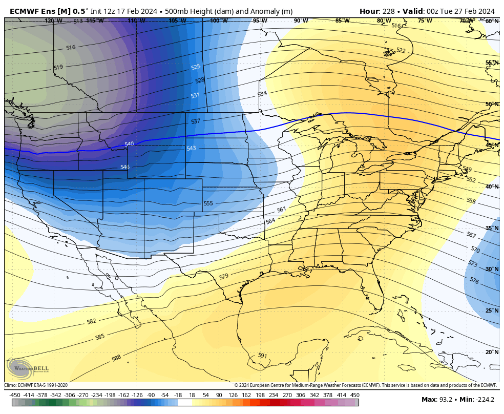
That’s the look of the EURO ENSEMBLES to end February and begin March. It’s a pattern that can cause some issues if it verifies.
I’ll see you guys later today for an update. Have a great Sunday and take care.

I’m not putting much stock into any forecast model especially over 10days.
Thanks for the update Chris. I’ll enjoy the Sunshine and mild temperatures the next several days. Spring will be early this year, I predict now along with the Groundhog. All the teleconnections indicate this, but will probably be interrupted by a plant damaging cold snap in April. Isn’t that the way it is most springs in our part of the country ?
On a more positive note, I enjoyed the weather cams yesterday of the snow scenes. Especially in the east and the more mountainous parts of the state.
Enjoy your Sunday.
With a little over a month of Winter remaining, and only 12 more days until the start of meteorological Spring, our local mid-range forecast for BG is predicting a run at the low 70’s by month’s end. I normally don’t put much faith in those forecasts, but I’m hopeful that this one holds its ground.
It looks like if We are going to have a good snow we better be doing it soon or springs here. Our time is going away. I know we can have snows in March and even April but they don’t stay around long. What determines the track of the lows??? I am always hearing depending on the track on snow I just wondered what determines the track of the low????
Honestly….I think it’s high pressure to the north and south of wherever the storm is that determines the track…. they can also slow a storm down sometimes too… I hope I got that right
Thank you
Mark, what your saying is the area between two highs. I agree.
The track of a well phased storm moves along a track of least resistance. Which would be the north or west rim of the high pressure ridge to the east or south.
Thanks Schroeder by the time we went from rain to snow I think Friday night it lasted an hour if that but the rain sure came down.
We had heavy rain and very little snow at the end that barely dusted the ground.
The positioning of the jetstream is an important factor in determining the path of a storm system, and is usually a more reliable indicator. However, the current split flow scenario makes it less dependable, possibly because the available energy is reduced when compared to a single stream.
Excellent information Joe. I keep learning something new from your post.