Good Tuesday, folks. It’s another day of pretty awesome weather across the state as this yo-yo pattern starts to kick into high gear. In terms of temps, there’s really no in between over the next few weeks as the numbers are either way up or way down.
This back and forth of a pattern also turns very active.
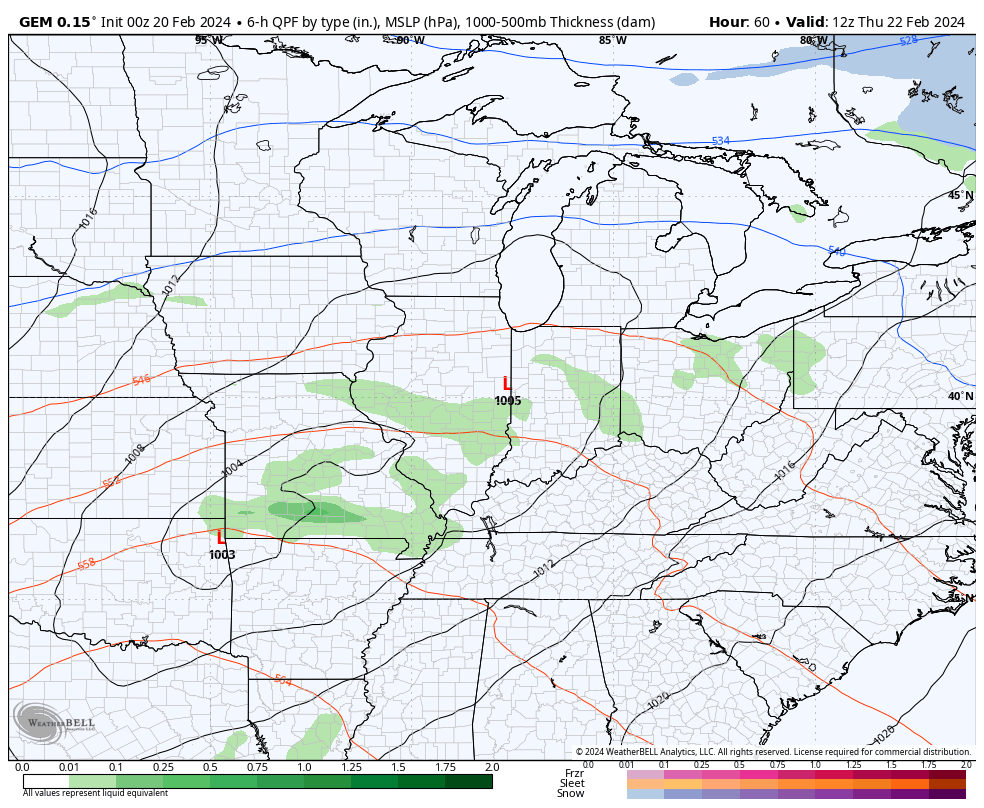
Let’s begin with today and go forward. Highs today are into the 50s with partly sunny skies. The west should tickle 60 and that’s a sign of what’s ahead for the entire region on Wednesday. Highs surge into the 60s during this time with a stout southwest wind. That southwest wind reaches 30mph-35mph at times ahead of low pressure arriving Thursday.
This brings showers and a few thunderstorms rolling from west to east across the state. Chillier winds blow on Friday with another system dropping in here or close to the region from the northwest on Saturday. That has the chance to bring a shower of rain and snow to parts of Kentucky with colder temps crashing in…
That cold does not last long and gets wiped out by mild temps early next week. Temps Monday and Tuesday likely reach deep into the 60s and may even make a run at 70 degrees as a southwest flow kicks in.
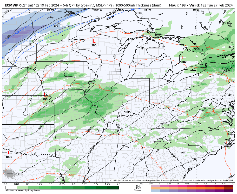
This windy and mild setup is ahead of what’s likely to be a a potent system racing from the plains into the Great Lakes by Wednesday of next week. That’s being pushed by another blast of cold and, possibly, some winter weather. The EURO shows this potential very well…
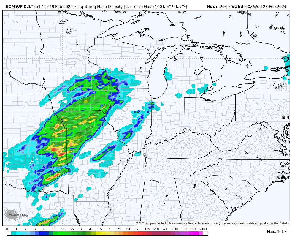
Can we get some big boomers ahead of that system? That’s a possibility and the EURO is showing quite a bit of lightning potential…
With these massive temp swings likely to continue through March, we can get ourselves into some trouble. From severe weather and flooding to quick hitting snow systems, we have to be on guard with such an exteme look.
Another update comes your way later today. Make it a good one and take care.

It looks to happen just as you said it would.
Thanks for the update Chris. Have a great day everyone !
I read 36 degrees here at my home, but the Kentucky Mesonet reads 24 degrees. Quite a difference in range of temperatures.
As I’m typing this God has giving us a beautiful Sunrise to enjoy. Hoping today turns out Sunny and milder with those deep blue skies like we had yesterday.
Winter temperature ranks from normal since 1893.
Not only is this a top 5 to warmest ever just from a temp standpoint in the midwest, Great Lakes and NE its also the lowest heating demand winter on record to date.
But hey keep buying into the tweets of “winters coming”
Meanwhile I would rather talk about a pattern that will favor an uptick in severe weather & possible tornadoes in my Spring posts.
What I won’t buy into is bad and asinine contrarian takes.
Let’s be kind Jeff.
Dash, your first paragraph is interesting. How many of these warm winter’s do we have to have before we receive a real cold and snowy one. Is the question. I’m wishing for a calm spring and summer with regular, normal rainfall. Winter weather may return, but it will not be that extreme. I hope.
If I wasn’t so lazy I would go back and paste incorrect prognosis about upcoming weather and that includes me.
There was a famous play writer in Hollywood years back that made this statement “everybody knows nothing about anything.” LOL
That statement is true.