Good evening, folks. Rain and thunderstorms are rolling across the state ad kicking off a very active setup. This setup brings a battle between spring and winter over the next week or two and that can get us into some trouble.
The storms in western Kentucky early this evening have been putting down large hail. For the rest of region, it’s mainly heavy rain and some thunder to take us through the evening. Here are your radars…

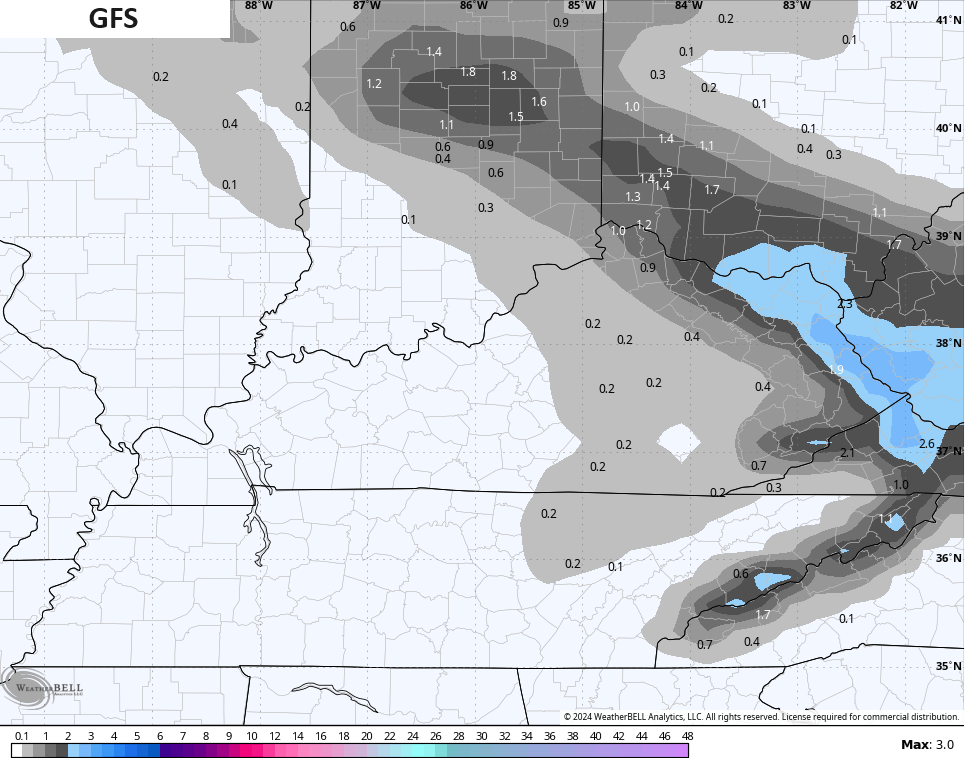
Better weather comes in on Friday with highs in the 50s and a mix of sun and clouds. This is ahead of a clipper dropping in Friday night and early Saturday, bringing a band of rain and snow with it.
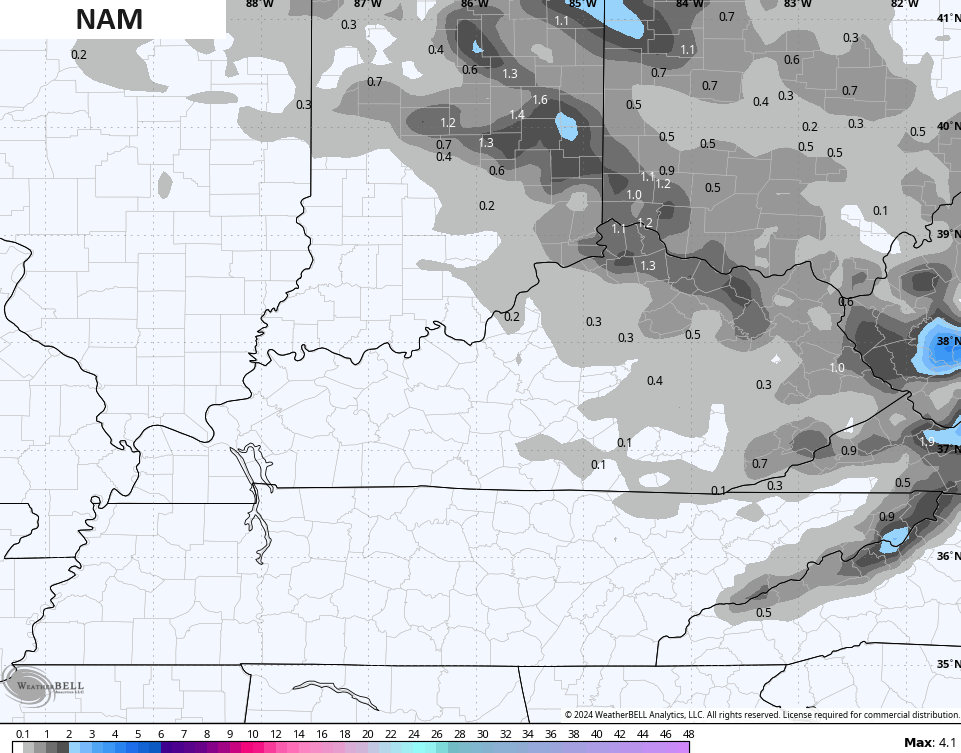
Here’s the future radar from the Hi Res NAM…
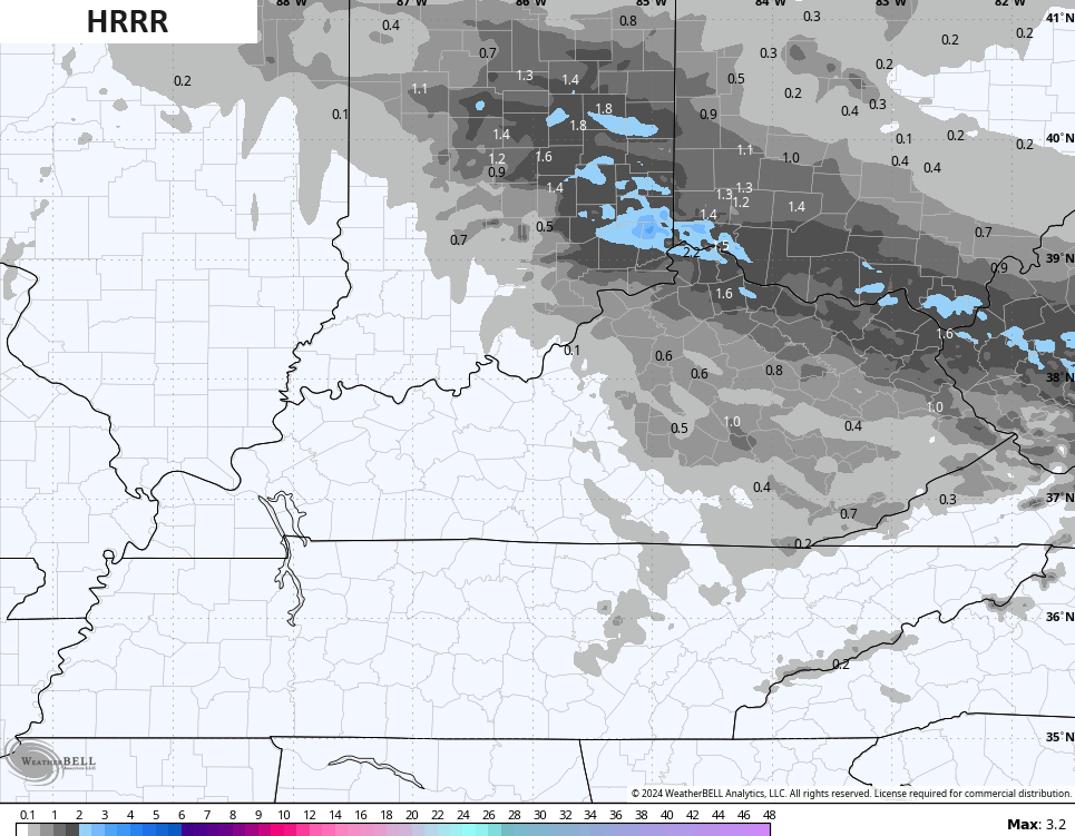
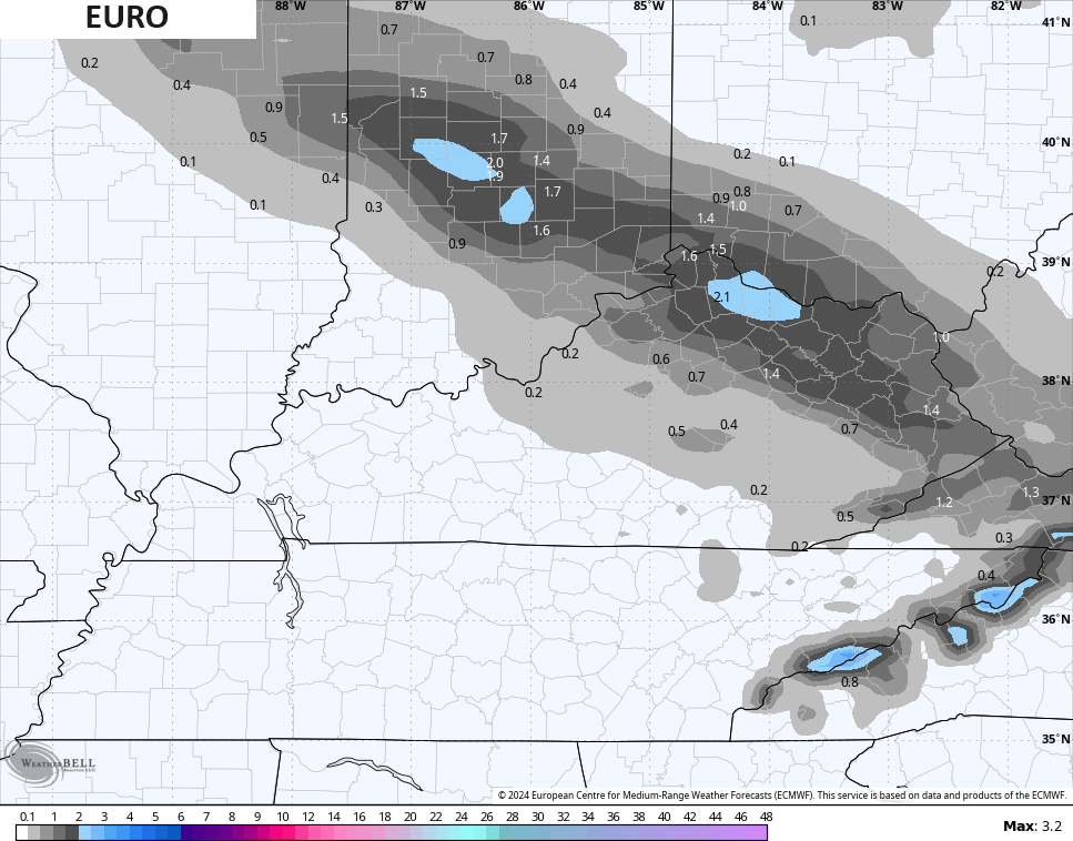
Some light slushy accumulations will be possible with the greatest chance in the north and east. Here’s a look at what the models are thinking…
Sunday has temps bouncing back very quickly with another surge of spring into early next week. Highs reach the 60s on a strong southwest flow ahead of a potent storm system that moves in by Wednesday. This may spawn strong to severe storms in our region.
The Storm Prediction Center is highlighting areas to our west for a severe threat on Tuesday…

That threat then focuses east across most of Kentucky for Wednesday…

That’s something to watch, certainly.
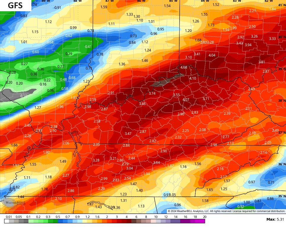
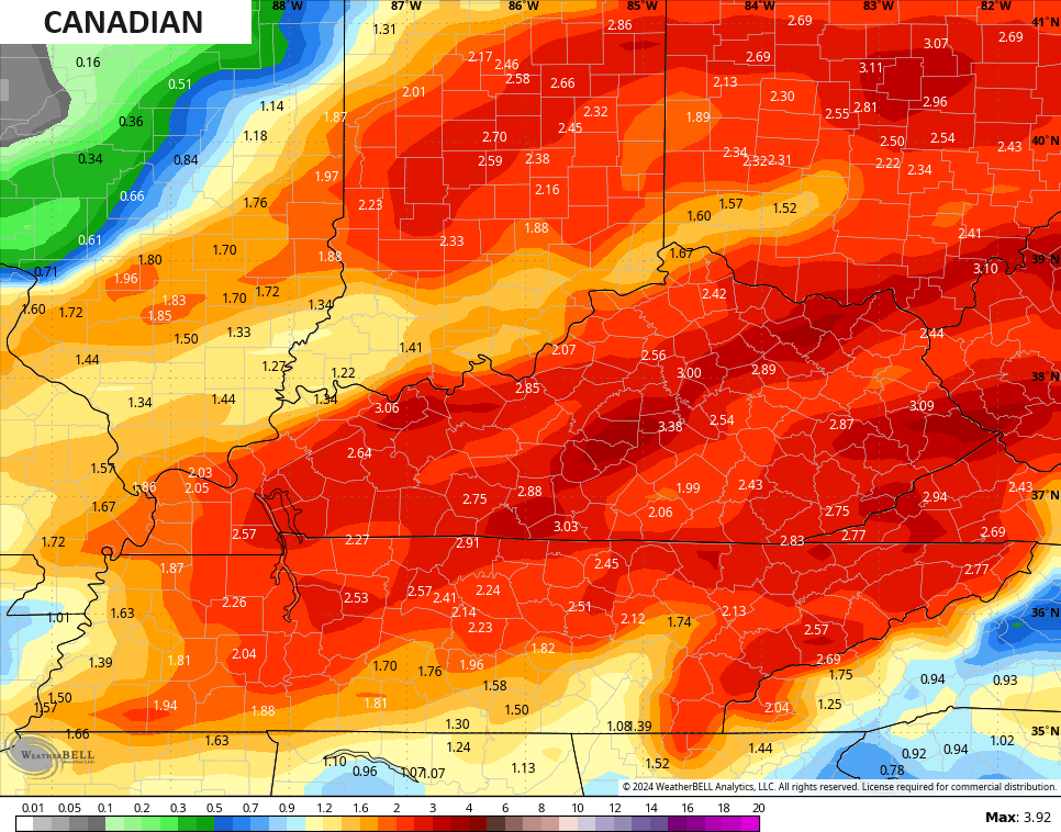
The setup can also put down a lot of rain…
The chance for some winter weather follows that by Thursday as temps tank for a day.
Enjoy the evening and take care.

With all the rain, we could have a lush rain forest summer. Then a drought going into fall again?