Good Friday, folks. March is here, so let the weather madness begin! This is a month that features some of the craziest weather of the entire year as we can get extremes from all sides of the weather spectrum. Thankfully, we only have some chilly showers to track here on day one.
These showers are coming from southwest to northeast as low pressure passes well to our south. The greatest threat for rain is across central and eastern Kentucky through tonight and there’s the chance for some areas of the east to see 1″ of rain.
Here are your radars to follow today’s showers across the region…

Temps out there today stay in the 40s for many.
Saturday is a slow starter of a day with lingering clouds and a shower or two in the east. Sunshine slowly takes over from southwest to northeast into the afternoon with temps reaching the 50s.
Sunday looks grand with highs deep into the 60s with the chance for a 70 in the west. This sets the stage for temps to reach 70-75 on Monday.
This warm surge is ahead of what looks like a very active pattern from Tuesday all the way through the following weekend. Waves of low pressure should roll across our region with the last wave having the potential to bring some winter weather behind it.
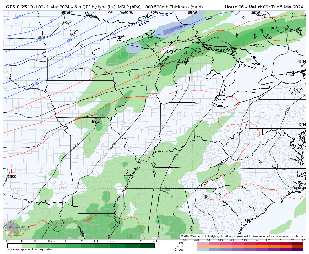
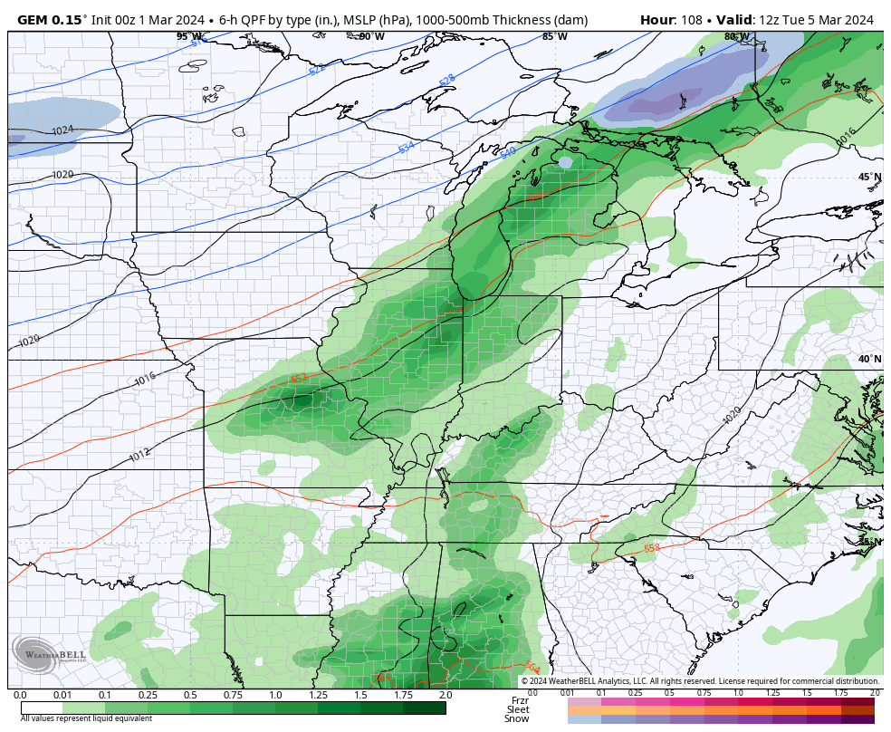
This look can bring a lot of rain to our region…
GFS
CANADIAN
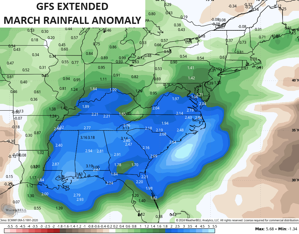
This is likely to be a very active March with above normal precipitation…
As I mentioned, March brings some wild extremes and I’m wondering if a late season snow or two will be part of all this. #TeamSpring hopes not.
Another update comes your way later today. Make it a fantastic Friday and take care.

I predict one or two more snows.
Probably on the Ides.
Thanks Chris. I don’t where I heard this, but everytime March comes around this weather poem comes to mine. ” In the month of March when thunder roars through the hollow snow will soon follow. ” I’ve seen this play out many times in my life.
Have a great day everyone !
I hope it follows another time or two then I will move to #team spring#
Heard that theme several times too Schroder!