Good evening, gang. March is off and running with a serious case of the uglies. Showers look to continue into the early part of Saturday before another case of spring fever shows up. That kicks off a very active pattern that may very well take us into a bit of a winter stretch eventually. Ugh.
As mentioned, showers continue across the region with low clouds and fog adding to our misery. Here are your radars to follow along…

Morning showers linger in the east on Saturday with a slowly clearing sky working in from the west and southwest during the afternoon and evening. This sets the stage for a really mild and windy Sunday with temps in the mid and upper 60s. Highs by Monday may reach the low and middle 70s on this gusty southwest wind.
All of this is ahead of a pattern that gets ready to change. The change looks to feature deeper troughs rolling from west to east across the country starting later next week into next weekend…
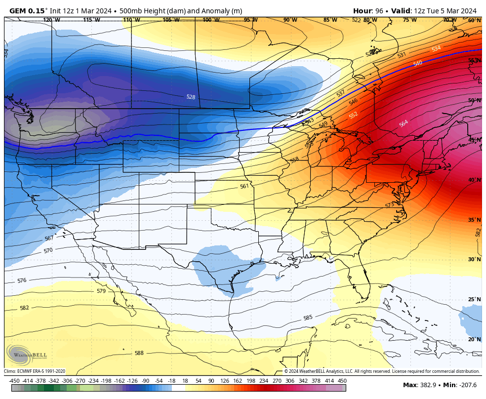
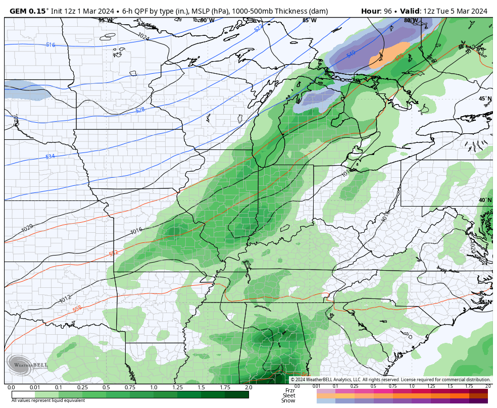
That setup gives us rounds of rain and some thunderstorms initially with the chance for some winter weather to start showing up as early as next weekend. The Canadian is most aggressive on this…
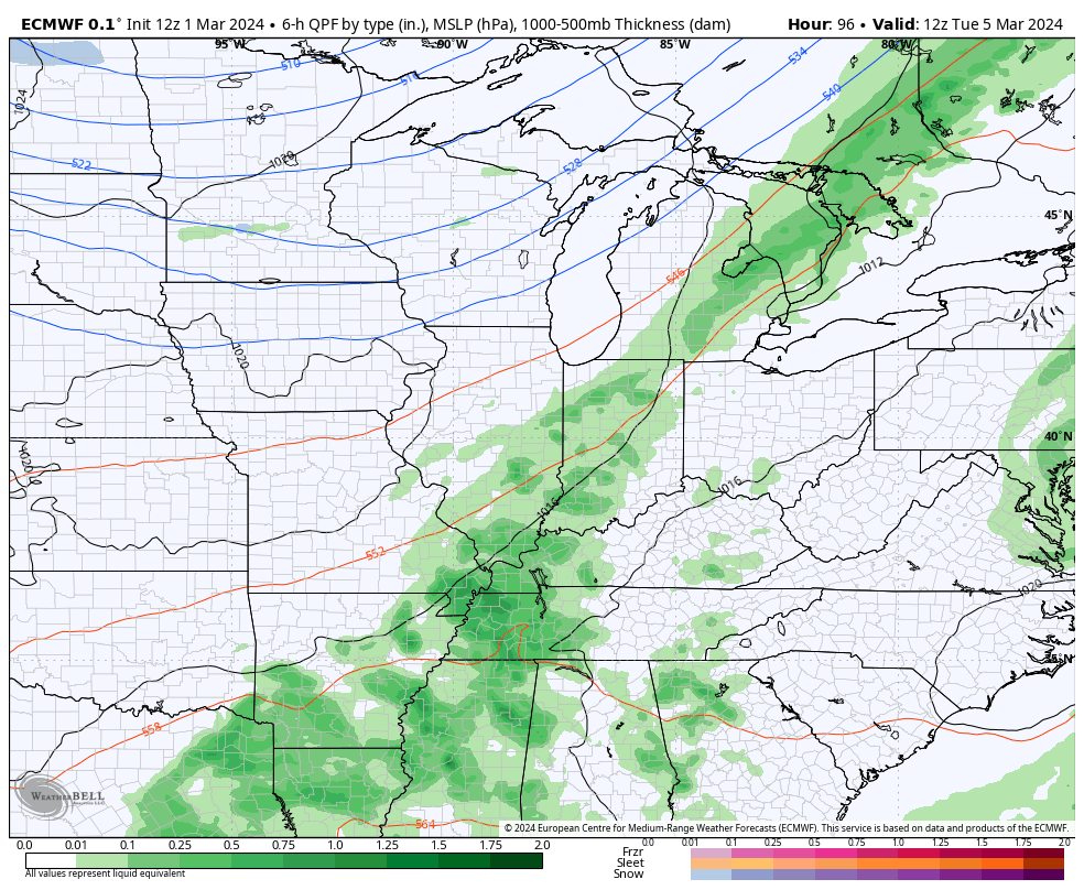
The EURO has a similar look…
Maybe that winter pattern shows up fashionably late? Double ugh.
Enjoy the rest of your day and take care.
