Good Saturday, everyone. It’s full steam ahead toward another big surge of springtime temps, but an active pattern tries to wipe that out by the middle and end of the week ahead. That same pattern has the chance to produce a little winter weather before all is said and done.
Let us begin with our Saturday before hitting the fast-forward button. Temps out there today should hit the 50s but it might be a struggle for some areas as clouds are going to be awfully stubborn. Those clouds may continue to spit out a few showers or some drizzle early today, especially in the east.
Here are your Saturday radars to follow along…

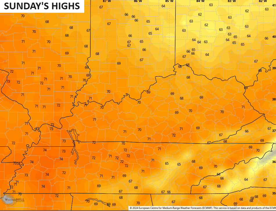
Sunday is a much better day with partly sunny skies teaming up with a strong southwest flow to spike temps deep into the 60s. The EURO is throwing a 70 into parts of the state…
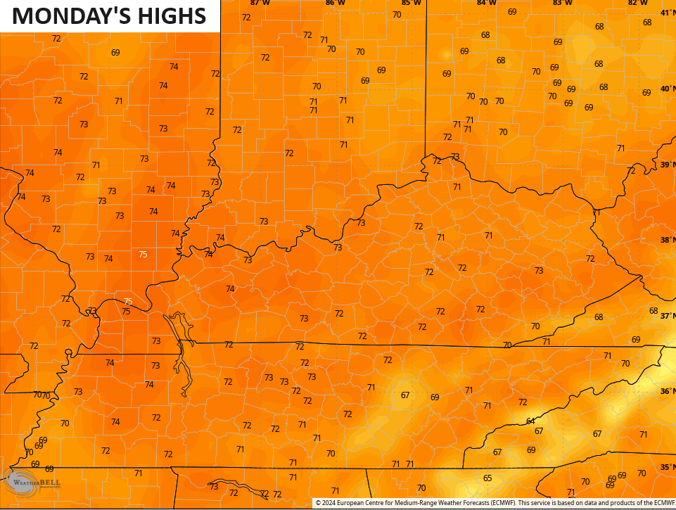
The 70s then surge in here on Monday…
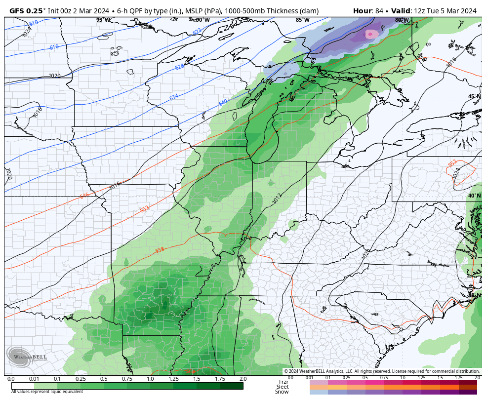
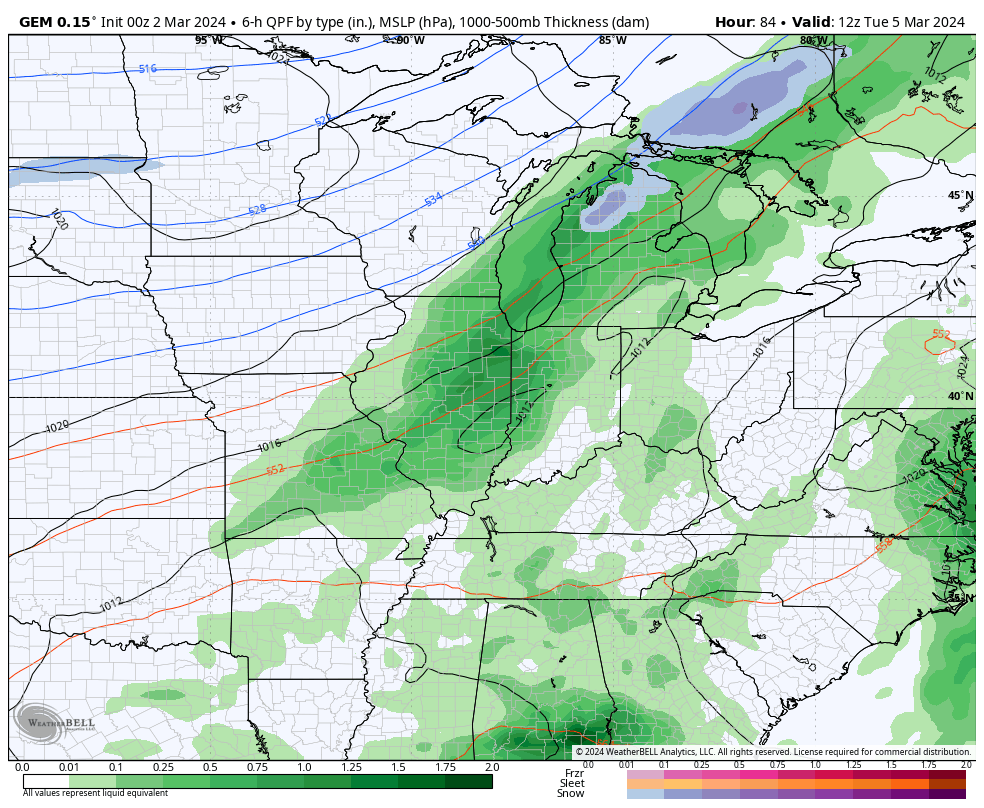
A cold front moves into the region on Tuesday and this looks to slow down, allowing for low pressure to develop along it, moving across our region on Wednesday. This means rounds of showers and thunderstorms become common during this time. This will be followed up by another storm system arriving later into the week and weekend. This brings more rain and storms ahead of it, and the potential for some winter trying to dive in behind it.
Here’s the GFS through this time period…
And the Canadian…
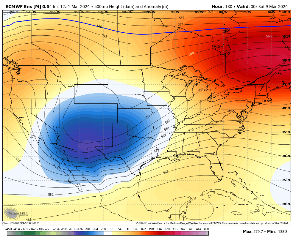
The various ensembles are also showing the overall pattern evolution looking more like one they suggested we would get back in February. Watch how the EURO Ensembles send troughs across the country with them deepening along the way…
I am not a fan of the pattern evolution.
Another update comes your way later today, so check back. Make it a sensational Saturday and take care.

Seems like the Ensembles could benefit from a trip to the shop, for an alignment check. While they’re at it, they should examine the bearings, since in nrecent weeks, the Ensembles have had little bearing on our weather.
On the home front, our lilac and maple tree buds have begun to pop, so we need to be in serious #TeamSpring mode!
You know what would be funny or ironic.
If we had a snowstorm on solar eclipse day. (April 8th)
I sure hope it’s not cloudy on the eclipse day, as this will be the last solar eclipse in the US until 2045. I can hardly wait ! LOL……
Schroeder are you in the path of total eclipse??? Wow not till 2045 for the next eclipse is that any or just total?? Maybe I should go to Indiana to see my sis and the eclipse if she’s in total. She is in he Bargersville/Greenwood area.
All of central and south central Indiana for best eclipse viewing. I don’t know the exact path of total eclipse though. In 2045 I think it means the total.
The trees and shrubs around my area are still stone dormant, but every spring there’s always a late freeze in April. I’m hoping for frequent cool downs through April that would keep every plant in check until freeze and frost are over.
It would sure put a crimp in observing opportunities! I read an article the other day that talked about how trained observers had documented that weather activity seemed to tail off as you approach totality, especially convective activity.
I remember back April 8th, 1971 there was 8″ of snow that fell at Dress Regional Airport in Evansville, Indiana.
I always have this strange feeling when we have a solar eclipse. I’ve witnessed 4 solar eclipse in my lifetime and all occurred under clear skies. It is strange to see birds fly into the woods to roost in middle of the day, and the last solar eclipse I could see the stars.
We really needs some interesting weather ( surprise March or April snowstorm ) to talk about, but the weather looks boring in our area next week. One thing that’s good is there’s no severe weather in the forecast.
On the West Coast ( California ) the Sierra Nevada Mountains are expecting 100 ” of snow this weekend. Not fair Mother Nature. The hundred million dollar question is why do we continue to get Gypped out of snows here in Kentucky ?
Here is a link to an article hope it post. Warmest on record is that true? Wonder what the winter of 2024/2025 holds? Any predictions???
https://www.usatoday.com/story/news/weather/2024/03/02/warmest-winter-on-record-early-data-says/72764565007/
Interesting article Crystal. Yes, the article is correct on the warmest winter. The winter of 2024 – 25 will most likely feature La Nina. Typically, La Nina’s produce less chances of snows in our area of the country, unless we have the polar / arctic air move farther south and the teleconnections ( AO, NAO and the EPO ) are negative for the entire winter. Thanks for sharing.