Good evening, folks. We are about to get hit by another surge of springtime temperatures in the coming days before things turn active once again. This active pattern brings strong storms, heavy rain and even unleashes a bit of winter.
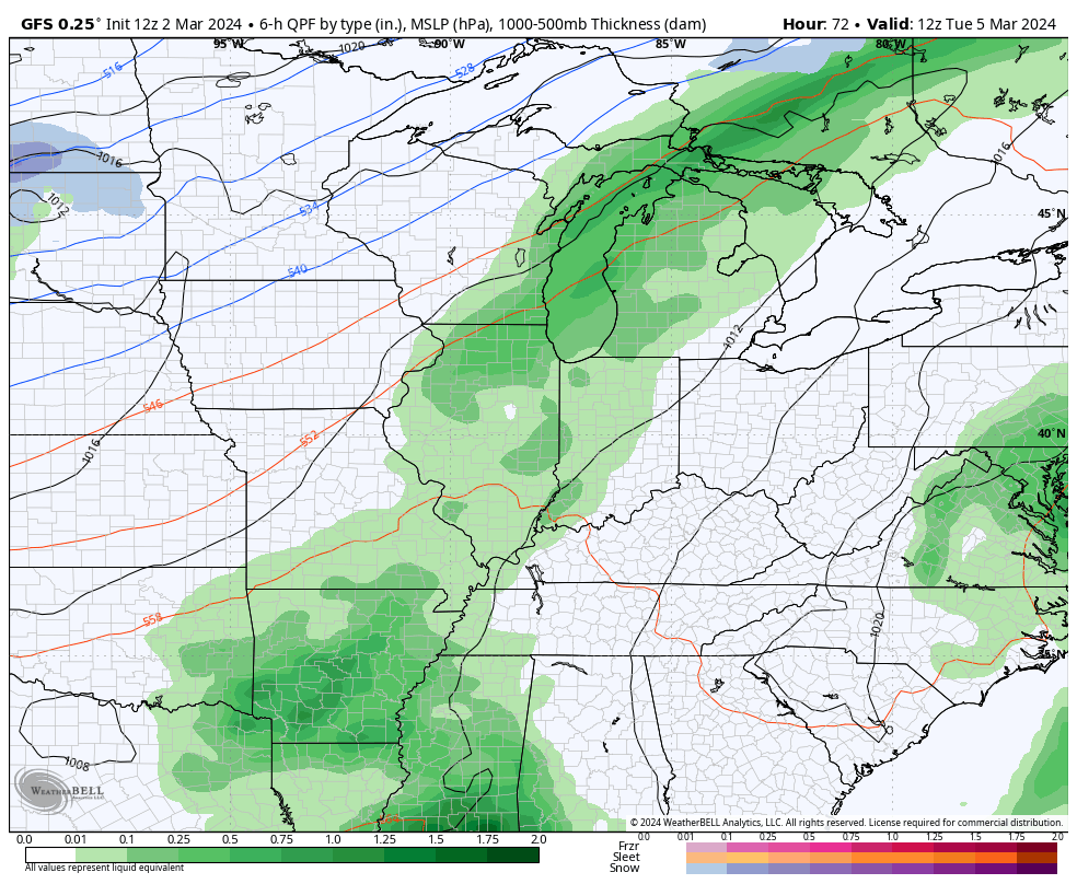
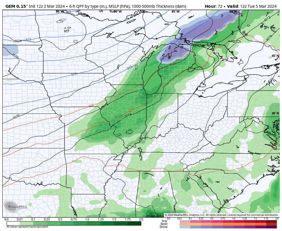
A cold front moves in for Tuesday with showers and storms increasing. This slows down and lets low pressure develop and roll along it, bringing more showers and storms across the state. After a bit of a break on Thursday, more rain and storms roll in for Friday and Saturday as a strong low pressure moves through here. Cold air comes in behind this with the chance for some winter weather next weekend.
Here’s the GFS showing everything we just talked about…
The Canadian is on board with this too…
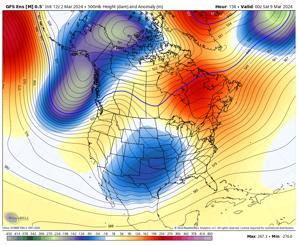
From the “better late than never” category, the models are settling on a return of a winter looking pattern starting next weekend and going through, at least, the middle of March. Watch these troughs take control…
#TeamSpring ain’t happy.
Enjoy your evening and take care.

I still feel like Ole man winter is going to give us a surprise snowstorm.
I hope so winterlover