Good Tuesday, everyone. It’s another early summer feeling day across the Commonwealth as that strong southwest wind does some more work. This is ahead of a potent Plains storm system that will produce a few strong to severe storms across our region through Wednesday.
Temps today are back into the 80-85 degree range with winds gusting 20-30mph at times.
There’s the chance for a couple of thunderstorms going up, but much of the day is on the dry side.
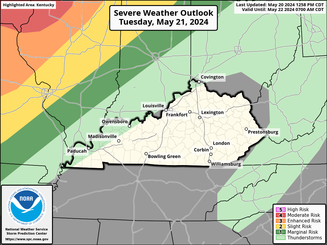
Severe storms are likely to our west today and some of those will roll to the east later tonight and could be strong or locally severe. The Storm Prediction Center continues with the low-end risk for parts of the state through the evening…

That line moves through early Wednesday with some sunshine and 70s following that up. That may spawn a renewed round of strong to severe storms during the afternoon and evening. The Storm Prediction Center has a Marginal Risk to Slight Risk across the area…
Thursday’s weather looks really good with temps in the 70s with a mix of sun and clouds. This is ahead of another thunderstorm maker arriving for Friday. That front moves in and slows down and we have to be on guard for this to feature a few waves of showers and storms with it into the weekend…
Temps for the weekend and early next week come way down and may give us a frost threat by Sunday or Monday. That shot of chill looks to get pushed out of town very quickly with another ridge of high pressure pushing in…
Temps back to 80 again later next week? Sure, why not.
I leave you with your Tuesday thunderstorm trackers…

Current watches

Possible Watch Areas

Enjoy the day and take care.

Thanks Chris. Looking like the best chance for my area is tomorrow. Hoping the weekend turns out mild and dry, and without the Frost potential.
Have a great day !