Good Wednesday, everyone. It’s another day of warm winds and scattered showers and thunderstorms across the Commonwealth and surrounding states. We roll with this setup for a few more days before we change it up this weekend.
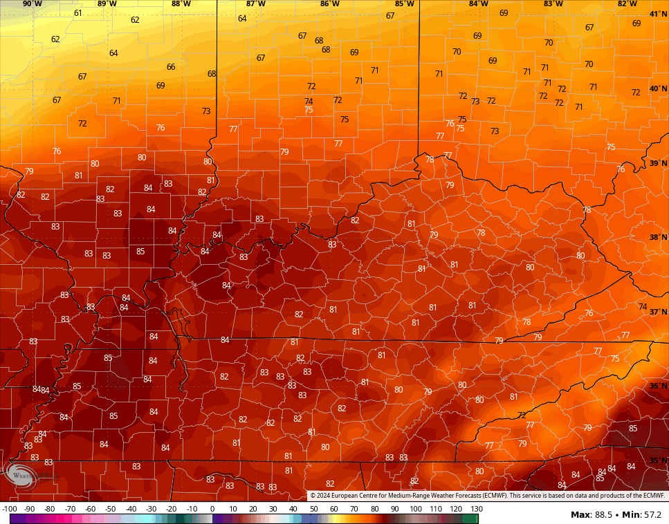
Our day starts with a line of gusty showers and thunderstorms racing through the state, weakening along the way. Skies become partly to mostly sunny behind this with temps of 75-80 degrees being common with some spots going above 80 again.
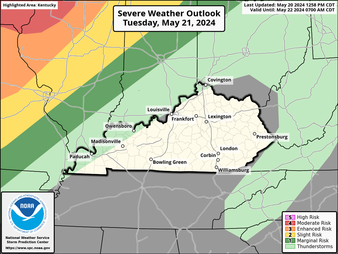
The chance is there for a broken line of storms to fire back up late this afternoon and evening, but the greatest threat for severe storms is to our north and east. Still, there’s a low-end risk for a few of these storms to impact parts of central and eastern Kentucky.
The Storm Prediction Center is following along with this thinking in showing the greatest severe risk north of the Ohio River…

Thursday is another VERY warm day with temps that can surge back into the low and middle 80s across the state. The models have been undercooked with temps in recent days so keep that in mind with this Thursday forecast…
Winds are from the southwest ahead of another cold front arriving Thursday night and Friday. This will bring additional showers and storms into western Kentucky during the afternoon and evening before sweeping across the state Thursday night and early Friday.
The Storm Prediction Center is highlighting the Thursday severe threat across the west…
The cold front moving through on Friday has a push of much cooler than normal air coming in behind it. That presses in over the weekend, but can we keep additional rains away? It may be a close call as the front slows down just to our south with waves of low pressure rolling along it.
The EURO is the closest to bringing those additional rains into the state…
I leave you with your mid-week storm tracking tools…

Current watches

Possible Watch Areas

Have a wonderful Wednesday and take care.

Only three days of “cool” weather, then it warms up again.
Weekend sun with temperatures in the 60s I can live with that.
Sunday is likely to be the last day that south central Kentucky sees temperatures in the 30’s until Fall. As far as precip is concerned, we’ve been pretty much rain free over the past week, picking up just 0.09 inches of rain overnight.