Good Thursday, everyone. A strong storm system is bowling its way toward the region and it’s bringing another severe storms threat. This threat arrives this afternoon and evening and is focused on the western half of Kentucky. Behind all this comes an extended run of much cooler than normal temps.
Today features a mix of sun and clouds with temps ranging from the upper 70s to middle 80s. This is ahead of a line of strong to severe storms racing into western Kentucky. This line will then slowly weaken into central Kentucky and likely fall apart across the east. Check out the future radar from the HRRR from 8pm until 8am Friday…
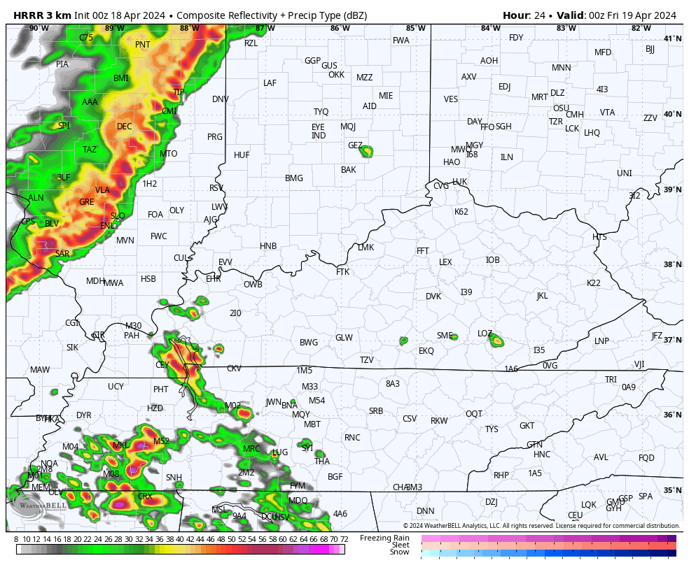
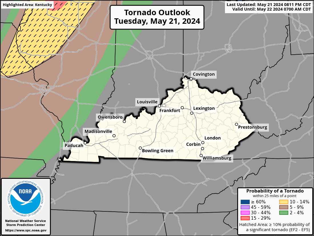
The Storm Prediction Center continues to highlight a Marginal Risk to Enhanced Risk of severe storms across the state today…

The chance is there for a tornado or two across western Kentucky and the SPC shows this chance well…
Damaging winds are the primary threat…

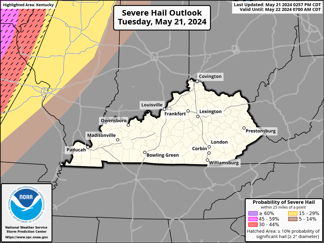
There’s also the chance for areas of large hail…
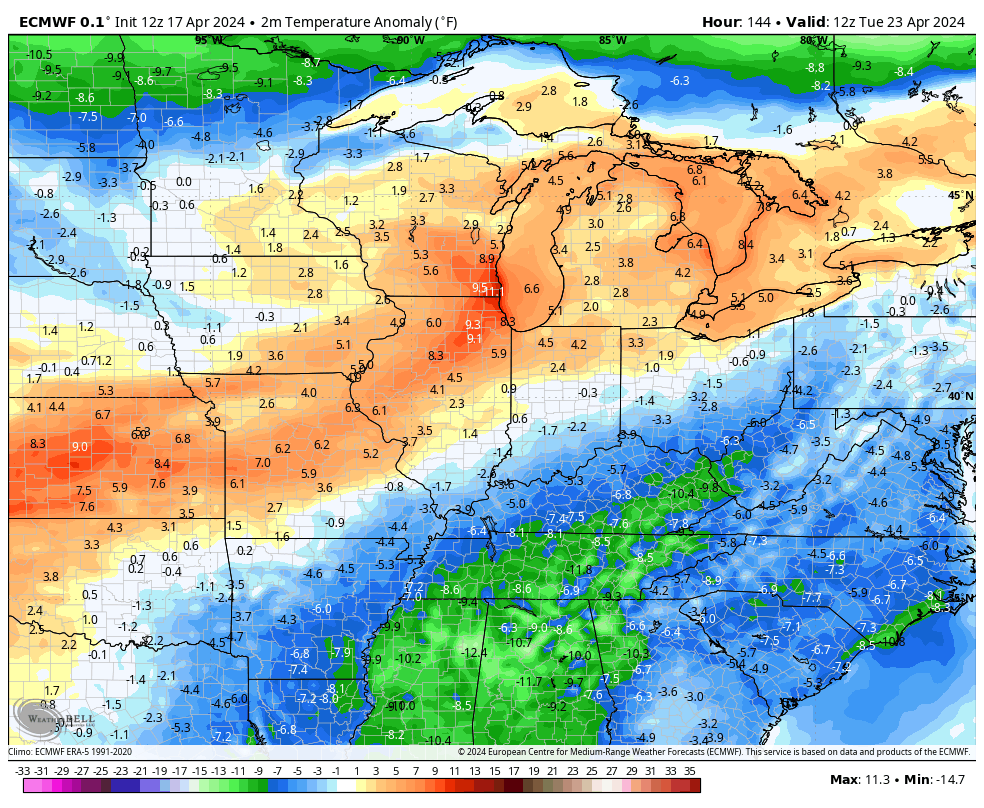
Much cooler winds come in behind that system for the weekend as we deal with a mix of sun and clouds. Highs this weekend range from the middle 50s to low 60s for highs during a time when the average high is 70-75, Lows by Sunday and Monday mornings drop into the 30s, giving us the chance for some frost.
Another cold front brings the chance for showers and storms to town on Tuesday with the chance for more storms showing up by the end of the week…
That first front arriving Tuesday has another shot of cooler than normal behind it, but those quickly jump to above normal by late week…
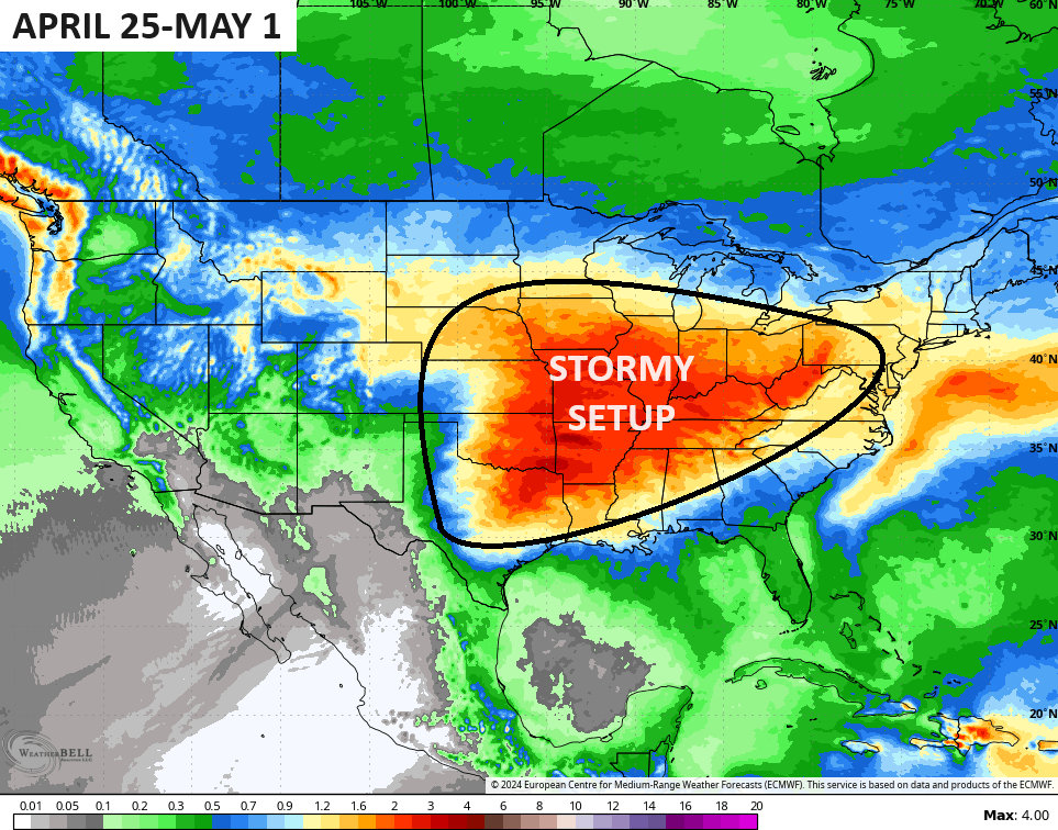
That leads into the closing days of April and the start of May. It’s a pattern threatening to turn very stormy once again…
I leave you with your storm tracking tools for the day…

Current watches

Possible Watch Areas

Make it a great day and take care.

I don’t think the end of the month will be very stormy.
I don’t put much stock in any long ranged predictions for stormy weather, as the potential is always there. Anymore I just follow the current trends. We have been in this same weather pattern every since the PDO has been in the negative, and will remain so, as there is a good chance of ENSO / La Nina forming later this summer.
Literally even a day before the forecast can change….. much less 5- 10 days. Example…. On Monday the forecast for Wed (which was my B day) was for severe storms… I remember thinking… Nooo.. Not on my B day… and then Tuesday the forecast for wednesday totally changed…. LOL
The weather forecast was really botch this week. Happy belated birthday Mark and many more……
Belated Happy birthday Mark. I’m glad you didn’t get severe storms on your special day.
Thanks Chris. Looks like one big wind later today for my area. Hoping hail is not a problem, but a decent ” April shower ” would be welcome, as the strong southwest winds are beginning to dry things out again. One note that I must report is that your site is slow to load and to log in. I checked my computer and it was in normal operation. Might be my server, don’t know for sure.
Have a great and safe day everyone !
As long as I have some sunshine I am a happy camper.
I am all in on rainy nights & sunny days.