Good Friday to one and all. The days of 80 degree high temps are over for a while as a much cooler air mass takes control of the pattern for the next week or so. Once the warm stuff tries to fight back in, it’s going to set us up with a very stormy period to end April and begin May.
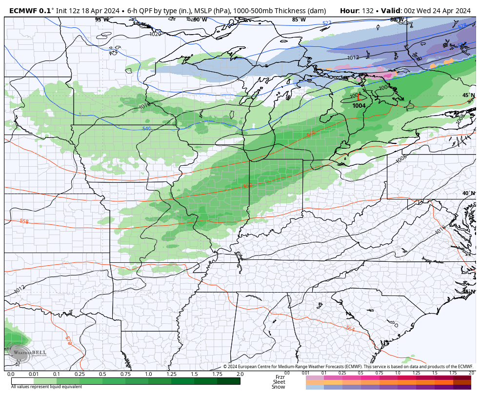
Speaking of stormy, very early morning thunderstorms are rolling from west to east across the state. These storms weaken the farther east they get into Kentucky, with a few showers lingering behind this on and off through the day.
Here are your radars to track the morning storms and the scattered showers…

Temps alone and behind the front drop into the 50s as cloud and scattered showers linger. Some sun may show up later in the afternoon in the north and west, giving temps a bump into the low and middle 60s,
Weekend temps range from the middle 50s to low 60s across the state with a mix of sun and clouds. Overnight lows can drop into the 30s with the best chance for some frost coming Sunday and Monday mornings where skies are clear.
Temps rebound closer to normal by late Monday and Tuesday ahead of another cold front bringing showers and storms in from the northwest. That looks to unleash another shot of chill behind it…
The EURO is currently showing temps going toward freezing or a bit below by Thursday of next week…
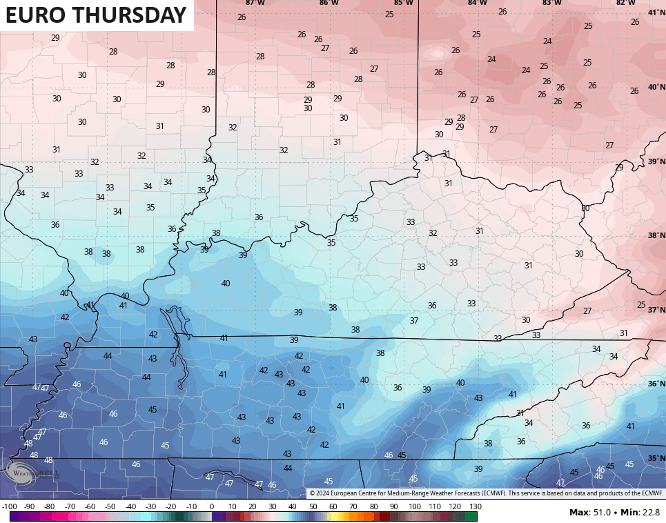
This is why we say slow ya roll green thumbs! Don’t do any planting until after Mother’s Day.
Warmer temps fight back in late next week into the final weekend of April. That fight means an increase in thunderstorms…
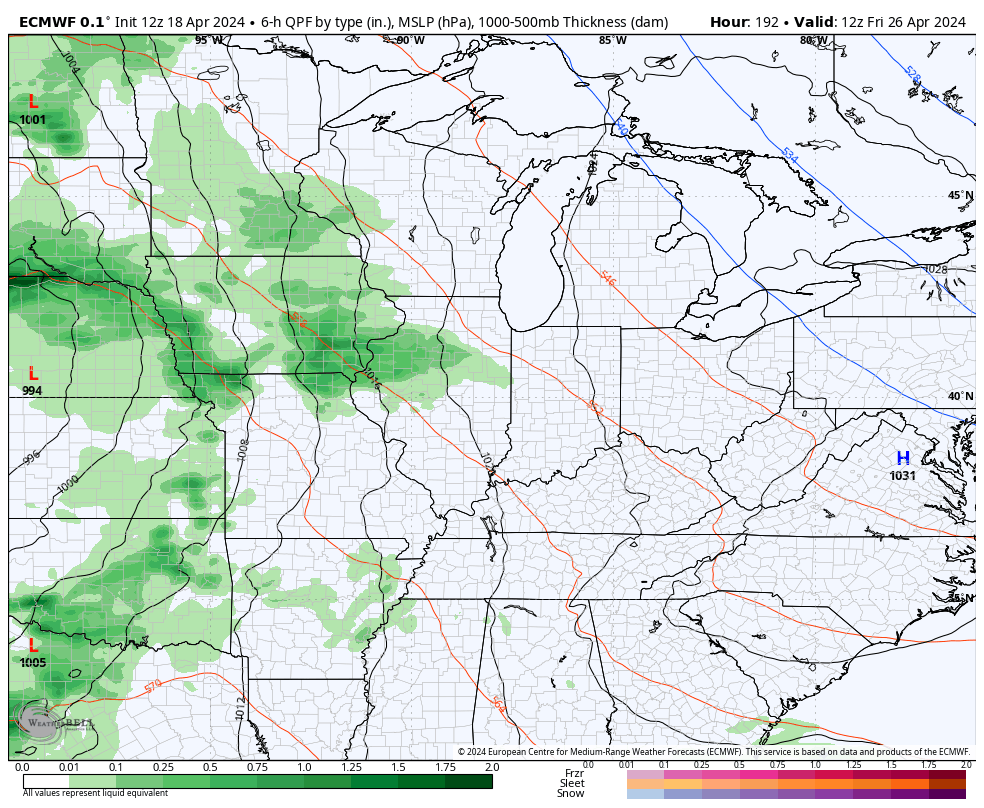
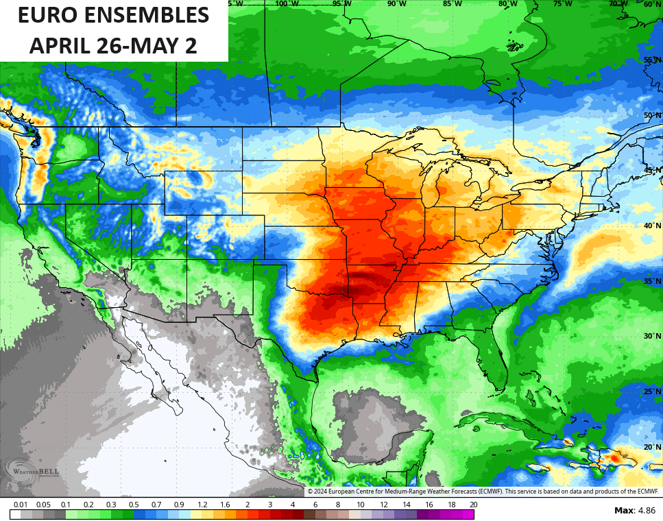
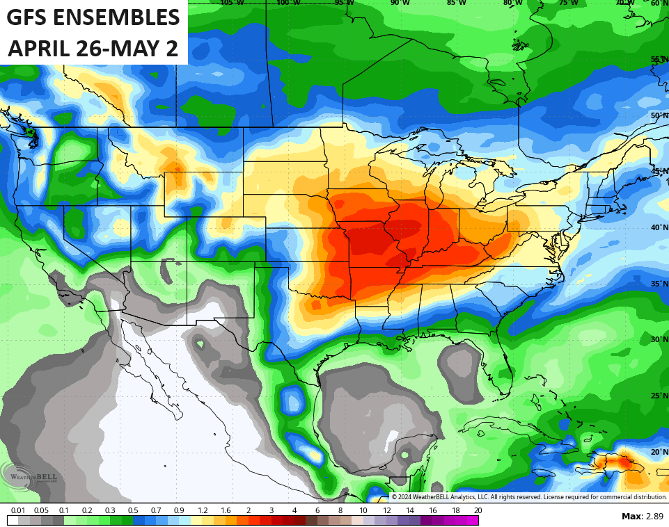
This is the stormy pattern I’ve been highlighting over the past several days and the latest ensembles are pointing toward a very active thunderstorm setup from the Plains into the Ohio Valley as we end April and say hello to May…
I’m going to be talking about the summer ahead over the next week or so. ️️
Have a fantastic Friday and take care.

Not sold on frost nor a stormy pattern. Heat will soon win.
Last night’s storms had a lot of flash, but left very little in the pan. Over the past 24 hours in the BG area, we picked up only 0.03 inches of rain, which is typical for what we’ve seen so far this month. On April 2nd we picked up just over 2 inches of rain, but only a half inch since that date.
We got <1" of rain, this early morning.